Omo River (Quebec)

Last updated
Omo
Nottaway map.png
Watershed of Nottaway River
Location
Country Canada
Province Quebec
Region Eeyou Istchee Baie-James (municipality)
Physical characteristics
SourceLittle unidentified lake
 - location Eeyou Istchee Baie-James (municipality), Nord-du-Québec, Quebec
 - coordinates 50°23′34″N75°21′52″W / 50.39278°N 75.36444°W / 50.39278; -75.36444
 - elevation371 m (1,217 ft)
Mouth Maicasagi River
 - location
Eeyou Istchee Baie-James (municipality), Nord-du-Québec, Quebec
 - coordinates
50°07′40″N75°46′59″W / 50.12778°N 75.78306°W / 50.12778; -75.78306 Coordinates: 50°07′40″N75°46′59″W / 50.12778°N 75.78306°W / 50.12778; -75.78306
 - elevation
323 m (1,060 ft)
Length60.4 km (37.5 mi) [1]

The Omo River is a tributary of the Maicasagi River located at Eeyou Istchee Baie-James (municipality), in the administrative region of Nord-du-Québec, in the Canadian province of Quebec, in Canada.

Maicasagi River tributary of lake Maicasagi, flowing in municipality of Eeyou Istchee Baie-James, in administrative region of Nord-du-Québec, in Québec, in Canada

The Maicasagi River is a tributary of Maicasagi Lake. This river flows from the municipality of Eeyou Istchee Baie-James (municipality), in the administrative region of Nord-du-Québec, in Quebec, in Canada.

Baie-James Municipality in Quebec, Canada

The Municipality of Baie-James was a municipality in northern Quebec, Canada, which existed from 1971 to 2012. Located to the east of James Bay, Baie-James covered 297,332.84 km2 (114,800.85 sq mi) of land, making it the largest incorporated municipality in Canada — only eight unorganized territories were larger. Its territory almost entirely covered the administrative region of Jamésie, although it contained less than five percent of the population. Essentially, it was the remainder of the Jamésie Territory's land after all of the major population centres were removed.

Nord-du-Québec Place in Quebec, Canada

Nord-du-Québec is the largest, but the least populous, of the seventeen administrative regions of Quebec, Canada. With nearly 750,000 square kilometres (290,000 sq mi) of land area, and very extensive lakes and rivers, it covers much of the Labrador Peninsula and about 55% of the total land surface area of Quebec, while containing a little more than 0.5% of the population.

Contents

The upper part of the course of the Omo River flows in the southwestern part of the Assinica Wildlife Sanctuary, then the river flow in township De Lucière, De Berey and De Dobeil.

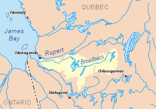
The hydrographic slope of the Omo River is served by road 113 linking Lebel-sur-Quévillon to Chibougamau.

Lebel-sur-Quévillon City in Quebec, Canada

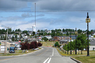
Lebel-sur-Quévillon is a city in the Canadian province of Quebec, located on Route 113 in the Jamésie region. It is located approximately 88 kilometres north of Senneterre and approximately 200 kilometres southwest of Chibougamau. It is surrounded by, but not a part of, the municipality of Baie-James.

Chibougamau City in Quebec, Canada

Chibougamau is a town in central Quebec, Canada, located on Lake Gilman. It has a population of 7,541 people. Chibougamau is completely surrounded by, but not part of, the Municipality of Baie-James.

The surface of the Omo River is usually frozen from early November to mid-May, however safe ice movement is generally from mid-November to mid-April.

Geography

The main hydrographic slopes near the Omo River are:

Assinica Lake lake in administrative region of Nord-du-Québec, in Quebec, in Canada

Assinica Lake is a fresh water body on the hydrographic slope of the Assinica River and Broadback Rivers, flowing into the Municipality of Eeyou Istchee Bay- James (municipality), in the administrative region of Nord-du-Québec, in Quebec, Canada.

Assinica River tributary of Broadback river (watershed of James Bay), in Eeyou Istchee Baie-James, in administrative region of Nord-du-Québec, in Quebec, in Canada

The Assinica River is a tributary of the Broadback River flowing west to Rupert Bay south of James Bay. The Assinica River flows into the municipality of Eeyou Istchee Baie-James (municipality) in the Nord-du-Québec administrative region, in Quebec, in Canada.

Brock River tributary of the Chibougamau River, in Northern Quebec (Canada)

The Brock River is a tributary of the Chibougamau River, flowing in Eeyou Istchee Baie-James, in the administrative region of Nord-du-Québec, in the province of Quebec, in Canada. The course of the river crosses successively the cantons of Beaulieu, Cherisy, La Rochette, Rageot, Livillier, La Touche and Opémisca.

The Omo River originates at the mouth of an unidentified lake (length: 3.4 kilometres (2.1 mi) altitude: 385 metres (1,263 ft)) in the Assinica Wildlife Sanctuary. This source of the river is located at:

Maicasagi Lake tributary of Goéland Lake, northwestern Quebec, Canada

Lake Maicasagi is a body of freshwater located in the territory of Eeyou Istchee Baie-James (municipality), in the administrative region of Nord-du-Québec, in the province of Quebec, in Canada.

Nottaway River tributary of South-East shore James Bay, flowing in munipality of Eeyou Istchee Baie-James, in administrative region of Nord-du-Québec, in Quebec, in Canada

The Nottaway River is a river in Quebec, Canada. The river drains Lake Matagami and travels 225 kilometers (140 mi) north-west before emptying into Rupert Bay at the south end of James Bay. Its drainage basin is 65,800 square kilometers (25,400 sq mi) and has a mean discharge of 1190 m³/s. Its source is the head of the Mégiscane River, which is 776 kilometers (482 mi) from the mouth.

Matagami City in Quebec, Canada

Matagami is a small town in Quebec, Canada. It is located north of Amos, on Matagami Lake, at the northern terminus of Route 109 and the start of the James Bay Road. The town had a population of 1,526 as of the Canada 2011 Census.

From the head lake, the Omo River flows on 60.4 kilometres (37.5 mi) in the Assinica Wildlife Sanctuary, according to the following segments:

Toponymy

The toponym "Monsan River" was formalized on December 5, 1968, at the Commission de toponymie du Québec, i.e. at the creation of this commission [2]

Upper part of the Omo River (segment of 37.9 kilometres (23.5 mi))

Lower part of the Omo River (segment of 22.5 kilometres (14.0 mi))

The "Omo River" flows into a river bend on the east bank of the Maicasagi River. From there, it flows southwest and west to the east shore of Maicasagi Lake. Then the current flows south-west through the Max Passage into the Goéland Lake. The latter is crossed to the northwest by the Waswanipi River which is a tributary of Matagami Lake.

The mouth of the Omo River located at:

North of the village center of Waswanipi;

Toponymy

Of Cree origin, this hydronym means the river where I ate only part of the dinner.

The toponym "Omo River" was formalized on December 5, 1968, at the Commission de toponymie du Québec, i.e. at the creation of this commission [4]

Related Research Articles

Waswanipi River tributary of lake Matagami, flowing in municipality of Eeyou Istchee Baie-James, in administrative region of Nord-du-Québec, in Quebec, in Canada

The Waswanipi River is a tributary of Matagami Lake. The Waswanipi River flows in the Municipality of Eeyou Istchee Baie-James in the administrative region of Nord-du-Québec, in Quebec, Canada.

Théodat River tributary of Evans Lake, in northwestern Quebec, Canada

The Théodat River is a tributary of Evans Lake, in Regional County Municipality (MRC) of Eeyou Istchee Baie-James (municipality), in the administrative region from Nord-du-Québec, Canadian province of Quebec, in Canada.

Goéland Lake lake crossed by the Waswanipi River, northwestern Quebec, Canada

The Lac au Goéland is a freshwater body of water crossed by the Waswanipi River and is located within Eeyou Istchee James Bay (municipality), within the administrative region of Nord-du-Québec, in the province of Quebec, in Canada.

Chensagi River tributary of Lake Maicasagi, Waswanipi Slope, Northwestern Quebec, Canada

The Chensagi River is a tributary of Maicasagi Lake, in Regional County Municipality (RCM) of Eeyou Istchee James Bay (municipality), in the administrative region from Nord-du-Québec, in the Canadian province of Quebec, in Canada.

Chensagi River East tributary of the Chensagi River, Waswanipi Slope, Northwestern Quebec, Canada

The Chensagi River East is a tributary of the Chensagi River in Regional County Municipality (RCM) of Eeyou Istchee Baie-James (municipality), in the administrative region of Nord-du-Québec, in the Canadian province of Quebec, in Canada.

Chensagi Lake lake crossed by the Chensagi River, Waswanipi Slope, Northwestern Quebec, Canada

Chensagi Lake is a freshwater body of the southern part of Baie-James, in the administrative region of Nord-du-Québec, in the province of Quebec, in Canada. The surface of the lake is partly in the township of Grandfontaine.

Chensagi River West tributary of the Chensagi River, Waswanipi Slope, Northwestern Quebec, Canada

The Chensagi River West is a tributary of the Chensagi River, in Regional County Municipality (RCM) of Eeyou Istchee James Bay (municipality), in the area of the Nord-du-Québec, Canadian province of Quebec, in Canada. The lower part of the river runs through the township of Dambourges.

Inconnue River (Maicasagi River) tributary of the Maicasagi River on the Waswanipi River in Northern Quebec, Canada

The Inconnue River is a tributary of the Maicasagi River located in the municipality of Eeyou Istchee Baie-James, in the administrative region of Nord-du-Québec, in the Canadian province of Quebec, in Canada.

Monsan River tributary of Lake Monsan which is crossed by the Moicasagi River, in Nord-du-Québec, Canada

The Monsan River is a tributary of Lake Monsan which is crossed by the Maicasagi River located at Eeyou Istchee Baie-James (municipality), in the administrative region of Nord-du-Québec, in the Canadian province of Quebec, in Canada.

La Trêve River tributary of the Maicasagi River, in Eeyou Istchee Baie-James, Northern Quebec, Quebec, Canada

The La Trêve River is a tributary of the Maicasagi River located at Eeyou Istchee Baie-James (Municipality), in the Nord-du-Québec, in the Canadian province of Quebec, in Canada.

Caupichigau River tributary of the La Trève River, on the Waswanipi River, in Northern Quebec, Canada

The Caupichigau River is a tributary of the La Trève River, flowing into Regional County Municipality (RCM) of Eeyou Istchee James Bay (municipality), within the administrative region of Nord-du-Québec, Canadian province of Quebec, in Canada.

Mildred River tributary of Lac La Trève, on the Waswanipi River, in Northern Quebec, Canada

The Mildred River is a tributary of La Trêve Lake, flowing in regional County Municipality (RCM) of Eeyou Istchee James Bay (municipality), in the administrative region of Nord-du-Québec, Canadian province of Quebec, in Canada.

Caupichigau Lake tributary of the Caupichigau River, on the Maicasagi River, in Northern Quebec, Canada

Caupichigau Lake is a freshwater body of the southern part of Eeyou Istchee James Bay (municipality), in the administrative region of Nord-du-Québec, in the province of Quebec, in Canada.

Bachelor River tributary of Waswanipi Lake, Northern Quebec, Canada

The Bachelor River is a tributary of Lake Waswanipi, flowing into the Regional County Municipality (RCM) of Eeyou Istchee Baie-James, within the administrative region of Nord-du-Québec, in the province of Quebec, in Canada. The course of the river crosses the townships of Lesueur and Nelligan.

Brock River West tributary of the Brock River (Chibougamau River Slope) in Northern Quebec, Canada

The West Brock River is a tributary of the Brock River, Brock River, flowing into the Eeyou Istchee Baie-James, in Jamésie, in the administrative region of Nord-du-Québec, in the province of Quebec, in the Canada. The course of the river crosses successively the townships of La Rochette, Livillier and La Touche.

Brock River North tributary of the Brock River (Chibougamau River Slope) in Northern Quebec, Canada

The North Brock River is a tributary of the Brock River, Brock River, flowing into the Eeyou Istchee Baie-James, in Jamésie, in the administrative region of Nord-du-Québec, in the province of Quebec, in the Canada. The course of the river crosses successively the Assinica Wildlife Reserve and the township of La Rochette.

Barlow River (Chibougamau River) tributary of the Chibougamau River, Northern Quebec, Canada

The Barlow River is a tributary of the Chibougamau River, flowing into the Regional County Municipality (RCM) of Eeyou Istchee Baie-James, Jamésie, in the administrative region of Nord-du-Québec, in the province of Quebec, in Canada.

References

Map all coordinates using: OpenStreetMap  
Download coordinates as: KML  ·  GPX
  1. "Atlas of Canada". atlas.nrcan.gc.ca. Retrieved 2017-12-08.
  2. "Quebec Place Names Commission - Place Names Bank - Toponym: "Monsan River"". toponymie.gouv.qc.ca. Retrieved 2017-12-06.
  3. Distances from the Department of Natural Resources Canada's Atlas of Canada (published on the Internet).
  4. "Commission de toponymie du Québec – Banque de noms de lieux (Bank of places names) - Toponym: "Rivière Omo" (Omo River)". toponymie.gouv.qc.ca. Retrieved 2017-12-08.

See also