
Namibia, officially the Republic of Namibia, is a country in Southern Africa. Its western border is the Atlantic Ocean. It shares land borders with Angola and Zambia to the north, Botswana to the east and South Africa to the east and south. Although it does not border Zimbabwe, less than 200 metres of the Botswanan right bank of the Zambezi River separates the two countries. Its capital and largest city is Windhoek.
The history of Namibia has passed through several distinct stages from being colonised in the late nineteenth century to Namibia's independence on 21 March 1990.

The Zambezi is the fourth-longest river in Africa, the longest east-flowing river in Africa and the largest flowing into the Indian Ocean from Africa. Its drainage basin covers 1,390,000 km2 (540,000 sq mi), slightly less than half of the Nile's. The 2,574 km (1,599 mi) river rises in Zambia and flows through eastern Angola, along the north-eastern border of Namibia and the northern border of Botswana, then along the border between Zambia and Zimbabwe to Mozambique, where it crosses the country to empty into the Indian Ocean.
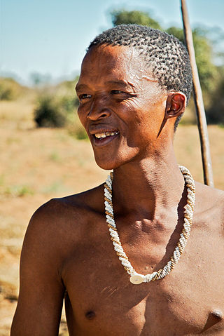
KhoisanKOY-sahn, or Khoe-Sān, is a catch-all term for the indigenous peoples of Southern Africa who traditionally speak non-Bantu languages, combining the Khoekhoen and the Sān peoples. Khoisan populations traditionally speak click languages and are considered to be the historical communities throughout Southern Africa, remaining predominant until European colonisation in areas climatically unfavorable to Bantu (sorghum-based) agriculture, such as the Cape region, through to Namibia, where Khoekhoe populations of Nama and Damara people are prevalent groups, and Botswana. Considerable mingling with Bantu-speaking groups is evidenced by prevalence of click phonemes in many especially Xhosa Southern African Bantu languages.

The Okavango Delta in Botswana is a vast inland delta formed where the Okavango River reaches a tectonic trough at an altitude of 930–1,000 m in the central part of the endorheic basin of the Kalahari.
Kaokoland was an administrative unit and a bantustan in northern South West Africa. Established in 1980 during the apartheid era, it was intended to be a self-governing homeland of the Ovahimba, but an actual government was never established, and the territory was administered by the leaders of Hereroland. Like other homelands in South West Africa, the Kaokoland bantustan was abolished in May 1989, at the beginning of the transition of Namibia towards independence.

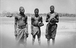
The Herero and Nama genocide or Namibian genocide, formerly known also as the Herero and Namaqua genocide, was a campaign of ethnic extermination and collective punishment which was waged against the Herero (Ovaherero) and the Nama in German South West Africa by the German Empire. It was the first genocide to begin in the 20th century, occurring between 1904 and 1908. In January 1904, the Herero people, who were led by Samuel Maharero, and the Nama people, who were led by Captain Hendrik Witbooi, rebelled against German colonial rule. On 12 January 1904, they killed more than 100 German settlers in the area of Okahandja.
The Herero are a Bantu ethnic group inhabiting parts of Southern Africa. There were an estimated 250,000 Herero people in Namibia in 2013. They speak Otjiherero, a Bantu language. Though the Herero primarily reside in Namibia, there are also significant populations in Botswana and Angola, and a small number in South Africa. The Hereros in Botswana and South Africa are there because of displacement during the 1904 - 1908 genocide committed by the German Empire.
The Ovambo people, also called Aawambo, Ambo, Aawambo, or Ovawambo (Kwanyama), are a Bantu ethnic group native to Southern Africa, primarily modern Namibia. They are the single largest ethnic group in Namibia, accounting for about half of the population. Despite concerted efforts from Christian missionaries to wipe out what were believed to be 'pagan practices', they have retained many aspects of their cultural practices. They are also found in the southern Angolan province of Cunene, where they are more commonly referred to as "Ambo". The Ovambo consist of a number of kindred Bantu ethnic tribes who inhabit what was formerly called Ovamboland. In Angola, they are a minority, accounting for about two percent of the total Angolan population.

Herero (Otjiherero) is a Bantu language spoken by the Herero and Mbanderu peoples in Namibia and Botswana, as well as by small communities of people in southwestern Angola. There were 250,000 speakers in these countries between 2015 and 2018.

The Ugab River is an ephemeral river in north-western Namibia. Its lower section forms the border between Kunene Region and Erongo Region but its catchment area extends well into the Otjozondjupa Region. Ugab's source is near Otavi. From there the riverbed leads westwards past the Paresis Mountains and the Fransfontein Mountains into the Skeleton Coast and the Atlantic Ocean. Inflows of the Ugab are Erundu, Ozongombo, Okomize and Uis.

Nama are an African ethnic group of South Africa, Namibia and Botswana. They traditionally speak the Nama language of the Khoe-Kwadi language family, although many Nama also speak Afrikaans. The Nama People are the largest group of the Khoikhoi people, most of whom have disappeared as a group, except for the Namas. Many of the Nama clans live in Central Namibia and the other smaller groups live in Namaqualand, which today straddles the Namibian border with South Africa.

Khaudum National Park is an isolated nature reserve situated in the Kalahari Desert to the west of the Caprivi Strip in the northeast of Namibia. It is a very remote and inaccessible reserve, but is home to some magnificent animals, such as the lion and hyena. The park has a campsite for visitors.

The Swakop River is a major river in western central Namibia. Its source is in the Khomas Highland. From there it flows westwards through the town of Okahandja, the historic mission station at Gross Barmen, and the settlement of Otjimbingwe. It then crosses the Namib desert and reaches the Atlantic Ocean at Swakopmund. The Swakop is an ephemeral river; its run-off is roughly 40 million cubic metres per annum.

The people of the country called Botswana are all referred to as Batswana(pl)/ Motswana(s) in reference to the country name or the land they all hail from, that is regardless of ethnicity, language, skin colour or heritage.

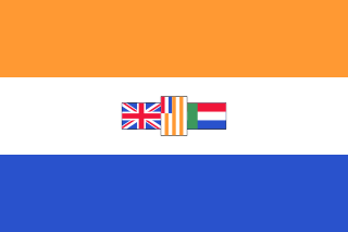
German South West Africa was a colony of the German Empire from 1884 until 1915, though Germany did not officially recognise its loss of this territory until the 1919 Treaty of Versailles.

The Omuramba Ovambo is an omuramba in Namibia. It originates about five kilometers from Tsintsabis and flows into Etosha Pan. Its catchment area is 15,784 square kilometres (6,094 sq mi). This river only flows when there is heavy rainfall. The river has almost no organic life in it due to its fluctuating water levels. The river banks are filled with rows of Camelthorn and Acacia trees which provide shade to the surrounding animals and San people who live in the area.
The Mbanderu are a population inhabiting eastern parts of Namibia and western parts of Botswana. They speak Otjiherero, a Bantu language.

Eiseb, also Eiseb Block, is a settlement in the Omaheke Region of Namibia. It is named after the Eiseb River, an ephemeral river (omuramba) in the Kalahari desert. Eiseb is situated on the District road D1635 c. 350 kilometres (220 mi) northeast of Tallismanus and belongs to the Otjombinde electoral constituency.
