Online map services of Slovenia

Last updated

Online map services of Slovenia are based on data provided by the Surveying and Mapping Authority of the Republic of Slovenia, [1] such as orthophoto covering entire territory of Slovenia with detailed imagery taken from a plane rather than satellite, and combine them with additional contents that are of interest to tourists and residents of Slovenia. Orthophoto images are taken every second year and provide more detailed aerial view of entire territory whereas satellite imagery shown by Google Maps only use detailed images for city areas and along major roads, but not for the entire territory. This is why orthophoto images are cited by geographers to show environmental change, rather than images taken by satellites that are shown on Google Maps. [2]

Orthophoto geometrically corrected aerial photograph

An orthophoto, orthophotograph or orthoimage is an aerial photograph or satellite imagery geometrically corrected ("orthorectified") such that the scale is uniform: the photo or image has follows a given map projection. Unlike an uncorrected aerial photograph, an orthophoto can be used to measure true distances, because it is an accurate representation of the Earth's surface, having been adjusted for topographic relief, lens distortion, and camera tilt.

Slovenia republic in Central Europe

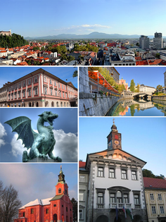
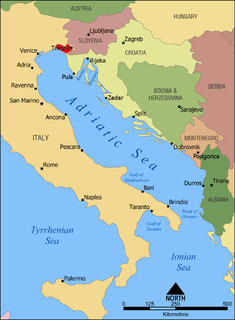
Slovenia, officially the Republic of Slovenia, is a sovereign state located in southern Central Europe at a crossroads of important European cultural and trade routes. It is bordered by Italy to the west, Austria to the north, Hungary to the northeast, Croatia to the southeast, and the Adriatic Sea to the southwest. It covers 20,273 square kilometers (7,827 sq mi) and has a population of 2.07 million. One of the successor states of the former Yugoslavia, Slovenia is a parliamentary republic and a member of the United Nations, of the European Union, and of NATO. The capital and largest city is Ljubljana.

Najdi.si combines orthophoto maps (despite its aerial view tab being named "satellite") with other contents, such as traffic info, city bus lines for Ljubljana and Maribor, and current info on the number of available bikes at BicikeLJ stations in Ljubljana.

BicikeLJ

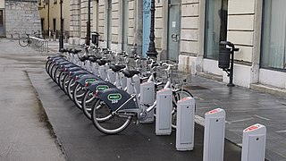
Bicikelj is a public bicycle rental program in the city of Ljubljana that was started in 2011. It is offered as public service by the City Municipality of Ljubljana and operated under concession by Europlakat. The system was provided by JCDecaux.

Geopedia.si [3] offers a number of maps, including:

Emona city

Emona or Aemona was a Roman castrum, located in the area where the navigable Ljubljanica river came closest to Castle Hill, serving the trade between the city's settlers - colonists from the northern part of Roman Italy - and the rest of the empire. Emona was the region's easternmost city, although it was assumed formerly that it was part of the Pannonia or Illyricum, but archaeological findings from 2008 proved otherwise. From the late 4th to the late 6th century, Emona was the seat of a bishopric that had intensive contacts with the ecclesiastical circle of Milan, reflected in the architecture of the early Christian complex along Erjavec Street in present-day Ljubljana.

Related Research Articles

Ljubljana Capital city in City Municipality of Ljubljana, Slovenia

Ljubljana is the capital and largest city of Slovenia. It has been the cultural, educational, economic, political, and administrative centre of independent Slovenia since 1991.

Gulf of Trieste bay

The Gulf of Trieste is a very shallow bay of the Adriatic Sea, in the extreme northern part of the Adriatic Sea. It is part of the Gulf of Venice and is shared by Italy, Slovenia and Croatia. It is closed to the south by the peninsula of Istria, the largest peninsula in the Adriatic Sea, shared between Croatia and Slovenia. The entire Slovenian sea is part of the Gulf of Trieste.

Satellite imagery imagery of the Earth or another astronomical object taken from an artificial satellite

Satellite imagery are images of Earth or other planets collected by imaging satellites operated by governments and businesses around the world. Satellite imaging companies sell images by licensing them to governments and businesses such as Apple Maps and Google Maps.

Prešeren Square square in Ljubljana, Slovenia

Prešeren Square is the central square in Ljubljana, the capital of Slovenia. It is part of the old town's pedestrian zone and a major meeting point, where festivals, Ljubljana carnival, concerts, sports, political, and protest events take place. It was renovated in 2007.

GeaBios

GeaBios is a free (non-profit) "Slovene Citizen Oriented Information Service", and the name stands for Geo Enabled And Better Internet Oriented Services.

Bing Maps Web mapping service from Microsoft

Bing Maps is a web mapping service provided as a part of Microsoft's Bing suite of search engines and powered by the Bing Maps for Enterprise framework.

Digital orthophoto quadrangle digital image format with the properties of an orthographic projection

A digital orthophoto quadrangle (DOQ) is aerial photography or satellite imagery that has been corrected so that its pixels are aligned with longitude and latitude lines, and have a narrowly defined region of coverage. This is a widely used format introduced by United States Geological Survey (USGS). The correction technique is called image rectification and is a large part of photogrammetry.

Géoportail web mapping service of the French government

Géoportail is a comprehensive web mapping service of the French government that publishes maps and geophysical aerial photographs from more than 90 sources for France and its territories. The service, first developed by two public agencies, was officially inaugurated on June 23, 2006 by president Jacques Chirac.

Pictorial map map that uses pictures to represent features

Pictorial maps depict a given territory with a more artistic rather than technical style. It is a type of map in contrast to road map, atlas, or topographic map. The cartography can be a sophisticated 3-D perspective landscape or a simple map graphic enlivened with illustrations of buildings, people and animals. They can feature all sorts of varied topics like historical events, legendary figures or local agricultural products and cover anything from an entire continent to a college campus. Drawn by specialized artists and illustrators, pictorial maps are a rich, centuries-old tradition and a diverse art form that ranges from cartoon maps on restaurant placemats to treasured art prints in museums.

St. Peters Bridge bridge in Slovenia

St. Peter's Bridge, also Ambrož Bridge, is a bridge in Ljubljana, the capital of Slovenia, that crosses the river Ljubljanica in the northeastern end of the old town. It is a continuation of Rozman Street. West of it lie Vraz Square on the northern (left) bank of the river and Ambrož Square on its southern (right) bank. East of it lies the Petkovšek Embankment on the northern bank and the Poljane Embankment on the southern bank. The bridge is named after the nearby St. Peter's Church. It is intended primarily for motorised traffic, but is also used by pedestrians.

St. Jamess Bridge bridge in Slovenia

St. James's Bridge in Ljubljana is a bridge that crosses the Ljubljanica River on the southern end of downtown Ljubljana, next to Zois Manor. It links Zois Street and Karlovac Street. The most important city traffic artery across the Ljubljanica runs across it.

Truške Village in Littoral, Slovenia

Truške is a village in the City Municipality of Koper in the Littoral region of Slovenia.

Digital mapping is the process by which a collection of data is compiled and formatted into a virtual image. The primary function of this technology is to produce maps that give accurate representations of a particular area, detailing major road arteries and other points of interest. The technology also allows the calculation of distances from one place to another.

Bing Maps Platform

Bing Maps Platform is a geospatial mapping platform produced by Microsoft. It allows developers to create applications that layer location-relevant data on top of licensed map imagery. The imagery includes samples taken by satellite sensors, aerial cameras, Streetside imagery, 3D city models and terrain.

Government Building and Presidents Office

The Government Building and President's Office, also simply the Government Building or the President's Office, is a building in Ljubljana, the capital of Slovenia, that houses the Office of the President of Slovenia, the Secretary-General of the Government of Slovenia, and the Protocol of Slovenia. It stands at the corner of Prešeren Street, Erjavec Street, and Gregorčič Street in the Center District, next to the Cankar Centre. It is used for state and ceremonial functions, as well as for receptions and meetings with visiting foreign dignitaries and heads of state. Occasionally, exhibits take place there.

Šempeter v Savinjski Dolini Place in Styria, Slovenia

Šempeter v Savinjski Dolini is a village in the Municipality of Žalec in east-central Slovenia. It lies on the left bank of the Savinja River east of Žalec. The Slovenian A1 motorway crosses the territory of the settlement northwest of the village core. The area is part of the traditional region of Styria. The entire municipality of Žalec is now included in the Savinja Statistical Region.

Casino Building

The Casino Building is a Neoclassical building in the city centre of Ljubljana, the capital of Slovenia. It stands in the northwestern corner of Congress Square next to the crossroad of Slovene Street and Šubic Street. In the past, it was the meeting place of Ljubljana's higher social classes. Today the Casino Building houses several institutions, including the Institute of Modern History, the Archives of Slovenia, the France Marolt Academic Folklore Society, and the Tone Tomšič Academic Choir.

Ljudmila Plesničar Gec Slovene archaeologist

Ljudmila Plesničar Gec was a Slovenian archaeologist who specialized in uncovering the Roman history of Ljubljana. Most known for her excavations at Emona, she received the Valvasor Prize in 1985, the Golden Order of Freedom of the Republic of Slovenia in 1997 and was honored in 2000 with the Lifetime Achievement Award from the Archaeological Society of Slovenia.

References

  1. Meta-data and samples for data provided by the Surveying and Mapping Authority of the Republic of Slovenia
  2. Brilly, M. (2010). Hydrological Processes of the Danube River Basin (citing Geopedia.si). Springer. ISBN   9789048134229.
  3. Perko, D.; Zorn, M. (2010). Geografski informacijski sistemi v Sloveniji 2009–2010 (Geographical Information Systems in Slovenia 2009-2010). Ljubljana: Institut of Geography at Slovene Academy of Sciences and Arts. ISBN   9789612542108.
  4. City maps from 19th century and architectural heritage in Ljubljana on geolocated 19th century postcards with comments from the book A pictorial chronicle of a capital city.
  5. Interactive archaeological map of Emona on top of the (orthophoto) map of Ljubljana
  6. Paragliding info mapping service
  7. Online natural hazards monitoring mapping service