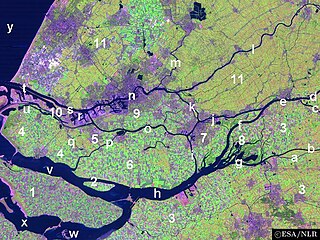
The Hoekse Waard is an island between the Oude Maas, Dordtsche Kil, Hollands Diep, Haringvliet and Spui rivers in the province of Zuid Holland in the Netherlands. The island is a mostly agricultural region, south of Rotterdam. The Hoeksche Waard consists of reclaimed land (polders): after the Saint Elisabeth flood of 1421 most of the area was flooded. The land has been reclaimed gradually in the following centuries.

Geervliet is a town in the Dutch province of South Holland. It is a part of the municipality of Nissewaard, and lies about 6 km northwest of Spijkenisse on the Brielse Maas. It received city rights in 1381.

Hei- en Boeicop is a small village in the Dutch province of Utrecht. Part of the municipality of Vijfheerenlanden, it lies about 9 km south of IJsselstein. The statistical area "Hei- en Boeicop", which includes the surrounding countryside, has a population of around 940.

Bommenede or Bommenee is a former island, village, and municipality in the Netherlands, located about 5 km east of the city of Brouwershaven.
's-Gravenhoek is a former municipality in the Dutch province of Zeeland. It consisted of a number of polders on the north side of the island of Noord-Beveland, east of Wissenkerke.
Kampensnieuwland or Kampernieuwland is a former municipality in the Dutch province of Zeeland. It existed until 1816, when it merged into the municipality of Wissenkerke.

Klaaskinderenkerke is a former village in the Dutch province of Zeeland. The polder Klaaskinderen was flooded on December 14, 1511, and was never reclaimed again. The church of Klaaskinderenkerke disappeared in this flood, and in the 19th century, only a small hamlet was left.
Nieuw-Strijen is a polder and a former municipality in the Dutch province of Zeeland, located on the island of Tholen. The small village "Nieuw-Strijen" is now called Strijenham.
Rengerskerke en Zuidland is a former municipality in the Dutch province of Zeeland. It existed until 1813, when it was merged with Kerkwerve.
Sint Joosland is a former municipality in the Dutch province of Zeeland. It existed until 1816, when it was merged with Nieuwland to form the new municipality of Nieuw- en Sint Joosland. The municipality consisted of a single polder southeast of the current village of Nieuw- en Sint Joosland.

Klaaswaal is a village and former municipality in the Dutch province of South Holland. It is centrally located on one of the island Hoeksche Waard. Klaaswaal was a separate municipality until 1984, when it was merged with Numansdorp to form the municipality Cromstrijen.
Nederslingeland is a polder in the Dutch province of South Holland. It is located about 5 km northwest of the city of Gorinchem. The hamlet Pinkeveer is located in the polder.
Nieuwland, Kortland, en 's-Graveland is a former municipality in the Dutch province of South Holland. It was located on three sides of the city of Schiedam. The municipality existed between 1817 and 1855.
Oude en Nieuwe Struiten is a former municipality in the Dutch province of South Holland. It consisted of a small polder east of Hellevoetsluis, and is now covered by the suburbs Wittenshoeck and De Struyten of that city.
Roxenisse is a former municipality in the Dutch province of South Holland. It consisted of a single polder to the west of the village of Melissant.
Sandelingen Ambacht is a polder about 12 km southeast of Rotterdam and a neighborhood of Hendrik-Ido-Ambacht, South Holland.
Schuddebeurs en Simonshaven is a former municipality in the Dutch province of South Holland. It was located about 4 km southwest of the town of Spijkenisse, and covered the two polders Schuddebeurs and Simonshaven, including the village of Simonshaven.

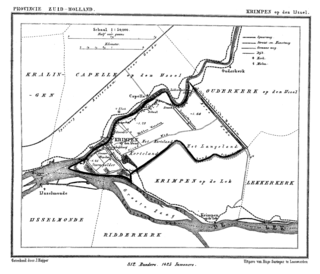
Stormpolder is a polder and a hamlet in the Dutch province of South Holland. It is located about 7 km east of the center of Rotterdam, in the municipality of Krimpen aan den IJssel. It lies between the Nieuwe Maas and Hollandsche IJssel rivers.
Baalhoek is a hamlet in the Dutch province of Zeeland. It is located in the municipality of Hulst, about 5 km east of Kloosterzande on the dyke of the Westerschelde.


