
Schouwen-Duiveland is a municipality and an island in the southwestern Netherlands province of Zeeland. The municipality has 33,737 inhabitants and covers an area of 488.94 square kilometres.

Dirksland is a village and former municipality on Goeree-Overflakkee Island in the western Netherlands, in the province of South Holland. The former municipality had a population of about 8,000 in 2007, and covered an area of about 74 km² of which about 19 km² was water. The former municipality of Dirksland also included the communities of Herkingen, and Melissant. On 1 January 2013, Dirksland merged with Goedereede, Middelharnis, and Oostflakkee into the new municipality of Goeree-Overflakkee.

Goedereede is a little town and former municipality in the western Netherlands, in the province of South Holland. The former municipality had a population of about 11,000 in 2010. It consisted of the west part of the island of Goeree-Overflakkee. Goedereede merged with Dirksland, Middelharnis, and Oostflakkee into the new municipality of Goeree-Overflakkee on January 1, 2013. The town have a population of about 2,000 in 2012.
Middelharnis is a town and former municipality in the western Netherlands, in the province of South Holland, on the island of Goeree-Overflakkee. The town had a population of about 6,800 in 2012. On 1 January 2013, Middelharnis merged with Goedereede, Dirksland, and Oostflakkee into the new municipality of Goeree-Overflakkee.
Goeree-Overflakkee is the southernmost delta island of the province of South Holland, Netherlands. It is separated from Voorne-Putten and Hoeksche Waard by the Haringvliet, from the mainland of North Brabant by the Volkerak, and from Schouwen-Duiveland by Lake Grevelingen.

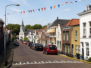
Oude-Tonge is a village in the Dutch province of South Holland. It is a part of the municipality of Goeree-Overflakkee, and lies about 16 km south of Hellevoetsluis.
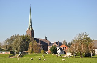
Hoogmade is a village in the Dutch province of South Holland. It is located about 7 km east of Leiden, in the municipality of Kaag en Braassem.

Ouddorp is a village in the Dutch province of South Holland. It is part of the municipality of Goeree-Overflakkee. It is often referred to as Ouddorp aan Zee to promote itself as a seaside resort, because the village has an 18 kilometres (11 mi) long beach which is the longest of the Netherlands.

Sommelsdijk is a village on the island of Goeree-Overflakkee, South Holland, the Netherlands, and part of the municipality of the same name. Sommelsdijk has 7,195 inhabitants which makes it the second largest settlement after Middelharnis on the island.

Stellendam is a village in the Dutch province of South Holland. It is a part of the municipality of Goeree-Overflakkee, and lies about 9 km west of Hellevoetsluis.

Achthuizen is a village in the Dutch province of South Holland. It is a part of the municipality of Goeree-Overflakkee, and lies about 17 km south of Spijkenisse.

Den Bommel is a village in the Dutch province of South Holland. It is a part of the municipality of Goeree-Overflakkee, and lies about 14 km south of Spijkenisse.
Ooltgensplaat is a village in the Dutch province of South Holland. It is a part of the municipality of Goeree-Overflakkee, and lies about 17 km south of Spijkenisse.

Nieuwe-Tonge is a village in the Dutch province of South Holland. It is a part of the municipality of Goeree-Overflakkee, and lies about 13 km south of Hellevoetsluis.

Stad aan 't Haringvliet is a village in the Dutch province of South Holland. It is a part of the municipality of Goeree-Overflakkee, and lies about 12 km southeast of Hellevoetsluis. The name means City on the Haringvliet. From 1812 to 1817 it was part of the municipality of Den Bommel, then it was a separate municipality until 1966 when it was merged with Middelharnis. Last one has made part of the new municipality of Goeree-Overflakkee since 2013.
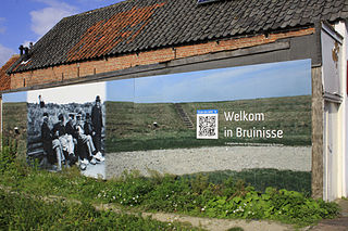
Bruinisse is a village in the south-west of the Netherlands. It is located in the municipality of Schouwen-Duiveland, Zeeland.

Herkingen is a village in the Dutch province of South Holland. It is located on the south coast of the island Goeree-Overflakkee, in the municipality of Goeree-Overflakkee.
Onwaard is a former municipality in the Dutch province of South Holland. It was located east of the village of Melissant on the island Goeree-Overflakkee. The municipality contained no villages nor hamlets; only a few farms. It consisted of a number of small polders: Onwaard, Oud-Kraaijer, Kraaijenisse, and part of the Nieuw-Kraaijer polder.
Langstraat is a hamlet in the Dutch province of South Holland. It is a part of the municipality of Goeree-Overflakkee. It lies near the village of Achthuizen.

Zuidzijde is a hamlet in the Dutch province of South Holland. It is a part of the municipality of Goeree-Overflakkee. It lies south of the village of Den Bommel.


