Opaoca River

Last updated
Opaoca
Nottaway map.png
Watershed of Nottaway River
Location
Country Canada
Province Quebec
Region Eeyou Istchee Baie-James (municipality)
Physical characteristics
SourceAnorthosite Lake
 - location Eeyou Istchee Baie-James (municipality), Nord-du-Québec, Quebec
 - coordinates 49°40′53″N77°09′58″W / 49.68139°N 77.16611°W / 49.68139; -77.16611
 - elevation336 m (1,102 ft)
Mouth Olga Lake (Waswanipi River), Waswanipi River
 - location
Eeyou Istchee Baie-James (municipality), Nord-du-Québec, Quebec
 - coordinates
49°40′53″N77°09′58″W / 49.68139°N 77.16611°W / 49.68139; -77.16611 Coordinates: 49°40′53″N77°09′58″W / 49.68139°N 77.16611°W / 49.68139; -77.16611
 - elevation
256 m (840 ft)
Length66.6 km (41.4 mi) [1]

The Opaoca River is a tributary of Olga Lake (Waswanipi River), in Regional County Municipality (RCM) of Eeyou Istchee James Bay (municipality), in the administrative region of Nord-du-Québec, Canadian province of Quebec, in Canada.

Baie-James Municipality in Quebec, Canada

The Municipality of Baie-James was a municipality in northern Quebec, Canada, which existed from 1971 to 2012. Located to the east of James Bay, Baie-James covered 297,332.84 km2 (114,800.85 sq mi) of land, making it the largest incorporated municipality in Canada — only eight unorganized territories were larger. Its territory almost entirely covered the administrative region of Jamésie, although it contained less than five percent of the population. Essentially, it was the remainder of the Jamésie Territory's land after all of the major population centres were removed.

Nord-du-Québec Place in Quebec, Canada

Nord-du-Québec is the largest, but the least populous, of the seventeen administrative regions of Quebec, Canada. With nearly 750,000 square kilometres (290,000 sq mi) of land area, and very extensive lakes and rivers, it covers much of the Labrador Peninsula and about 55% of the total land surface area of Quebec, while containing a little more than 0.5% of the population.

Quebec Province of Canada

Quebec is one of the thirteen provinces and territories of Canada. It is bordered to the west by the province of Ontario and the bodies of water James Bay and Hudson Bay; to the north by Hudson Strait and Ungava Bay; to the east by the Gulf of Saint Lawrence and the province of Newfoundland and Labrador; and to the south by the province of New Brunswick and the U.S. states of Maine, New Hampshire, Vermont, and New York. It also shares maritime borders with Nunavut, Prince Edward Island, and Nova Scotia. Quebec is Canada's largest province by area and its second-largest administrative division; only the territory of Nunavut is larger. It is historically and politically considered to be part of Central Canada.

Contents

The course of the river successively crosses the townships of Bourbaux, Berthiaume, Noyelles, Le Tardif, Comporte and Pouchot.

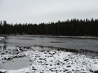
The hydrographic slope of the Opaoca River is served by various forest roads including the R1026 road (North-South direction). The northern route from Matagami passing at 19.4 kilometres (12.1 mi) to the northwest of the mouth of the Opaoca River. The surface of the river is usually frozen from early November to mid-May, however, safe ice circulation is generally from mid-November to mid-April.

Matagami City in Quebec, Canada

Matagami is a small town in Quebec, Canada. It is located north of Amos, on Matagami Lake, at the northern terminus of Route 109 and the start of the James Bay Road. The town had a population of 1,526 as of the Canada 2011 Census.

Geography

The main hydrographic slopes near the Opaoca River are:

Waswanipi River tributary of lake Matagami, flowing in municipality of Eeyou Istchee Baie-James, in administrative region of Nord-du-Québec, in Quebec, in Canada

The Waswanipi River is a tributary of Matagami Lake. The Waswanipi River flows in the Municipality of Eeyou Istchee Baie-James in the administrative region of Nord-du-Québec, in Quebec, Canada.

Goéland Lake lake crossed by the Waswanipi River, northwestern Quebec, Canada

The Lac au Goéland is a freshwater body of water crossed by the Waswanipi River and is located within Eeyou Istchee James Bay (municipality), within the administrative region of Nord-du-Québec, in the province of Quebec, in Canada.

Lake Waswanipi freshwater lake in Eeyou Istchee Baie-James (municipality), in the Nord-du-Québec, in Quebec, in Canada

Lake Waswanipi is a lake located in municipality of Eeyou Istchee Baie-James (municipalité), in administrative region of Nord-du-Québec, in Quebec, in Canada.

The Opaoca River originates at the mouth of Lake Anorthosite (length: 1.6 kilometres (0.99 mi) altitude: 336 metres (1,102 ft)). This lake straddles the townships of Bourbaux, Berthiaume and Noyelles.

The mouth of this lake is located at:

Nottaway River tributary of South-East shore James Bay, flowing in munipality of Eeyou Istchee Baie-James, in administrative region of Nord-du-Québec, in Quebec, in Canada

The Nottaway River is a river in Quebec, Canada. The river drains Lake Matagami and travels 225 kilometers (140 mi) north-west before emptying into Rupert Bay at the south end of James Bay. Its drainage basin is 65,800 square kilometers (25,400 sq mi) and has a mean discharge of 1190 m³/s. Its source is the head of the Mégiscane River, which is 776 kilometers (482 mi) from the mouth.

From its source, the "Opaoca River" flows on 66.6 kilometres (41.4 mi) according to the following segments:

The "Opaoca River" empties in Elisabeth bay, an extension of Olga Lake (Waswanipi River). The latter flows is crossed at the North by the Waswanipi River.

The mouth of the Opaoca River is located at:

Toponymy

Presumably of Cree origin, the origin of this hydronym would be a deviation from the word "opawakaw", meaning that there is "a pass, a narrowing between sandbanks". The “Commission de géographie du Québec” (English: Geographical Survey of Quebec) had formalized this name in 1948. The graphism Opaoka appears on the map of the township of Pouchot designed by the Department of Lands and Forests in 1965. [3]

The toponym "Opaoca River" was formalized on December 5, 1968, at the Commission de toponymie du Quebec, i.e. the creation of this commission [4]

Related Research Articles

Canet River river in Nord-du-Québec, Quebec, Canada

The Canet River is a tributary of Matagami Lake, flowing into the territory of Eeyou Istchee Baie-James (municipality), in the administrative region of Nord-du-Québec, in Quebec, in Canada.

Olga Lake lake crossed by Waswanipi River, in Nord-West of Quebec, in Canada

Olga Lake is a freshwater body crossed by the Waswanipi River and located in the southern part of Eeyou Istchee James Bay (municipality), in administrative region of the Nord-du-Québec, in the province of Quebec, in Canada.

Maicasagi Lake tributary of Goéland Lake, northwestern Quebec, Canada

Lake Maicasagi is a body of freshwater located in the territory of Eeyou Istchee Baie-James (municipality), in the administrative region of Nord-du-Québec, in the province of Quebec, in Canada.

Chensagi River tributary of Lake Maicasagi, Waswanipi Slope, Northwestern Quebec, Canada

The Chensagi River is a tributary of Maicasagi Lake, in Regional County Municipality (RCM) of Eeyou Istchee James Bay (municipality), in the administrative region from Nord-du-Québec, in the Canadian province of Quebec, in Canada.

Chensagi River East tributary of the Chensagi River, Waswanipi Slope, Northwestern Quebec, Canada

The Chensagi River East is a tributary of the Chensagi River in Regional County Municipality (RCM) of Eeyou Istchee Baie-James (municipality), in the administrative region of Nord-du-Québec, in the Canadian province of Quebec, in Canada.

Chensagi River West tributary of the Chensagi River, Waswanipi Slope, Northwestern Quebec, Canada

The Chensagi River West is a tributary of the Chensagi River, in Regional County Municipality (RCM) of Eeyou Istchee James Bay (municipality), in the area of the Nord-du-Québec, Canadian province of Quebec, in Canada. The lower part of the river runs through the township of Dambourges.

Maicasagi River tributary of lake Maicasagi, flowing in municipality of Eeyou Istchee Baie-James, in administrative region of Nord-du-Québec, in Québec, in Canada

The Maicasagi River is a tributary of Maicasagi Lake. This river flows from the municipality of Eeyou Istchee Baie-James (municipality), in the administrative region of Nord-du-Québec, in Quebec, in Canada.

Inconnue River (Maicasagi River) tributary of the Maicasagi River on the Waswanipi River in Northern Quebec, Canada

The Inconnue River is a tributary of the Maicasagi River located in the municipality of Eeyou Istchee Baie-James, in the administrative region of Nord-du-Québec, in the Canadian province of Quebec, in Canada.

La Trêve River tributary of the Maicasagi River, in Eeyou Istchee Baie-James, Northern Quebec, Quebec, Canada

The La Trêve River is a tributary of the Maicasagi River located at Eeyou Istchee Baie-James (Municipality), in the Nord-du-Québec, in the Canadian province of Quebec, in Canada.

Caupichigau River tributary of the La Trève River, on the Waswanipi River, in Northern Quebec, Canada

The Caupichigau River is a tributary of the La Trève River, flowing into Regional County Municipality (RCM) of Eeyou Istchee James Bay (municipality), within the administrative region of Nord-du-Québec, Canadian province of Quebec, in Canada.

Mildred River tributary of Lac La Trève, on the Waswanipi River, in Northern Quebec, Canada

The Mildred River is a tributary of La Trêve Lake, flowing in regional County Municipality (RCM) of Eeyou Istchee James Bay (municipality), in the administrative region of Nord-du-Québec, Canadian province of Quebec, in Canada.

Iserhoff River tributary of Waswanipi Lake, Northern Quebec, Canada

The Iserhoff River is a tributary of Lake Waswanipi, flowing into Regional County Municipality (RCM) of Eeyou Istchee James Bay (municipality) in the area of the Nord-du-Québec, Canadian province of Quebec, Canada.

Iserhoff River North watercourse in Canada

The Iserhoff River North is a tributary of the Iserhoff River, flowing into Regional County Municipality (RCM) of Eeyou Istchee Baie-James (municipality), in the administrative region of Nord-du-Québec, in the province Canadian of Quebec, in Canada.

Bachelor River tributary of Waswanipi Lake, Northern Quebec, Canada

The Bachelor River is a tributary of Lake Waswanipi, flowing into the Regional County Municipality (RCM) of Eeyou Istchee Baie-James, within the administrative region of Nord-du-Québec, in the province of Quebec, in Canada. The course of the river crosses the townships of Lesueur and Nelligan.

Obatogamau River tributary of the Chibougamau River, Northern Quebec, Canada

The Obatogamau River is a tributary of the Chibougamau River, flowing into the Regional County Municipality (MRC) of Jamésie, in the Nord-du-Québec, in the province of Quebec, in Canada.

Opémisca River tributary of the Chibougamau River, Northern Quebec, Canada

The Opémisca River is a tributary of the Chibougamau River, flowing into the regional County Municipality (RCM) of Eeyou Istchee Baie-James, within the administrative region of Nord-du-Québec, province of Quebec, Canada. The course of the river crosses the townships of Cuvier and Rageot.

Panache River tributary of the Wetetnagami River (Nottaway Slope), Abitibi-Témiscamingue, Quebec, Canada

The Panache River is a tributary of the east bank of the Wetetnagami River flowing into Senneterre in the La Vallée-de-l'Or Regional County Municipality, in the administrative region of Abitibi-Témiscamingue, in Quebec, in Canada.

Faribault River watercourse in Canada

The Faribault River is a tributary of the east bank of the Chibougamau River flowing into Eeyou Istchee Baie-James (municipality), in Jamésie, in the administrative region from Nord-du-Québec, in Quebec, Canada.

References

Map all coordinates using: OpenStreetMap  
Download coordinates as: KML  ·  GPX
  1. "Atlas of Canada". atlas.nrcan.gc.ca. Retrieved 2017-12-03.
  2. Distances measured from the Atlas of Canada (published on the Internet) of the Ministry of Natural Resources. Canada.
  3. Source: Names and places of Quebec, Commission book toponymy of Quebec, published in 1994 and 1996 in the form of a printed illustrated dictionary, and under that of a CD-ROM produced by the company Micro-Intel, in 1997, from this dictionary.
  4. "Commission de toponymie du Québec - Place names bank - Toponym: "Opaoca River"". toponymie.gouv.qc.ca. Retrieved 2017-12-02.

See also