The Taupo Volcanic Zone (TVZ) is a volcanic area in the North Island of New Zealand that has been active for the past two million years and is still highly active. Mount Ruapehu marks its south-western end and the zone runs north-eastward through the Taupo and Rotorua areas and offshore into the Bay of Plenty. It is part of the larger Central Volcanic Region that extends further westward through the western Bay of Plenty to the eastern side of the Coromandel Peninsula and has been active for four million years. The Taupo Volcanic Zone is widening east–west at the rate of about 8 mm per year. It is named after Lake Taupo, the flooded caldera of the largest volcano in the zone.
The Wairau River is one of the longest rivers in New Zealand's South Island. It flows for 170 kilometres (110 mi) from the Spenser Mountains, firstly in a northwards direction and then northeast down a long, straight valley in inland Marlborough.

The Firth of Thames is a large bay located in the north of the North Island of New Zealand. It is the firth of the rivers Waihou and Piako, the former of which was formerly named the Thames River, and the town of Thames lies on its southeastern coast.

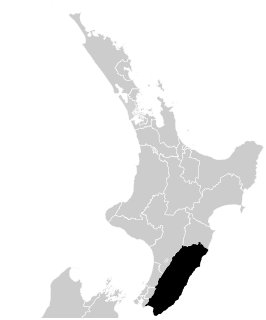
Palliser Bay is at the southern end of the North Island of New Zealand, to the southeast of Wellington. It runs for 40 kilometres along the Cook Strait coast from Turakirae Head at the southern end of the Rimutaka Ranges to Cape Palliser, the North Island's southernmost point.
Turua is a small village community located on the banks of the Waihou River in the Hauraki Plains, southeast of Auckland in the North Island of New Zealand. Turua is a Maori place name meaning "twice seen," referring to reflections in the river. Before European settlement, the town site was a Maori pā surrounded by vast forests of kahikatea that came to be known as the "Turua Woods." In the late 19th century the village of Turua became one of the most important sites of kahikatea exploitation in New Zealand when the family of George and Martha Bagnall bought the Turua sawmill in 1875. Over the next forty years the stands of kahikatea surrounding the town were replaced by small family farms. In 2006 there were 441 households in Turua, with an enrolment of 184 students in the Turua Primary School.
The Aorangi Range is a mountain range on the North Island of New Zealand. It is located in the Wairarapa region, extending more than 20 kilometres north from Cape Palliser, and is the southernmost mountain range on the island. The greater portion of these mountains are covered in native forest which is protected and set aside for public recreational use as part of the Aorangi Forest Park.
The Cape River is a river of New Zealand. A tributary of the Opouawe River, it is located in the Wairarapa in the southern North Island.
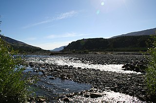
The Huangarua River is a river of the southern North Island of New Zealand. Rising in the foothills of the Aorangi Range it flows north to join the Ruakokoputuna River to the south of Martinborough.
The Kaiwhata River is a river of the southern North Island of New Zealand. It rises in rough hill country to the southeast of Masterton, flowing southeast to reach the Pacific Ocean 12 kilometres (7 mi) south of Riversdale Beach.
The Manganui o te Ao River is a river of the centre of New Zealand's North Island. It has its source in numerous streams and small rivers which flow west from the slopes of Mount Ruapehu, though the main course of the river flows predominantly southwest through rugged hill country to meet with the Whanganui River 10 kilometres (6 mi) north of Pipiriki, at the edge of the Whanganui National Park.

The Mangaroa River is a river of the Wellington Region of New Zealand's North Island. It flows north from the western foothills of the Remutaka Range to the west of Lower Hutt, meeting with the Hutt River on the northern outskirts of Upper Hutt.
The Mangawharariki River is a river of the Manawatu-Wanganui Region of New Zealand's North Island. It flows northwest from the Ruahine Range to meet the Rangitikei River at Mangaweka.
The Pakuratahi River is a river of the Wellington Region of New Zealand's North Island. It flows northwest from its source in the Remutaka Range 15 kilometres (9 mi) east of Lower Hutt to join the Hutt River near Kaitoke.

The Rai River is a river of the Tasman Region of New Zealand's South Island. It flows predominantly south, reaching the Pelorus River at Pelorus Bridge. The township of Rai Valley is located close to the river's banks.
The Rerewhakaaitu River is a river of the Wellington Region of New Zealand's North Island. It flows southeast from its sources in rough hill country southeast of Martinborough, reaching the Pacific Ocean 40 kilometres (25 mi) northeast of Cape Palliser.
The Waingawa River is a river of the Wellington Region of New Zealand's North Island. A major tributary of the Ruamahanga River, it flows generally southeast from its origins close to The Mitre, the highest peak of the Tararua Range. The Waingawa flows through the western suburbs of the city of Masterton and reaches the Ruamahanga 10 kilometres (6 mi) southeast of Carterton.
The Wainuiora River is a river of the Wellington Region of New Zealand's North Island. It is an upper tributary of the Wainuioru River.
The Wainuioru River is a river of the Wellington Region of New Zealand's North Island. A major tributary of the Pahaoa River, it follows a twisting generally southwestward course from its origins 25 kilometres east of Masterton, reaching the Pahaoa 20 kilometres (12 mi) southeast of Martinborough.

The Waiohine River is a river of the Wellington Region of New Zealand's North Island. It flows generally south from its origins in the Tararua Range south-east of Levin, turning south-east once it reaches the plains to the north of Lake Wairarapa. From here, the river flows through many channels and irrigation features, with some of its waters reaching the lake but most flowing into the Ruamahanga River south-east of Greytown.
The Whawanui River is a river of the Wellington Region of New Zealand's North Island. It flows south from the Aorangi Range to reach Cook Strait 10 kilometres (6 mi) northeast of Cape Palliser. It is one of the southernmost rivers in the North Island.