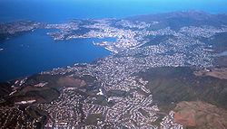
The Kāpiti Coast District, is a local government district of the Wellington Region in the lower North Island of New Zealand, 50 km (31 mi) north of Wellington City. The district is named after Kapiti Island, a prominent island 5 kilometres (3.1 mi) offshore.

The South Wairarapa District is a district at the south-east tip of the North Island of New Zealand, governed by the South Wairarapa District Council. The district comprises the southernmost part of the Wairarapa, and is part of the Wellington Region.

Carterton is a small town in the Wellington Region of New Zealand and the seat of the Carterton District. It lies in a farming area of the Wairarapa in New Zealand's North Island. It is located 14 km (8.7 mi) southwest of Masterton and 80 km (50 mi) northeast of Wellington. The town has a population of 5,980, out of a total district population of 10,250.

Horowhenua District is a territorial authority district on the west coast of the North Island of New Zealand, administered by Horowhenua District Council. Located north of Wellington and Kāpiti, it stretches from slightly north of the town of Ōtaki in the south to just south of Himatangi in the north, and from the coast to the top of the Tararua Range. It is in the Manawatū-Whanganui local government region. The name Horowhenua is Māori for landslide.

The Thames-Coromandel District is a territorial authority district in the North Island of New Zealand, covering all the Coromandel Peninsula and extending south to Hikutaia.

Waikato District is a territorial authority of New Zealand, in the northern part of Waikato region, North Island. Waikato District is administered by the Waikato District Council, with headquarters in Ngāruawāhia.

Southland District is a New Zealand territorial authority district that covers most of the southern end of the South Island as well as Stewart Island.

Central Otago District is local government district in New Zealand. It is administered by the Central Otago District Council, and it is in the Otago region, the top tier of local government in New Zealand. The major towns in the district are Alexandra, Cromwell, Roxburgh, Clyde and Ranfurly. The district covers 9,968 km2 (3,849 sq mi), making it the fourth-largest district in New Zealand by area, and is home to 26,500 people as of June 2024.

Westland District is a territorial authority district on the West Coast of New Zealand's South Island. It is administered by the Westland District Council. The district's population is 9,430.
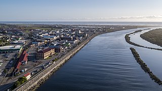
Grey District is a district in the West Coast Region of New Zealand that covers Greymouth, Runanga, Blackball, Cobden, and settlements along the Grey River. It has a land area of 3,474.31 square kilometres (1,341.44 sq mi). The seat of the Grey District Council, the local government authority that administers the district, is at Greymouth, where 58.4% of the district's population live.

Clutha District is a local government district of southern New Zealand, with its headquarters in the Otago town of Balclutha. Clutha District has a land area of 6,334.47 km2 (2,445.75 sq mi) and an estimated population of 19,300 as of June 2024. Clutha District occupies the majority of the geographical area known as South Otago.
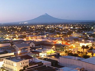
South Taranaki is a territorial authority on the west coast of New Zealand's North Island that contains the towns of Hāwera, Manaia, Ōpunake, Patea, Eltham, and Waverley. The District has a land area of 3,575.46 km2 and a population of 30,400. It is part of the greater Taranaki Region.

Mackenzie District is a local government district on New Zealand's South Island, administered by the Mackenzie District Council. It is part of the larger Canterbury Region. The region takes its name from the Mackenzie Basin, an elliptical intermontane basin which covers much of inland Canterbury.

Taupō District is a territorial authority district in New Zealand. It covers 6,333 km² of land, and a further 610 km² of lake area, including Lake Taupō, New Zealand's largest lake, and Lake Rotoaira. The district stretches from the small town of Mangakino in the northwest to the Tongariro National Park in the south, and east into the Kaingaroa Forest. The district's population is largely located in the two main centres, Taupō and Tūrangi.

Whangarei District is a territorial authority district in the Northland Region of New Zealand that is governed by the Whangarei District Council. The district is made up in area largely by rural land, and includes a fifth of the Northland Region. It extends southwards to the southern end of Bream Bay, northwards to Whangaruru and almost to the Bay of Islands, and westwards up the Mangakahia River valley past Pakotai and almost to Waipoua Forest. It includes the Hen and Chicken Islands and the Poor Knights Islands.

Lower Hutt is a city in the Wellington Region of New Zealand. Administered by the Hutt City Council, it is one of the four cities that constitute the Wellington metropolitan area.

Ōtorohanga District is a territorial authority in the King Country area and Waikato region of the North Island of New Zealand. It is a mostly rural area, with Ōtorohanga town being by far the biggest urban area, with a population nearing 3,000. The District was called Otorohanga County from 1971 to 1979.

Timaru District is a local government district on New Zealand's South Island, administered by the Timaru District Council. It is part of the larger Canterbury Region. Timaru district was formed in 1989 from the amalgamation of Timaru City, Geraldine borough, Temuka borough and Strathallan County.

Ashburton District is a territorial authority district in the Canterbury Region of the South Island of New Zealand. It encompasses the town of Ashburton, a number of small towns and settlements and the surrounding rural area, roughly coterminous with Mid Canterbury. The district had a population of 38,400 as of June 2024.

Waimate District is a territorial authority district located in the Canterbury Region of the South Island of New Zealand. The main town is Waimate, while there are many smaller rural communities dispersed throughout the area. Its boundary to the south is the Waitaki River, to the west Lake Benmore and to the north-east the Pareora River.