Porirua Harbour

Last updated

Te Awarua-o-Porirua Harbour
Porirua Harbour
Sunset, Porirua harbour entrance.jpg
Sunset over Porirua Inlet and Harbour entrance
NZ-NI plain map.png
Disc Plain red.svg
Te Awarua-o-Porirua Harbour
Location on the North Island
Location Porirua, Wellington, New Zealand
Coordinates 41°05′S174°51′E / 41.083°S 174.850°E / -41.083; 174.850
Type Harbour
River sourcesPorirua Stream, Pauatahanui Stream
Ocean/sea sources Tasman Sea

Te Awarua-o-Porirua Harbour, commonly known as Porirua Harbour, is a natural inlet in the south-western coast of the North Island of New Zealand. [1]

Contents

The harbour is within the main urban area of the Wellington Region, and is surrounded by the city of Porirua, with the city centre to the south of the harbour.

Geography

The harbour has an entrance only a few hundred metres in width, close to the suburb of Plimmerton. It opens up into two arms, Onepoto Arm to the south and Pauatahanui Arm to the north-east. Each arm is around three kilometres in length. [1]

The Pauatahanui Inlet arm extends eastward to the settlement of Pāuatahanui. The wetland there where the Pauatahanui Stream enters the Pauatahanui Inlet, is the largest remaining estuarine wetland in the lower North Island, and the Pauatahanui Wildlife Reserve was established in the 1980s to protect the inlet's environment and to restore damaged areas. [1]

History

The Porirua Harbour formed when westward flowing rivers were drowned by rising postglacial sea levels approximately 10000–14000 years ago. [2] There is a tradition that the 1855 Wairarapa Earthquake caused tectonic uplift in the Pauatahanui Arm of the inlet, changing the shoreline and reducing its navigability. However, according to George Eiby, the inlet always had limited accessibility, and the earthquake didn't significantly change the shoreline, with any changes likely coming from more recent sedimentation. [3]

Part of the Porirua Inlet was reclaimed for a causeway carrying the North Island Main Trunk railway when the section between Porirua and Mana was straightened and double tracked. The new section of the Kapiti Line was opened on 7 November 1960. A new Paremata Railway Station and bridge over the entrance to the Pauatahanui Inlet were required. [4] [5]

The line no longer followed the curves of the shoreline bays north of Porirua, and three shallow lagoons on the land side of the new causeway were created. When State Highway 1 was re-aligned and straightened in the 1970s to run alongside the rail line, these lagoons were partially filled in. Aotea Lagoon was developed into a recreational area, albeit very polluted. [4] [1]

The name of the harbour was officially altered to Te Awarua-o-Porirua Harbour in August 2014. [6]

Recreation

The Pauatahanui Inlet is used for windsurfing, but is not recommended for swimming. [1]

North of Paremata are the swimming beaches of Plimmerton and Karehana Bay. The southern end of Plimmerton Beach is also exposed to northwesterly winds for windsurfing. [1]

There are also fishing spots at Tokaapapa Reef (or Grandfather rocks) off Plimmerton, Mana Island and Hunters Bank. However, weather conditions can change quickly and can be hazardous. [1]

Guardians of Pāuatahanui Inlet

A community group, the Guardians of Pāuatahanui Inlet, was set up in 1991 as a registered charity, [7] to undertake tasks such as cleaning up around the inlet. They also run photographic competitions. [8]

The Pauatahanui arm of the Porirua Harbour with the entrance at the extreme left and Pauatahanui at the extreme right Pauatahanui Inlet-20070919.jpg
The Pauatahanui arm of the Porirua Harbour with the entrance at the extreme left and Pauatahanui at the extreme right
Porirua Harbour viewed from Camborne. Mana Island is in the centre; Plimmerton to the right. Pauatahanui inlet to the left. Camborne panorama March 2010.jpg
Porirua Harbour viewed from Camborne. Mana Island is in the centre; Plimmerton to the right. Pauatahanui inlet to the left.
Porirua Harbour (bottom centre) and Pauatahanui Inlet (top centre) viewed from the ISS. Porirua Harbour and Mana Island, New Zealand (ISS014-E-18096).jpg
Porirua Harbour (bottom centre) and Pauatahanui Inlet (top centre) viewed from the ISS.

See also

Related Research Articles

<span class="mw-page-title-main">Porirua</span> City in the North Island of New Zealand

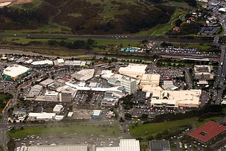
Porirua, a city in the Wellington Region of the North Island of New Zealand, is one of the four cities that constitute the Wellington metropolitan area. The name 'Porirua' is a corruption of 'Pari-rua', meaning "the tide sweeping up both reaches". It almost completely surrounds Porirua Harbour at the southern end of the Kāpiti Coast. As of June 2023, Porirua has a population of 60,900.

<span class="mw-page-title-main">Plimmerton</span> Suburb of Porirua

The suburb of Plimmerton lies in the northwest part of the city of Porirua in New Zealand, adjacent to some of the city's more congenial beaches. State Highway 59 and the North Island Main Trunk railway line pass just east of the main shopping and residential area.

<span class="mw-page-title-main">Porirua City Council</span> Territorial authority of New Zealand

The Porirua City Council is the territorial authority for the city of Porirua, New Zealand.

<span class="mw-page-title-main">Paremata</span> Suburb of Porirua

Paremata is a suburb of Porirua, on the Tasman Sea coast to the north of Wellington, New Zealand.

<span class="mw-page-title-main">Pukerua Bay</span> Suburb of Porirua

Pukerua Bay is a small seaside suburb at the southern end of the Kāpiti Coast, New Zealand. In local government terms it is the northernmost suburb of Porirua City, in the Wellington Region. It is 12 km north of the Porirua City Centre on State Highway 59, and 30 km north of central Wellington. In Māori, the words puke rua literally mean two hills but it is not clear to which hills the name refers.

<span class="mw-page-title-main">Camborne, New Zealand</span> Suburb of Porirua

Camborne, New Zealand is a hilltop and seaside suburb of Porirua.

<span class="mw-page-title-main">Mana Island (New Zealand)</span> Island in New Zealand

Mana Island is the smaller of two islands that lie off the southwest coast of the North Island of New Zealand. The name of the Island is an abbreviation of the Maori name Te Mana o Kupe, which means "The Mana of Kupe".

<span class="mw-page-title-main">Pāuatahanui</span> Rural locality in Wellington Region, New Zealand

Pāuatahanui is a village in New Zealand's North Island. It is at the far eastern end of what was known as the Pāuatahanui Inlet, an arm of the Porirua Harbour, northeast of Wellington. In local government terms, Pāuatahanui is part of the Northern Ward of Porirua City.

Wellington Regional Council, branded as Greater Wellington Regional Council, is the regional council overseeing the Wellington Region of New Zealand's lower North Island. It is responsible for public transport under the brand Metlink, environmental and flood protection, and the region's water supply. As of 2023, it is the majority owner of CentrePort Wellington with a 77% shareholding.

<span class="mw-page-title-main">Aotea Lagoon</span> Lagoon in Porirua

Aotea Lagoon is an artificial lagoon surrounded by a public park in the Papakōwhai suburb of Porirua, New Zealand.

<span class="mw-page-title-main">Kapiti Line</span> Wellington commuter rail line

Metlink's Kapiti Line is the electrified southern portion of the North Island Main Trunk railway between New Zealand's capital city, Wellington, and Waikanae on the Kāpiti Coast, operated by Transdev Wellington on behalf of Greater Wellington Regional Council. Trains run frequently every day, with stops at 16 stations. Until 20 February 2011 it was known as the Paraparaumu Line.

<span class="mw-page-title-main">Mana (New Zealand electorate)</span> Electoral district in Wellington, New Zealand

Mana is a New Zealand parliamentary electorate in the Wellington metropolitan area. It has been held by Barbara Edmonds of the Labour Party since the 2020 election.

<span class="mw-page-title-main">Mana, New Zealand</span> Suburb in Porirua, New Zealand

Mana is a locality of Porirua City in New Zealand, part of the Suburb of Paremata. It is a narrow isthmus bounded to the west by the entrance to Porirua Harbour, and to the east by the Pauatahanui inlet of the Porirua Harbour. Mana Island lies about three kilometres west of the isthmus.

<span class="mw-page-title-main">Taupō Swamp</span> Swamp in New Zealand

Taupō Swamp is a lowland freshwater swamp located three kilometres (1.9 mi) north of Plimmerton and 20 kilometres (12 mi) north-northeast of Wellington. In 1986 the Queen Elizabeth II National Trust purchased Taupō Swamp with the aim of both protecting and restoring the wetland. Taupō Swamp is home to largely indigenous vegetation including sedges, flax, ferns, shrubs, herbaceous plants, and grasses. Flax leaves shelter and shade the swamp providing a habitat that is favourable for eels and native fish including galaxiid species. There are invasive plant species present that threaten the swamp including Darwin's barberry, Blackberry, Gorse, Broom, Pussy Willow and Japanese honeysuckle. Another possible threat is development of nearby land as this may cause silt to run off into the swamp as well as fire.

<span class="mw-page-title-main">Paremata railway station</span> Railway station in New Zealand

Paremata railway station on the Kapiti Line section of the North Island Main Trunk Railway (NIMT) in Paremata in the city of Porirua, New Zealand, is part of the Wellington Region's Metlink suburban rail network.

<span class="mw-page-title-main">Porirua railway station</span> Railway station in New Zealand

Porirua railway station is an important intermediate station in New Zealand on the Kapiti Line from Wellington and is part of Wellington's Metlink suburban rail network operated by Transdev Wellington.

The Haywards–Plimmerton Line was a railway development proposed several times between 1879 and the 1960s to connect the Hutt Valley and Porirua areas of Wellington via Haywards.

State Highway 58 (SH 58) is a New Zealand state highway in the Wellington Region linking the Hutt Valley to Porirua City.

State Highway 59 (SH 59) is a New Zealand state highway in the Wellington Region linking Mackays Crossing to Linden. It came into existence on 7 December 2021, prior to the opening of the Transmission Gully Motorway and consists of the former route of State Highway 1 between Mackays Crossing and Linden.

<span class="mw-page-title-main">Whitireia Park</span>

Whitireia Park is a headland north of Tītahi Bay and Te Awarua-o-Porirua Harbour in Porirua, in the Wellington Region at the southern end of New Zealand's North Island. It is a park administered by the Whitireia Park Board, in collaboration with Wellington Regional Council. The park includes Onehunga Bay, Kaitawa Point and part of Rocky Bay.

References

  1. 1 2 3 4 5 6 7 "Te Awarua-o-Porirua Harbour". gw.govt.nz. Wellington Regional Council.
  2. J. Irwin (1976) Morphological stability of pauatahanui inlet, porirua harbour, New Zealand Journal of Marine and Freshwater Research, 10:4, 641-650, doi:10.1080/00288330.1976.9515646
  3. George Eiby (1990) Changes to Porirua Harbour in about 1855 : historical tradition and geological evidence, Journal of the Royal Society of New Zealand, 20:2, 233-248, doi:10.1080/03036758.1990.10426727
  4. 1 2 Hoy, D.G. Rails out of the Capital (NZRLS, 1970) pp. 70,71
  5. "Porirua Harbour Basin c1956 (images)". Transactions of the Royal Society of New Zealand. 1956.
  6. "NZGB decisions". Land Information New Zealand. August 2014. Archived from the original on 21 November 2015. Retrieved 7 November 2015.
  7. "Guardians of Pāuatahanui Inlet". NZBN. Retrieved 24 October 2021.
  8. "Caring for the inlet". Guardians of Pāuatahanui Inlet. Retrieved 8 October 2021.