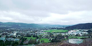
Upper Hutt is a city in the Wellington Region of New Zealand and one of the four cities that constitute the Wellington metropolitan area.

The Hutt River flows through the southern North Island of New Zealand. It flows south-west from the southern Tararua Range for 56 kilometres (35 mi), forming a number of fertile floodplains, including Kaitoke, central Upper Hutt and Lower Hutt.

Wainuiomata is a large dormitory suburb of Lower Hutt, in the Wellington metropolitan area in New Zealand. Its population was estimated as being 19,840 as of June 2023, with a density of 1,600 people per km2. European settlement of Wainuiomata began in the 1850s with timber-felling and farming and began to grow in the 1920s. After World War 2 there was rapid population expansion, with Wainuiomata earning the nickname 'Nappy Valley' because of the large number of families with young children. From the late 1980s the economy slowed and the population decreased, but since about 2020 there has been a housing boom and corresponding increase in population. Wainuiomata is noted for being the origin of New Zealand's kōhanga reo movement.
Wellington Regional Council, branded as Greater Wellington Regional Council, is the regional council overseeing the Wellington Region of New Zealand's lower North Island. It is responsible for public transport under the brand Metlink, environmental and flood protection, and the region's water supply. As of 2023, it is the majority owner of CentrePort Wellington with a 77% shareholding.

Regional parks of New Zealand are protected areas administered by regional councils, the top tier of local government. Regional parks are found across five regions of New Zealand: the Auckland Region, Waikato Region, Bay of Plenty Region, Wellington Region and Canterbury Region. Regional parks in the Auckland and Waikato regions are administered by the Auckland Council, while parks in other areas are administered by regional councils: the Bay of Plenty Regional Council, Greater Wellington Regional Council, and Canterbury Regional Council.

Wainuiomata High School, a state co-educational secondary school, operates in Wainuiomata, a suburb of Lower Hutt in New Zealand. The school was founded in January 2002 from the merger of Wainuiomata College and Parkway College. A total of 617 students from Years 9 to 13 attended the school as of April 2023.
Multiple proposals have been made for a branch line railway to Wainuiomata as part of the Wellington commuter railway network. Despite strong local pressure at times during the 20th century, none of the proposals have come to fruition. There are currently (2021) no plans under consideration to build a rail line to Wainuiomata, although in 2021 a Christchurch-based property development company advertised townhouses in Wainuiomata as in "close proximity" to a non-existent Wainuiomata Train Station.
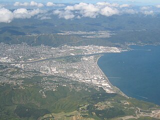
Lower Hutt is a city in the Wellington Region of New Zealand. Administered by the Hutt City Council, it is one of the four cities that constitute the Wellington metropolitan area.

Battle Hill Farm Forest Park is a regional park near Paekākāriki, in the Kāpiti Coast District and Wellington Region of New Zealand's lower North Island.

Belmont Regional Park is a regional park located between Lower Hutt and Porirua, in the Wellington Region at the southern end of New Zealand's North Island. It is administered by Wellington Regional Council. It was the first park in New Zealand to include land for recreation, conservation and farming.
East Harbour Regional Park is a regional park stretching from Baring Head along the east side of the Wellington Harbour along the east side of Eastbourne. It is located in Lower Hutt City, in the Wellington Region of New Zealand's North Island.

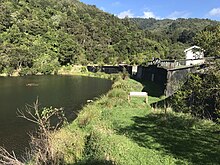
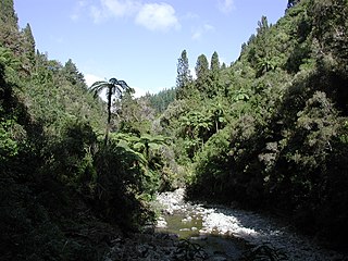
Kaitoke Regional Park is regional park located at Kaitoke, northeast of Upper Hutt, in the Wellington Region of New Zealand's southern North Island. It is administered by Wellington Regional Council, alongside the adjacent Hutt Water Collection Area.
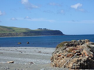
Baring Head is a headland, located between Wellington Harbour and Palliser Bay at the southern end of the North Island of New Zealand. It marks the southern end of Fitzroy Bay.
The Hutt City Council is a territorial authority in New Zealand, governing the city of Lower Hutt. Lower Hutt is the country's seventh largest city. The city borders Porirua to the north, Upper Hutt to the northeast, South Wairarapa District to the east, and Wellington to the southwest and west. It is one of nine territorial authorities in the Wellington Region.
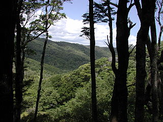
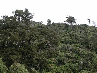
Akatarawa Forest is a regional park in the Upper Hutt within the Wellington Region at the southern tip of the North Island of New Zealand. It encompasses 15,000 hectares of native and plantation forest. It includes the headwaters of the Maungakotukutuku Steam, Akatarawa River West and the Whakatīkei River.

Hutt Water Collection Area is a reserve located in Upper Hutt in the Wellington Region at the southern end of New Zealand's North Island. It is administered by Wellington Regional Council and is located alongside the larger Kaitoke Regional Park.
Pākuratahi Forest is a regional park located in Upper Hutt in the Wellington Region at the southern end of New Zealand's North Island. It is administered by Wellington Regional Council.
Wainuiomata Water Collection Area is a reserve located near Wainuiomata, Lower Hutt in the Wellington Region at the southern end of New Zealand's North Island. It is administered by Wellington Regional Council, for exclusive use by Wellington Water as a water catchment reserve. The park covers the catchments of the Wainuiomata River and the Ōrongorongo River. It adjoins Remutaka Forest Park and Wainuiomata Regional Park.

Whitireia Park is a headland north of Tītahi Bay and Te Awarua-o-Porirua Harbour in Porirua, in the Wellington Region at the southern end of New Zealand's North Island. It is a park administered by the Whitireia Park Board, in collaboration with Wellington Regional Council. The park includes Onehunga Bay, Kaitawa Point and part of Rocky Bay.
The 2022 Wellington Region local elections were held on 8 October 2022 as part of the wider 2022 New Zealand local elections to elect members to sub-national councils and boards. These elections covered one regional council, eight territorial authorities, and various community boards and licensing trusts.