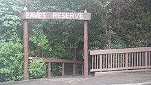
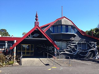
Alice Eaves Scenic Reserve, known colloquially as "Eaves Bush", is a 16ha forest located at the northern end of Orewa, in Auckland, New Zealand. It is named after Alice Caroline Eaves, whose family bequeathed the land to the nation in 1960.
Alice Eaves Scenic Reserve, known colloquially as "Eaves Bush", is a 16ha forest located at the northern end of Orewa, in Auckland, New Zealand. It is named after Alice Caroline Eaves, whose family bequeathed the land to the nation in 1960.
The area was previously a defensive pā, built by Te Kawerau sub-tribes, occupied until as recently as 1827. Ngāti Pāoa ceded the land to the Crown on 5 January 1854, which was subsequently granted to an Austrian, Captain Martin Krippner, in 1860. [1]
In the 1870s, Major de Grut took over the land until it was sold to the Eaves family in 1919. In 1940, the Eaves family made the decision that the land should "never fall into private hands again" and after the death of Mrs Eaves in 1955, the native bush on the property was "designated as reserve and gifted to the community." [2] : p.11
The local Lions began making tracks, building bridges and removing invasive weeds, and the Reserve was formally opened by the Lions Club Chairman, Don Woods on 10 December 1960. The daughters of Alice and Edward Eaves were present. [2] : p.11
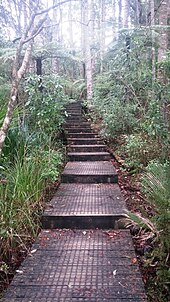
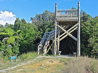
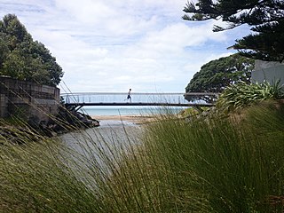
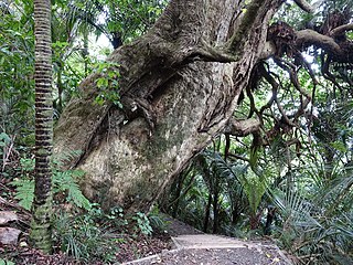
A series of pedestrian walkways have been constructed through the reserve, as well as a wooden look out point over Orewa Beach that was built in 1997.
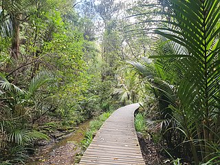
The reserve includes kauri trees as old as 300 years. In addition, the bush contains native trees such as tōtara, mataī, kahikatea, pūriri, rata, karaka, rimu, rewarewa, nīkau and taraire. A number of these trees can be identified by labels along the walkway.
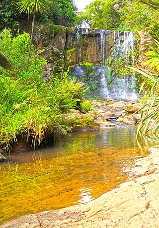
Several small streams feed the Nukumea Stream, which marks the reserve's southern boundary.
The status of the land is Scenic Reserve 19(1)(a) and under the Reserves Act, the management is the responsibility of the Hibiscus and Bays Local Board, elected representatives under the Governing Body, Auckland Council. The role of the Board is to make decisions on local matters such as the maintenance and upgrading of facilities, caring for the environment, preservation of heritage and supporting activities in the area. Taking into account issues that could impact the significant natural and heritage values of the Reserve, the Board's draft Plan for 2020 proposed intentions aimed at preserving and enhancing ecosystems, improving or realigning paths to protect against pathogen incursion, retaining "cultural heritage including the remnant ring ditch Pā site particularly when considering any future development or park enhancement and [consideration of] opportunities to improve connections through the park and deliver on the Hibiscus and Bays Greenways / Local Paths Plan 2016." [3] Following community consultation the Final Hibiscus and Bays Local Board Plan adopted on 5 November 2020, listed "aspirational outcomes" and key initiatives to achieve objectives. Under Outcome 3, one objective was to "support the development and implementation of ecological and environmental restoration plans", with one key initiative to "support the remediation of tracks to help stop the spread of kauri dieback and enable public access." [4] Another outcome in the Plan that related to the Reserve, to 'Protect, maintain and improve access and amenities for activities on our coastlines, parks and reserves' stated a key initiative to "implement the Hisbiscus and Bays Greenways Local Paths Plan for walkways and cycleways." [4] The 2020/2021 Annual Report of the Local Board noted that the pedestrian bridge over the Nukumea Stream near Reserve had been renewed, and acknowledged the contribution of the Eaves Bush Appreciation Group in maintaining the Reserve over many years. [5]
In June 2019, the Reserve was required by the Auckland Council to close to the public due to the danger of Kauri dieback caused by the spread of a pathogen in contaminated soil possibly being carried on the soles of shoes. Lauri Rands from the Eaves Bush Appreciation Society expressed sadness but noted that protection of the 800-year-old kauri in the Reserve was a good example of the importance of taking this action. [6]

The lower track on the Reserve was re-opened on 30 August, 2020 with a hygiene station at the entrance and exit to allow shoes to be cleaned. It was noted at the time, that the upper tracks were scheduled for re-opening late in 2021. Hibiscus and Bays Local Board Chair Gary Brown expressed delight at the reopening and appreciation to the Council for the work they had done to bring this about. He also acknowledged the voluntary contribution of the Eaves Bush Appreciation Group who had worked for years to weed, plant and trap pests. [7] Members of this group were the first to walk the re-opened section. [8]
The Greenways project proposed by the Auckland Council in 2016 [9] had been prioritised by the Hisbiscus and Bays Local Board in 2017 and a feasibility report for implementing walking and cycling connections between the Reserve and Hatfields Beach was completed in 2018. In its Objectives, the Report noted: "The proposed Alice Eaves Walkway and Cycleway development has potential benefits to a wide range of the community and visitors; from local residents who wish to venture along a safe walkway, commuters using the walkway as an alternative to using the road and visitors looking to explore the area." [10]
Hakarimata Range is a range of hills on the western edge of Ngāruawāhia township, in the Waikato region of New Zealand, overlooking the confluence of the Waikato and Waipā Rivers. The Hakarimata Range is separated from the Taupiri Range by the Taupiri Gorge, through which the Waikato River flows.

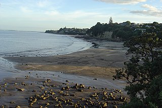
Orewa is a suburb of Auckland, New Zealand’s largest city. It lies on the Hibiscus Coast, just north of the base of the Whangaparāoa Peninsula and 40 kilometres north of central Auckland. It is a popular holiday destination.
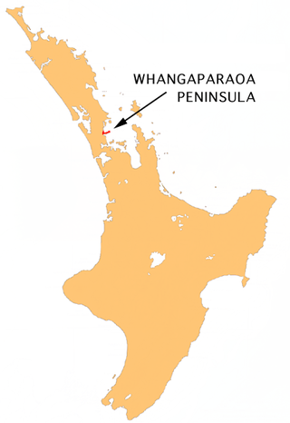
The Whangaparāoa Peninsula is a suburban area about 30–50 km north of Auckland, New Zealand. It had 33,390 residents in 2018. It stretches from Red Beach, where it connects to Kingsway, Orewa and Silverdale, and extends to Army Bay in the Hauraki Gulf. It is part of the Hibiscus Coast. The area is populated by residents who work on the peninsula, or commute from the area to other parts of the Hibiscus Coast, the North Shore, Rodney district, Auckland CBD and beyond for work. They travel by vehicle, or via the Gulf Harbour ferry at Gulf Harbour Marina, or the Hibiscus Coast Bus Station at Silverdale. There is one main road along its entire length, which is accessible from State Highway 1 via Hibiscus Coast Highway at Silverdale, or from Hibiscus Coast Highway at Orewa via Red Beach. It is popular as a tourist destination for catching a ferry to Tiritiri Matangi Island, and for visiting Shakespear Regional Park. It has one open (Whangaparāoa Golf Club) and one closed golf club (Gulf Harbour Country Club), beaches, sporting and recreation facilities, a library, shops, businesses and public and private primary and secondary schools. The median age of the population is in the 30s-40s.

Birkenhead is a suburb of Auckland, in northern New Zealand. It is located on the North Shore of the Waitematā Harbour, 4 kilometres (2.5 mi) northwest of the Auckland City Centre. The area has been settled by Tāmaki Māori since at least the 14th century, and is the location of Te Matarae ō Mana, a fortified pā for Te Kawerau ā Maki that overlooked an important seasonal shark fishery. European settlement in Birkenhead began in late the 1840s, and by the late 19th century the area became renowned for strawberry crops. In 1884, the Chelsea Sugar Refinery was constructed in Birkenhead, becoming a major source of income for Birkenhead. The increased population growth led to Birkenhead becoming one of the first boroughs of Auckland in 1888. Birkenhead transitioned from a semi-rural community to suburban Auckland after the opening of the Auckland Harbour Bridge in 1959, becoming a city in 1978. In 1989, Birkenhead City was amalgamated with North Shore City.
Dairy Flat is a northern rural district located 8 km south of Orewa in the North Island of New Zealand and 28 km north of central Auckland. Until the early 1990s most of the district was in dairy farms of 40 to 60 hectares, but with the growth of Auckland and the extension of the Northern Motorway into the area, these are being gradually overtime subdivided into lifestyle blocks of around 2 to 5 hectares, many of which are grazing sheep, horses, beef cattle or deer. Although it still retains a rural character, it is counted as part of the Auckland urban area in official statistics.
Mairangi Bay is a coastal suburb of North Shore, Auckland, located in the northern North Island of New Zealand, on the south-east-facing peninsula forming the northern side of the Waitematā Harbour. Mairangi Bay came under the local governance of the North Shore City Council until subsumed into the Auckland Council in 2010.
Torbay is a northern suburb of Auckland, New Zealand. It is located in the upper East Coast Bays of the city's North Shore, and is governed by Auckland Council.
Chatswood is a suburb in the city of Auckland, New Zealand, in the middle-eastern side of North Shore. It contains a primary school and many parks. To the south of Chatswood is Kendall's Bay, a small bay of the Waitematā Harbour. The suburb is under the governance of Auckland Council. The Royal New Zealand Navy's Kauri Point Armament Depot is located in Chatswood. Chelsea Sugar Refinery is located in Chatswood.

Te Atatū South is a residential suburb in West Auckland, New Zealand. Its location allows the suburb easy access to the city and Henderson town centre. Its elevation allows views back on to the city and Waitākere Ranges. Situated on the Te Atatū Peninsula, it has coasts backing on to water on its eastern and western sides with walkways and cycleways on both sides.
The Hibiscus Coast is a populated area on a stretch of the Hauraki Gulf coast in New Zealand's Auckland Region. It has a population of 63,400, making it the 10th most populous urban area in New Zealand, and the second most populous in the Auckland Region, behind Auckland itself.

Rothesay Bay is a small suburb in Auckland's East Coast Bays region. The suburb is roughly the same size as Murrays Bay, the suburb to the immediate south.
Murrays Bay is a small suburb in the East Coast Bays region, located in the North Shore of Auckland. The suburb is roughly the same size as Rothesay Bay, the suburb to the immediate north. It is primarily a residential area but does have a community centre, restaurant and café. Murrays Bay is regularly serviced by buses which go to Takapuna and the Auckland city centre.
Campbells Bay is a suburb of the North Shore located in Auckland, New Zealand. Centennial Park is a popular recreational space that has walking tracks and stunning harbour views.
Le Roys Bush is a public reserve between Birkenhead and Northcote in Auckland, New Zealand.

Kauri dieback is a forest dieback disease of the native kauri trees of New Zealand that is suspected to be caused by the oomycete Phytophthora agathidicida. Symptoms can include root rot and associated rot in a collar around the base of the tree, bleeding resin, yellowing and chlorosis of the leaves followed by extensive defoliation, and finally, death.

Aotea Conservation Park is a 12,300 hectare protected area on Great Barrier Island in New Zealand's Hauraki Gulf. It was established in 2015, and comprises 43 percent of the island.
Mokoroa Falls is a waterfall located between Muriwai and the Waitākere Ranges in Auckland's west coast in New Zealand. It is located in the Goldie Bush Scenic Reserve.
Hibiscus and Bays is a local government area in Auckland, in New Zealand's Auckland Region, governed by the Hibiscus and Bays Local Board and Auckland Council. It currently aligns with the council's Albany Ward.

The Goldie Bush Scenic Reserve, also known as Goldies Bush and Te Taiapa, is a forested area of West Auckland, New Zealand. Located south-east of Muriwai, the reserve is home to the Mokoroa Falls.
The Okura Bush Scenic Reserve is a protected forested area on the Hibiscus Coast in the Auckland Region, New Zealand. It is the location of the Okura Bush Track.