Demographics
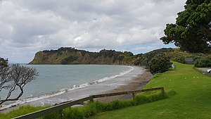
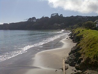
Army Bay covers 6.22 km2 (2.40 sq mi) [1] and had an estimated population of 1,630 as of June 2023, [2] with a population density of 262 people per km2.
Historical population| Year | Pop. | ±% p.a. |
|---|
| 2006 | 1,284 | — |
|---|
| 2013 | 1,410 | +1.35% |
|---|
| 2018 | 1,566 | +2.12% |
|---|
| Source: [5] |
Army Bay had a population of 1,566 at the 2018 New Zealand census, an increase of 156 people (11.1%) since the 2013 census, and an increase of 282 people (22.0%) since the 2006 census. There were 561 households, comprising 777 males and 786 females, giving a sex ratio of 0.99 males per female. The median age was 42.9 years (compared with 37.4 years nationally), with 306 people (19.5%) aged under 15 years, 243 (15.5%) aged 15 to 29, 726 (46.4%) aged 30 to 64, and 291 (18.6%) aged 65 or older.
Ethnicities were 91.4% European/Pākehā, 8.0% Māori, 3.3% Pacific peoples, 5.0% Asian, and 2.5% other ethnicities. People may identify with more than one ethnicity.
The percentage of people born overseas was 34.1, compared with 27.1% nationally.
Although some people chose not to answer the census's question about religious affiliation, 55.9% had no religion, 32.0% were Christian, 0.2% had Māori religious beliefs, 0.4% were Hindu, 0.2% were Muslim, 1.0% were Buddhist and 2.1% had other religions.
Of those at least 15 years old, 303 (24.0%) people had a bachelor's or higher degree, and 153 (12.1%) people had no formal qualifications. The median income was $38,000, compared with $31,800 nationally. 297 people (23.6%) earned over $70,000 compared to 17.2% nationally. The employment status of those at least 15 was that 618 (49.0%) people were employed full-time, 219 (17.4%) were part-time, and 39 (3.1%) were unemployed. [5]

Cape Runaway is the eastern extremity of the Bay of Plenty in New Zealand's North Island. It is located 157 kilometres northeast off Whakatāne and 65 kilometres west of East Cape.

Okiato or Old Russell is a small town in the Bay of Islands, New Zealand, 7 kilometres (4.3 mi) south of present-day Russell. It was founded in 1840 and served as New Zealand's first national capital until 1841, when the seat of government was moved to Auckland. The car ferry across the Bay of Islands, which provides the main access to Russell, runs between Okiato and Opua.
Gulf Harbour is a development some 4 km from the end of the Whangaparaoa Peninsula, towards the northern end of Auckland, New Zealand. It has one of the country's largest marinas, and one of the country's top golf courses, and is regarded as a retreat for Auckland's well-off. The site is also known as Hobbs Bay and was sold in the early seventies by landowners, the Hobbs family, who still retain some of the coastal area including the Hobbs Bay beach.

Matauri Bay is a bay in New Zealand, situated 30 km north of Kerikeri, in Whangaroa county, just north of the Bay of Islands. It has over a kilometre of white sand and crystal clear water, making it a popular summer destinations for surfers, divers, fishers and holidaymakers.
Pukawa or Pukawa Bay is a bay and a small township on the southern shores of Lake Taupō on New Zealand's North Island. It is off State Highway 41 between Turangi and Taumarunui, in the Taupō District and Waikato region.
Waipapa is a small town in the Bay of Islands, Northland, New Zealand. It is located on State Highway 10, approximately 10 minutes drive from Kerikeri, the nearest urban centre. Waipapa itself has no school with most pupils travelling to Kerikeri on a daily basis. It is governed by the Far North District council.
Kaharoa is a rural area of New Zealand approximately 20 km from Rotorua and 45 km from Tauranga on the North Island. At its highest point the area is approx. 500m above sea level, with some areas able to see towards the coastline of the eastern Bay of Plenty.

Purerua Peninsula is a peninsula on the northwest side of the Bay of Islands in Northland, New Zealand. Te Puna Inlet lies to the south of the peninsula. Communities on the peninsula are Purerua, Te Tii and Taronui Bay. Rangihoua Bay is at the southern end of the peninsula.
Rawhiti is a small beachfront town about 27km from Russell in the Bay of Islands of New Zealand.
Stanmore Bay is a suburb and beach located on the Whangaparaoa Peninsula, in the Auckland Region of New Zealand. The beach is on the northern side of the peninsula.

The Pines Beach is a small town situated roughly 4 km east of Kaiapoi in the Canterbury region of the South Island of New Zealand. It is 1 km north of the mouth of the Waimakariri River. It takes its name from its close proximity to both a pine forest and the beach.
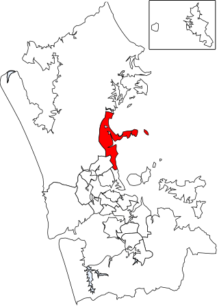
The Hibiscus and Bays Local Board is one of the 21 local boards of the Auckland Council. It is one of two boards overseen by the council's Albany Ward councillors. The board consists of eight members elected at large.

Pōhara is a rural locality in the Tasman District of New Zealand's South Island. The locality is northeast of Tākaka and southwest of Tata Beach. To the north is Limestone Bay, part of Golden Bay / Mohua
Waitahanui is a village in the Taupō District, Waikato region, New Zealand. The village is on the eastern shore of Lake Taupō, 14 km (9 mi) south of the district seat of Taupō.

Taupō Bay is a bay, village and rural community in the Far North District and Northland Region of New Zealand's North Island. There are about 40 permanent residents, and 180 properties. The white sand beach is 1.5 km wide.
Matakatia is a suburb situated on the Whangaparaoa Peninsula, towards the northern end of Auckland, New Zealand. It is about 43 kilometres north of the city centre.
Fairview Heights is a suburb located on the North Shore of Auckland, New Zealand. It is under local governance of Auckland Council. The area is defined by Lonely Track Road on the north, East Coast Road on the east, Oteha Valley Road on the south, and the Auckland Northern Motorway on the west. Until the end of the 20th century, the area was rural.
Holdens Bay is an eastern suburb of Rotorua in the Bay of Plenty region of New Zealand's North Island.
Kawakawa Bay is an east coast bay and settlement in the Franklin area of New Zealand's Auckland Region.
Arkles Bay is one of the northernmost suburbs of the contiguous Auckland metropolitan area located in New Zealand. It is located on the southern side of the Whangaparaoa Peninsula, in the Hibiscus Coast, located 25 kilometres (16 mi) north of the Auckland CBD. It is part of the Albany Ward area for local government purposes. Arkles Bay is known for its sheltered beaches, suitable for swimming and paddle boarding.