Hibiscus Coast

Last updated
Hibiscus Coast
Suburban area
Orewa morning.jpg
Red Beach in 2010.jpg
View of Stanmore Bay.jpg
Big Manly Beach.jpg
View of Arkles Bay.jpg
Tiritri Matangi lighthouse and macrocarpa tree.jpg
Auckland Council 2019 Wards Outlined Blank.png
Red pog.svg
Hibiscus Coast
Location in the Auckland Region
Coordinates: 36°36′21″S174°41′52″E / 36.6058°S 174.6978°E / -36.6058; 174.6978
CountryNew Zealand
Island North Island
Region Auckland
Electoral ward Albany Ward
Local board Hibiscus and Bays
Electorate Whangaparāoa
Te Tai Tokerau
Area
[1]
  Total49.38 km2 (19.07 sq mi)
Population
  Estimate 
(June 2023) [2]
64,660
Time zone UTC+12 (NZST)
  Summer (DST) UTC+13 (NZDT)

The Hibiscus Coast is a populated area on a stretch of the Hauraki Gulf coast in New Zealand's Auckland Region. It has a population of 64,660(June 2023), [2] making it the 10th most populous urban area in New Zealand, and the second most populous in the Auckland Region, behind Auckland itself. As an urban area delineated by Statistics New Zealand, the Hibiscus Coast consists of Hatfields Beach, Orewa, Silverdale and Whangaparāoa Peninsula. The Auckland Council's Hibiscus Coast subdivision of the Hibiscus and Bays includes the neighbouring communities of Waiwera and Stillwater, [3] and Milldale in Rodney, is also described as a part of the Hibiscus Coast. [4]

Contents

Tāmaki Māori settled the Hibiscus Coast area since at least the 13th century, utilising the resources of the Weiti River, Ōrewa River and Whangaparāoa Bay, where an important shark fishery was located. After the Kawerau warrior Maki unified many of the Tāmaki Māori people of the northern and western Auckland Region, his children and grandchildren established hapū including Ngāti Kahu, Ngāti Maraeariki and Ngāti Manuhiri. Ngāti Kahu and Ngāti Pāoa from the Hauraki Gulf fought for control over the Whangaparāoa Bay shark fishery in the 18th century. After fleeing the area in the 1820s due to the Musket Wars, Ngāti Kahu returned to the Hibiscus Coast, living here until the 1870s.

The Hibiscus Coast was a part of the Mahurangi Block, forest sold to the Crown in 1841. Kauri loggers and itinerant kauri gum diggers were among the first Europeans to come to the area. The township of Silverdale, then known as The Wade, was established as a logging town along the Weiti River, and the Waiwera Hot Pools became a popular tourist attraction in the latter 19th century.

Orewa and the Whangaparāoa Peninsula became popular tourist destinations in the 1920s, when holiday baches were constructed in the area. During World War II, a New Zealand Army base was constructed at the end of the peninsula. The area rapidly developed in the 1950s and 1960s, in part due to the opening of the Auckland Harbour Bridge, and town centres were constructed in Orewa and Whangaparāoa. The 1960s saw the opening of two regional parks, Wenderholm Regional Park, adjacent to the Hibiscus Cost, and Shakespear Regional Park, at the eastern headland of the Whangaparāoa Peninsula.

The Hibiscus Coast was connected to the Auckland Northern Motorway in the late 1990s, after which further residential development occurred on the coast, most notably at Silverdale. In 2023, construction began on O Mahurangi Penlink, a new motorway to Whangaparāoa, crossing the Weiti River.

Geography

Shakespear Regional Park Walking trails at Shakespear Regional Park.jpg
Shakespear Regional Park
Kotanui Island Kotanui Island.jpg
Kotanui Island

The Hibiscus Coast is an area of the northern Auckland Region, located between the Waiwera River to the north and the Ōkura River to the south, adjacent to the Hauraki Gulf. The area includes the Whangaparāoa Peninsula and Tiritiri Matangi Island, found 3.4 kilometres (2.1 mi) east of the peninsula. [5] Major communities on the Hibiscus Coast include Orewa, the Whangaparāoa Peninsula, Silverdale, and the villages of Stillwater, Hatfields Beach and Waiwera.

The area is home to six rivers, estuaries and streams: the Waiwera Estuary, [6] to the north, Ōtānerua Stream, [7] Nukumea Stream, [8] [9] Ōrewa River, Weiti River, and Ōkura River to the south. [1]

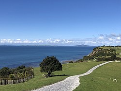
Beaches in the region are predominantly sandy, [10] with gentle slopes. Many of these are wide and provide excellent opportunities for sunbathing, swimming, and water sports. [10] [11] Red Beach and Orewa are some of Auckland's best beginner surf beaches, [12] whilst other Hibiscus Coast beaches are more suitable for swimming and families.

Tiritiri Matangi Island is an open sanctuary, [13] and the largest island on the Hibiscus Coast. Tiritiri Matangi is located a short distance off the end of the Whangaparāoa Peninsula adjacent to the Shakespear Regional Park. Mahurangi Island is a smaller Island which sits off the mouth of the Waiwera River, [14] the island forms part of the Wenderholm Regional Park. [15] The smallest island on the Hibiscus Coast is Kotanui Island (Frenchman's Cap), which sits between Matakatia and Gulf Harbour Marina. [16]

Prior to European settlement, the inland Hibiscus Coast area was densely forested, [17] dominated by kauri, [18] and the upper Ōrewa River catchment was a wetland. [19] By the mid-19th century, the Whangaparāoa Peninsula was no longer forested, and was dominated by mānuka scrub and swamplands. [20]

Etymology

A Hibiscus rosa-sinensis flower in Orewa. Hibiscus plants are the namesake of the region Pink Hibiscus flower.jpg
A Hibiscus rosa-sinensis flower in Orewa. Hibiscus plants are the namesake of the region

The name Hibiscus Coast dates from the early 1960s, when a group of Whangaparāoa and Orewa businessmen looked for an inclusive name for the developing Whangaparāoa/Orewa area. The group chose hibiscus, a non-native flower, due to its associations with beach and holiday atmospheres. [21] [22] Hibiscus was also used as the name of one of the minereal baths at the Waiwera Hot Pools in the early 20th century. [23] The Hibiscus Coast Association was established in the 1960s, and lobbied against other regions of New Zealand adopting the hibiscus as a symbol. [24] The name was officially adopted in 1971, when the Whangaparaoa Riding of the Waitemata County was renamed the Hibiscus Coast Riding. [25] [21]

Hibiscus Coast has been translated into Māori as Te Kūiti o te Puarangi, referring to puarangi, a rare native species of hibiscus. [26]

History

Māori history

The Hibiscus Coast area has been settled since at least the 13th century, with many of the first Māori occupants identifying as Ngā Oho. [17] The wider area between the Ōrewa River and Mahurangi River was traditionally known as Mahurangi, named after a located at the mouth of the Waiwera River. [27] Archaeological sites in the area are most densely found at Karepiro Bay, the Ōrewa River estuary and Shakespear Regional Park, at the end of the Whangaparāoa Peninsula. [17] The Ōrewa River estuary was an important sheltered harbour, which offered marine resources such as shellfish and flounder, and connections to inland walking routes. [17] The Tainui migratory waka is known to have visited Whangaparāoa in the 14th century, [28] and Tahawhakatiki, nephew of Tama-te-kapua of the Arawa waka settled at Whangaparāoa. [29] [28]

The Whangaparāoa Peninsula was an important transportation node between the wider Northland and Auckland regions, [20] and was often used as a resting point for people travelling between the Mahurangi Harbour and Waitematā Harbour. [28] Portages, where waka could be hauled overland between waterways, connected the Hibiscus Coast area to the Kaipara Harbour in the west. The Weiti Portage crossed overland between the Kaukapakapa River and the Weiti River, while the Aotoetoe portage travelled north between the Kaukapakapa River and the Ōrewa River. [30] [31] Additionally, the Waiau portage bisected the Whangaparāoa Peninsula between Tindalls Beach and Matakatia, and it is likely that another portage existed on the peninsula to the west, connecting Red Beach to the Weiti River. [30]

Arrival of Maki

Rarowhara, found between the Weiti River and Arkles Bay, was the major defensive pa for Ngati Kahu Kia Ora House, Arkles Bay, Auckland (20988321003) (cropped).jpg
Rarowhara, found between the Weiti River and Arkles Bay, was the major defensive for Ngāti Kahu

Likely in the 17th century, the warrior Maki migrated from the Kāwhia Harbour to his ancestral home in the Auckland Region. Maki conquered and unified many of the Tāmaki Māori tribes as Te Kawerau ā Maki, including those of the North Shore and Hibiscus Coast. [32] [33] After Maki's death, his sons settled different areas of his lands, creating new hapū, including the wider Hibiscus Coast hapū of Ngāti Manuhiri, Ngāti Maraeariki, Ngāti Poataniwha and Ngāti Kahu. [34] [35]

Maki's younger son Maraeariki primarily settled at the head of the Ōrewa River, [34] [36] [37] and his hapū Ngāti Maraeariki grew to occupy lands between Whangaparāoa and Ōmaha. [35] Maraeariki's children Te Utu and Kahu settled along the Whangaparāoa Peninsula. [20] Ngāti Poataniwha formed marriage links with Ngāi Tai descendants of Taihaua and Waiohua, [38] while Ngāti Kahu, who descend from Maraeariki's daughter Kahu, formed links with both Ngāi Tai descendants of Taihaua and Ngāti Whātua o Kaipara. [20] [35]

Ngāti Kahu focused settlement at Te Haruhi Bay at modern Shakespear Regional Park, due to its desirble location, [28] and held a defensive , Rarowhara, at the eastern headland of the Weiti River. [20] [28]

Outside of Rarowhara, pā were established across the wider area, including a ring of protective pā surrounding the Waiwera hot spring, [39] Dacre Point, [40] Alice Eaves Scenic Reserve, [41] Rakauananga Pā at Hobbs Bay, Coalminers Bay, Big Manly Beach and Little Manly Beach. [42]

Shark fishery conflict and the Musket Wars

Ngati Paoa established a pa on Tiritiri Matangi Island in the 18th century, in order to have more access to the Whangaparaoa shark fishery Tiritiri Matangi Island Shakespear.jpg
Ngāti Pāoa established a on Tiritiri Matangi Island in the 18th century, in order to have more access to the Whangaparāoa shark fishery

The Hibiscus Coast was the location of an important shark fishery, located between Kawau Island and the Whangaparāoa Peninsula, which was contested between iwi of the wider region. [35] By the mid-1700s, Marutūāhu tribes from the Hauraki Gulf, especially Ngāti Pāoa, sought to control the important resource. Ngāti Pāoa established a pā on Tiritiri Matangi Island, for use during shark fishing expeditions. [20] War between Ngāti Pāoa and Ngāti Kahu lasted until the 1790s. After a peace accord held at Mihirau at Wenderholm Regional Park was broken, Ngāti Pāoa attacked Rarowhara Pā, which Ngāti Kahu successfully defended. [20] During this period, Kawerau-descended hapū held exclusive land rights to the Hibiscus Coast area, while fishing rights were shared between Ngāti Kahu and Marutūāhu tribes. [35]

In September 1821 during the Musket Wars, a Ngāpuhi taua (war party) ventured south to avenge past losses against Ngāti Kahu in the 1790s. The Kawerau-descendant tribes were heavily defeated, and Rarowhara Pā was sacked. [28] [20] Survivors fled to the Ararimu Valley, Muriwai, and eventually to the Waikato, gradually returning in the 1830s. [28] [20] On return, Ngāti Kahu formed intertribal marriages with Ngāti Whātua o Kaipara, seasonally migrating between Orewa, Te Haruhi Bay and Ōkura. [28] [20] Ngāti Kahu settlement at Whangaparāoa continued until the 1870s. [20]

After the war, prominent Ngāpuhi chief Eruera Maihi Patuone, who married Takarangi / Rīria, a high ranking Ngāti Paoa woman, [43] [44] seasonally stayed at Whangaparāoa with his Ngāti Paoa relatives. [45]

Early colonial era: logging and Waiwera resort

John Kinder's 1868 watercolour depicting Kotanui Island / Frenchmans Cap seen from the Whangaparaoa Peninsula Kotanui Whangaparaoa (1868).jpg
John Kinder's 1868 watercolour depicting Kotanui Island / Frenchmans Cap seen from the Whangaparāoa Peninsula
The de Grut family house at Orewa, pictured between 1880 and 1899. The house would later become a popular hotel, the Orewa House Front view of Major De Grut's house, Orewa, Rodney District, including native trees and fence (cropped).jpg
The de Grut family house at Orewa, pictured between 1880 and 1899. The house would later become a popular hotel, the Orewa House
The Waiwera Hot Pools hotel in the 1930s Waiwera Hot Pools (AM 79543-1).jpg
The Waiwera Hot Pools hotel in the 1930s

The Hibiscus Coast area was visited by explorer Jules Dumont d'Urville in 1827 aboard the Astrolabe . d'Urville decided to name Karepiro Bay Tofino Bay after the Spanish navigator and mathematician Vicente Tofiño de San Miguel, [46] and the Whangaparāoa Peninsula 'Buache'. [47] The first known European to step ashore onto the Hibiscus Coast was a missionary in 1833, [48] and early timber merchants were attracted to the Weiti River catchment by the late 1830s. [47]

Following the signing of the Treaty of Waitangi in 1840, [49] the Crown made the first purchases of the Mahurangi and Omaha blocks on 13 April 1841, which included the Hibiscus Coast. While some iwi and hapū with customary interests had been engaged, such as Ngāti Paoa and Ngāi Tai ki Tāmaki, others, including Te Kawerau ā Maki, Ngāti Manuhiri and Ngāti Rango, were not involved with transactions. [50] [51] [52] This led to Ngāti Manuhiri being alienated from land on the Hibiscus Coast. [34]

Timber felling increased along the Weiti River catchment in the 1840s, and a settlement called the Wade (modern-day Silverdale) was established at the navigable heads of the Weiti River around the year 1853, becoming the commercial centre for the area. [53] [54] The first known permanent settler along the Weiti River was John Robey Cole Hatfield, who settled in 1844. [55] By 1853, there were likely between 200 and 300 people living at the Wade. [54] [40] Maurice and Ellen Kelly, who operated a timber milling business, opened the Wade Hotel, which became the social centre for the town. [56] The hotel was of ill repute among early settlers to New Zealand, known for cockfighting, dog fighting, and had a reputation for criminality. [54] Silverdale School was established as the first school on the Hibiscus Coast in 1869 (then known as Wade School). [57]

In 1844, Robert Graham constructed a house adjacent to the Waiwera Hot Pools, [45] publicising the hot pools as a tourist destination from 1848 onwards. [58] In 1864, the Waiwera hot springs hotel was constructed, [59] and by 1878 ferry services operated between Auckland and the hotel. [60] Outside of the Wade, Ranulph Dacre acquired Weiti Station, a timber mill at modern Okura Bush Scenic Reserve in 1846, [20] and the Polkinghorme family settled at Whangaparāoa in the 1850s, establishing a short-lived cheese factory. [45] By the mid-1850s, the majority of accessible native forest had been logged across the region, and the Hibiscus Coast was subdivided into farming lots. [48] Six years after the construction of New Zealand's first lighthouse, the Tiritiri Matangi Lighthouse was built in 1864. [61] It remains New Zealand's oldest working lighthouse. [61]

In 1856 Captain Isaac Rhodes Cooper built Orewa House with the 58th (Rutlandshire) Regiment of Foot. [62] [31] This became the family residence of Channel Islands migrants, the de Jersey Gruts, in 1868, [62] after the family struggled to establish a farm at Birkenhead. [63] Orewa House was the de Jersey Grut home for three generations, [62] becoming a commercial guest house in 1906. [62]

Early 20th century

As kauri gum deposits became rarer, land at Orewa was developed into orchards, where apples, pears, grapes and citrus fruit were grown for the Auckland market. [64] By the turn of the 20th century, dairy farming had become a viable and profitable business in New Zealand. This led to escalating land prices on the Hibiscus Coast and more intensive land use, [65] and by the 1920s orchards were replaced by dairy farms. [64] A long jetty was constructed at Waiwera in 1905, quickly becoming dilapidated due to the wharf's length making it difficult to maintain. [60] In 1911, the residents of the Wade decided to rename the settlement Silverdale, due to its poor reputation. [54]

Orewa became a popular destination for campers and holidayers in the 1920s, [66] which led to the height of popularity of Orewa House, then owned by Alice and Edward Eaves. [31] The first holiday baches were constructed on Whangaparāoa in the 1920s, at Red Beach and Manly. Small coastal communities developed around each bay, without the entire Whangaparāoa Peninsula having a shared identity. [21]

By the 1930s, coastal steamers were no longer the major form of transportation due to improved roading infrastructure. [65] During the night of the 27 September 1939, a fire broke out in the Waiwera Hotel, seeing the building burnt to the ground. [67] The fire was reportedly visible from Auckland City. The hotel's two only guests were able to escape the building safely. [67]

Following the start of World War II, the threat of Japanese invasion saw the headland of the Whangaparāoa Peninsula chosen as one of two Auckland defence sites. [68] Coastal defences were subsequently established in what was then the Shakespear family farm. [68] Eleven pillboxes, [69] and a number of other army barracks were built on the land. [69] By 1961, the batteries and much of the other military equipment had been decommissioned. [68] The base, remains active into the 21st century as part of the Royal New Zealand Navy as the RNZN Tamaki Training Centre. [68]

Suburban development

Gulf Harbour marina surrounded by farmland in the 1980s Gulf Harbour marina in the 1980s (cropped).jpg
Gulf Harbour marina surrounded by farmland in the 1980s

Orewa and the Whangaparāoa Peninsula were subdivided for suburban housing in the 1950s. [31] The Orewa town centre was developed in 1953, which included a shopping precinct and Hillary Square, [70] joined by a town centre at Whangaparāoa in 1957. Residents narrowly decided on the name Whangaparāoa to describe the new town centre, favoured over the runner up name Glen Arkle. [45] The Hibiscus Coast experienced a building and population boom in the 1960s, due to the opening of the Auckland Harbour Bridge. [21] Orewa and western Whangaparāoa rapidly urbanised between 1964 and 1975, with the eastern Whangaparāoa peninsula developing in the late 1980s. [71]

In 1957, the Orewa Skating Rink was constructed. The rink developed into an entertainment precinct for the Hibiscus Coast in the 1960s, including a minigolf range and concert space. The rink was demolished in 1983. [72]

In the mid-1960s, the Hibiscus Coast Association was established by local businessmen, looking to create a unified identity for the Orewa and Whangaparāoa areas. As a part of their efforts, more than 1,000 hibiscus trees were planted in the area in 1964. [24] By the end of the 1960s, the peninsula had approximately 2,000 permanent residents, with the population swelling to over 25,000 during the summer. [42]

In 1965, the Auckland Regional Authority established Wenderholm Regional Park, the first newly established regional park in Auckland, directly adjacent to the Hibiscus Coast. [73] [39] This was followed by Shakespear Regional Park, at the eastern headland of the Whangaparāoa Peninsula, in 1967. [74]

By the 1980s, large-scale housing developments were being constructed along the Whangaparāoa Peninsula. [42] In 1990, the Centrestage Theatre was constructed in Orewa. [75]

On 20 December 1999, the Auckland Northern Motorway was extended to Silverdale. [76] This created a major link for the area back to the city. In 2004, a 12-storey apartment complex called the Nautilus was completed at Orewa. The only high rise building on the Hibiscus Coast, it is home to over 300 people, and in 2009 faced issues for being a leaky building. [77] Silverdale rapidly expanded in the early 2000s. [71]

In 2018, the Waiwera Hot Pools closed for renovations; [78] however it never reopened. In 2023, the derelict water park was demolished. [79]

During the early days of the COVID-19 pandemic in New Zealand in 2020, New Zealanders returning from Wuhan were required to quarantine at the Whangaparāoa Naval Base. [80] As the pandemic continued, the facility was not used further in favour of quarantine hotels and facilities closer to the international airports.

In late 2022, construction began on O Mahurangi Penlink, a new motorway between the Auckland Northern Motorway and the Whangaparāoa Peninsula, crossing the Weiti River at Stillwater and connecting the township to the Auckland motorways network. [81] The road is projected to open in 2026. [82] Future areas that are zoned for development on the Hibiscus Coast include the Highgate Business Park and Weiti Lands, the area between Okura Bush Scenic Reserve and Stillwater. [5]

Demographics

Hibiscus Coast covers 49.38 km2 (19.07 sq mi) [83] [upper-alpha 1] and had an estimated population of 64,660 as of June 2023, [2] with a population density of 1,309 people per km2.

Historical population
YearPop.±% p.a.
200638,010    
201344,106+2.15%
201854,924+4.48%
Source: [84]

Hibiscus Coast had a population of 54,924 at the 2018 New Zealand census, [upper-alpha 2] an increase of 10,818 people (24.5%) since the 2013 census, and an increase of 16,914 people (44.5%) since the 2006 census. There were 20,334 households, comprising 26,517 males and 28,416 females, giving a sex ratio of 0.93 males per female, with 10,320 people (18.8%) aged under 15 years, 8,667 (15.8%) aged 15 to 29, 24,294 (44.2%) aged 30 to 64, and 11,637 (21.2%) aged 65 or older.

Ethnicities were 86.0% European/Pākehā, 7.8% Māori, 2.4% Pasifika, 10.7% Asian, and 2.3% other ethnicities. People may identify with more than one ethnicity.

The percentage of people born overseas was 35.1, compared with 27.1% nationally.

Although some people chose not to answer the census's question about religious affiliation, 50.5% had no religion, 38.8% were Christian, 0.2% had Māori religious beliefs, 1.2% were Hindu, 0.4% were Muslim, 0.9% were Buddhist and 1.6% had other religions.

Of those at least 15 years old, 10,122 (22.7%) people had a bachelor's or higher degree, and 6,435 (14.4%) people had no formal qualifications. 9,966 people (22.3%) earned over $70,000 compared to 17.2% nationally. The employment status of those at least 15 was that 21,348 (47.9%) people were employed full-time, 6,522 (14.6%) were part-time, and 1,209 (2.7%) were unemployed. [84]

Individual statistical areas (2018 Census)
NameArea
(km2)
PopulationDensity
(per km2)
HouseholdsMedian ageMedian
income
Hatfields Beach 0.921,5541,68955840.4 years$41,000 [85]
Orewa North3.044,0981,3481,56952.4 years$30,600 [86]
Orewa South2.313,0481,3191,37160.5 years$25,400 [87]
Orewa Central0.453,0966,8801,44958.1 years$27,700 [88]
Millwater North1.753,6422,0811,11336.2 years$45,400 [89]
Millwater South2.412,30495667232.8 years$43,300 [90]
Kingsway0.902,1872,43070537.8 years$40,100 [91]
Silverdale Central3.36282849038.1 years$35,500 [92]
Red Beach West1.842,1361,16178950.3 years$25,100 [93]
Red Beach East1.564,0232,5791,53344.9 years$36,300 [94]
Vipond1.382,9252,1201,11340.7 years$35,500 [95]
Stanmore Bay West0.992,7212,74893635.0 years$37,600 [96]
Whangaparāoa Central3.693,7861,0261,35039.3 years$37,000 [97]
Stanmore Bay East1.342,7332,0401,00237.1 years$34,500 [98]
Manly West1.032,3492,28188245.2 years$35,900 [99]
Tindalls-Matakatia 2.931,97767572347.8 years$36,200 [100]
Gulf Harbour North1.762,9341,66798738.8 years$38,300 [101]
Manly East1.573,5552,2641,35644.1 years$33,100 [102]
Army Bay 6.221,56625256142.9 years$38,000 [103]
Gulf Harbour South2.432,6641,0961,04142.6 years$39,100 [104]
7001403 [upper-alpha 3] 4.20129313943.0 years$32,900
7001364 [upper-alpha 4] 0.5524043615054.8 years$30,100
7001576 [upper-alpha 5] 0.111681,5276343.7 years$43,100
70015770.071562,2294836.3 years$50,700
70015780.041323,3004539.3 years$60,900
70015790.071742,4866040.6 years$42,000
70015920.122281,9009644.3 years$41,300
70015930.041172,9253332.6 years$56,300
New Zealand37.4 years$31,800
  1. In this paragraph, Hibiscus Coast is using the Statistics New Zealand-defined large urban area (Urban Rural Code 1093) for the 2023 census, plus the rural settlements of Waiwera (Urban Rural Code 1089) and Stillwater (Urban Rural Code 1095).
  2. In the remainder of this section giving 2018 census figures, Hibiscus Coast is treated as including the SA2 and SA1 areas listed in the table of individual statistical areas below. This is a slightly smaller area than that used in the previous paragraph, covering 47.07 km2 (18.17 sq mi), not including the 2023 SA2 area Ara Hill or part of the 2023 SA2 area of Milldale.
  3. This SA1 area, which does not have a name in the census results, covers most of the 2023 SA2 area of Milldale.
  4. This SA1 area covers the 2023 rural settlement of Waiwera.
  5. The remaining SA1 areas cover the 2023 rural settlement of Stillwater.

Notable people

Recreation

Snowplanet indoor ski slope Snowplanet.jpg
Snowplanet indoor ski slope

The Hibiscus Coast has a number of beaches that attract people to live there. Other places of interest on the coast or nearby include Snowplanet, [112] Auckland Adventure Park, [113] the Waiwera Hot Pools (now abandoned), Orewa Beach, Shakespear Regional Park, [114] and Gulf Harbour. Gulf Harbour is near the end of the Whangaparaoa Peninsula, which is quite close to the wildlife reserve Tiritiri Matangi Island. Ferries transport people to the island from the harbour and back on a regular basis. [115]

Politics

From 1877 until 1974, the area was administered by the Waitemata County, a large rural county north and west of the city of Auckland. [37] In 1974 the county was dissolved, [116] becoming part of Rodney County, them from 1989 to 2010 Rodney District. Orewa was the administrative centre for the Rodney District. [117] The Hibiscus Coast was amalgamated into Auckland Council in November 2010, under a single unitary authority system. [118]

Within the Auckland Council, the Hibiscus Coast subdivision is a part of the Hibiscus and Bays local government area governed by the Hibiscus and Bays Local Board. [119] It is a part of the Albany ward, which elects two councillors to the Auckland Council.

Education

Orewa College 20230101 154222 Orewa College.jpg
Orewa College

Primary

Secondary

Transport

Ferry at Tiritiri Matangi Island Tiritiri Matangi wharf and Tiri Kat ferry.jpg
Ferry at Tiritiri Matangi Island

Roading infrastructure

Marking the inner boundary of the Hibiscus Coast is Auckland's Northern Motorway (State Highway One). [1] The motorway was extended to Orewa at the end of the 1990s. [76] In early 2009, a further motorway extension connected the motorway to Puhoi, creating the Northern Gateway Toll Road and replacing that section of State Highway 17. [135]

Connecting State Highway One at Silverdale to Puhoi via Orewa and Hatfields Beach, the Hibiscus Coast Highway was formerly a section of State Highway 17 [136] and prior to that State Highway One. [76] Motorway extensions allowed the Hibiscus Coast Highway to be repurposed to serve growth in the local areas.

Set to connect State Highway One at Weiti Station (between Silverdale and Albany) to Stillwater and Stanmore Bay, O Mahurangi Penlink will be a crucial connection to the Whangaparaoa Peninsula. The new connection will feature a new crossing of the Weiti River [137] and is set to open in 2026. [138]

Bus services

Auckland Transport local bus routes are operated by AT Metro across the Hibiscus Coast. [139] Urban Rapid Transit services operate from the Hibiscus Coast Busway Station and connect the coast to central Auckland and Warkworth. [140] InterCity services also operate via the Hibiscus Coast Busway Station. [141]

Ferry services

Auckland Transport commuter ferry services are operated by Fullers360, running between Gulf Harbour and Downtown Auckland on weekdays. [142] [143] Tourism services are operated by Explore via Gulf Harbour to Tiritiri Matangi Island and operate year-round. [115]

Climate

The Hibiscus Coast has a warm temperate oceanic climate (Cfb) on the Köppen Climate Classification System.

Climate data for Whangaparāoa (2010-2020)
MonthJanFebMarAprMayJunJulAugSepOctNovDecYear
Record high °C (°F)28.65
(83.57)
27.66
(81.79)
26.68
(80.02)
22.72
(72.90)
20.75
(69.35)
17.78
(64.00)
16.8
(62.2)
17.78
(64.00)
19.76
(67.57)
21.74
(71.13)
22.72
(72.90)
26.68
(80.02)
28.65
(83.57)
Mean daily maximum °C (°F)21.66
(70.99)
22.25
(72.05)
20.94
(69.69)
18.93
(66.07)
16.69
(62.04)
14.7
(58.5)
13.61
(56.50)
13.97
(57.15)
14.61
(58.30)
16.19
(61.14)
18.07
(64.53)
20.71
(69.28)
17.65
(63.77)
Daily mean °C (°F)19.89
(67.80)
20.33
(68.59)
19.12
(66.42)
17.32
(63.18)
15.31
(59.56)
13.54
(56.37)
12.29
(54.12)
12.54
(54.57)
13.11
(55.60)
14.52
(58.14)
16.34
(61.41)
18.45
(65.21)
16.06
(60.91)
Mean daily minimum °C (°F)16.63
(61.93)
17.28
(63.10)
16.38
(61.48)
15.19
(59.34)
13.47
(56.25)
11.94
(53.49)
10.54
(50.97)
10.66
(51.19)
10.9
(51.6)
11.87
(53.37)
13.12
(55.62)
15.27
(59.49)
13.6
(56.5)
Record low °C (°F)11.86
(53.35)
11.86
(53.35)
10.87
(51.57)
10.87
(51.57)
4.94
(40.89)
5.93
(42.67)
5.93
(42.67)
3.95
(39.11)
4.94
(40.89)
5.93
(42.67)
4.94
(40.89)
10.8
(51.4)
3.95
(39.11)
Average rainfall mm (inches)85.35
(3.36)
92.54
(3.64)
96.2
(3.79)
116.12
(4.57)
143.69
(5.66)
157.72
(6.21)
132.52
(5.22)
144.99
(5.71)
135.34
(5.33)
85.51
(3.37)
98.28
(3.87)
103.59
(4.08)
115.99
(4.57)
Average rainy days9.0711.0511.5913.215.1815.4515.2617.1515.8113.2912.2111.513.4
Source: Weather and Climate [144]

Sport

The Hibiscus Coast Raiders are rugby league club based in Stanmore Bay, who play as a part of the Auckland Rugby League HBCRaidersvPapatoetoe.png
The Hibiscus Coast Raiders are rugby league club based in Stanmore Bay, who play as a part of the Auckland Rugby League

Bowling

The Hibiscus Coast is home to two outdoor lawn bowling clubs, one in Orewa, [145] and another in Manly. [146] A third bowls club formerly operated in Silverdale at the War Memorial Park, but closed prior to 2018. [147]

Football

Founded in 1974, the Hibiscus Coast AFC is an amateur football club based in Stanmore Bay which competes in the Lotto Sport Italia NRFL Division 2.

Golf

The Hibiscus Coast formally had three golf clubs, as of 2023 only the Whangaparaoa Golf Club remains operational. Whangaparaoa Golf Club first opened in the 1950s and is located on 41 acres in Army Bay. [148] [149] The former Peninsula Golf Course was originally formed in 1956. [150] It was an 18-hole golf course which covered almost 45 hectares. [150] In 2014, Fletcher Living was granted a consent to convert the golf course to a residential development. [150]

Following the development of Gulf Harbour, the Gulf Harbour Country Club opened in 1997, [151] the following year, the club hosted the 1998 World Cup of Golf. Then in 2005 and 2006 the club hosted the New Zealand Open. [151] [152] In July 2023 the club closed after "two years of unsuccessfully looking for ways to make the running of the club financially viable".

Netball

The Hibiscus Coast Netball Centre is home to six netball courts and is located in Manly, on Edith Hopper Park. [153] In 2009 the Silverdale Seahawks Netball Club was established. [154]

Rugby

Union

The Silverdale United Rugby Club is a rugby union club based in Silverdale. [155] The club was established in 1887 [156] in 1963 the Kaukapakapa Rugby Club was merged with the Silverdale Club. During the 2011 Rugby World Cup, New Zealand rugby clubs were asked to host country's national teams, as a result, the Silverdale War Memorial Park grounds played host to teams from Japan, Namibia, and Samoa. [155]

League

The Hibiscus Coast Raiders rugby league club is based in Stanmore Bay. [157] The club is a part of the Auckland Rugby League and compete in the Fox Memorial Championship. [158]

Sailing

The Hibiscus Coast is home to two Yacht and Sailing Clubs, the Gulf Harbour Yacht Club is based in Gulf Harbour and faces towards the south side of the Whangaparaoa Peninsula whilst the Manly Sailing Club is located on Big Manly Beach on the north side. Both clubs host a variety of Regional, National and International regattas. As of 2023, only the Manly Sailing Club offer Learn to Sail Programmes in their respective classes.

Surf Life Saving

Two Hibiscus Coast beaches, Orewa and Red Beach are patrolled by lifeguards over the summer months. [159] Orewa Surf Lifesaving Club was first established in 1950 with the current club building opening in 1960. [160] Orewa Surf Lifesaving Club is currently developing a new Surf Life Saving Community Hub on the site of the existing club. [161] [162] Red Beach Surf Life Saving Club was formed three years after Orewa in 1953, [163] the first club house was completed in 1956 then replaced with a new building in 1983. [163]

Auckland Surf Park is a planned artificial surfing lagoon set to open between 2026 and 2027 in nearby Dairy Flat. [164]

Tennis

The Silverdale Tennis Club is located in the Silverdale War Memorial Park. [165] Two tennis clubs are situated in Manly at Edith Hopper Park and Manly Park. Another Tennis Club is located in Victor Eaves Park, Orewa. [166]

Related Research Articles

<span class="mw-page-title-main">Warkworth, New Zealand</span> Town in Auckland, New Zealand

Warkworth is a town on the Northland Peninsula in the upper North Island of New Zealand. It is in the northern part of the Auckland Region. It is located on State Highway 1, 64 km (40 mi) north of Auckland and 98 km (61 mi) south of Whangārei, and is at the head of Mahurangi Harbour.

<span class="mw-page-title-main">Orewa</span> Suburb in Auckland, New Zealand

Orewa is a settlement in the northern Auckland Region of New Zealand. It is a suburb of the Hibiscus Coast, just north of the base of the Whangaparāoa Peninsula and 40 kilometres (25 mi) north of central Auckland. The Northern Motorway, part of State Highway 1, passes just inland of Orewa and extends through the twin Johnston Hill tunnels to near Puhoi.

Whangaparāoa Peninsula Suburban area in Auckland Council, Auckland, New Zealand

The Whangaparāoa Peninsula is a suburban area about 30–50 km north of Auckland, New Zealand. It had 33,390 residents in 2018. It stretches from Red Beach, where it connects to Kingsway, Orewa and Silverdale, and extends to Army Bay in the Hauraki Gulf. It is part of the Hibiscus Coast. The area is populated by residents who work on the peninsula, or commute from the area to other parts of the Hibiscus Coast, the North Shore, Rodney district, Auckland CBD and beyond for work. They travel by vehicle, or via the Gulf Harbour ferry at Gulf Harbour Marina, or the Hibiscus Coast Bus Station at Silverdale. There is one main road along its entire length, which is accessible from State Highway 1 via Hibiscus Coast Highway at Silverdale, or from Hibiscus Coast Highway at Orewa via Red Beach. It is popular as a tourist destination for catching a ferry to Tiritiri Matangi Island, and for visiting Shakespear Regional Park. It has one open (Whangaparāoa Golf Club) and one closed golf club (Gulf Harbour Country Club), beaches, sporting and recreation facilities, a library, shops, businesses and public and private primary and secondary schools. The median age of the population is in the 30s-40s.

<span class="mw-page-title-main">Browns Bay, New Zealand</span> Suburb in Auckland, New Zealand

Browns Bay is one of the most northernmost suburbs in the contiguous Auckland metropolitan area, located in the North Shore. Named after the Brown family who settled here in 1876, Browns Bay became a holiday destination in the late 19th century. The area gradually developed into a suburb of Auckland in the 1950s, and was the administrative centre for the East Coast Bays City from 1975 until it was disestablished in 1989. During the 1990s, the suburb became a hub for the South African New Zealander community.

<span class="mw-page-title-main">Mairangi Bay</span> Suburb in Auckland, New Zealand

Mairangi Bay is a coastal suburb of North Shore, Auckland, located in the northern North Island of New Zealand, on the south-east-facing peninsula forming the northern side of the Waitematā Harbour. Mairangi Bay came under the local governance of the North Shore City Council until subsumed into the Auckland Council in 2010.

<span class="mw-page-title-main">Rothesay Bay</span> Suburb in Auckland, New Zealand

Rothesay Bay is a small suburb in Auckland's East Coast Bays region. The suburb is roughly the same size as Murrays Bay, the suburb to the immediate south.

<span class="mw-page-title-main">Silverdale, Auckland</span> Suburb in Auckland, New Zealand

Silverdale is a village approximately 30 km north of Auckland in the North Island of New Zealand. It is located on the north bank of the Weiti River and lies to the west of the Whangaparaoa Peninsula.

O Mahurangi Penlink, is a 7-kilometre-long (4.3-mile), two-lane future state highway. Construction began in late 2022 and is expected to conclude in late 2026. Once completed the new state highway will create a more direct and quicker route between the Whangaparaoa Peninsula and central Auckland in New Zealand.

<span class="mw-page-title-main">Murrays Bay</span> Suburb in Auckland, New Zealand

Murrays Bay is a small suburb in the East Coast Bays region, located in the North Shore of Auckland. The suburb is roughly the same size as Rothesay Bay, the suburb to the immediate north. It is primarily a residential area but does have a community centre, restaurant and café. Murrays Bay is regularly serviced by buses which go to Takapuna and the Auckland city centre.

<span class="mw-page-title-main">Snells Beach</span> Place in Auckland Region, New Zealand

Snells Beach is a small coastal town in the north of Auckland Region in the North Island of New Zealand. It is situated on the eastern coast of the Mahurangi Peninsula and its namesake beach faces east across Kawau Bay to Kawau Island. The nearest town is Warkworth, 8 km (5.0 mi) to the west, which is linked by 8 buses a day and also Mahu City Express twice a day.

<span class="mw-page-title-main">Red Beach, New Zealand</span> Suburb in Auckland, New Zealand

Red Beach is a suburb surrounding the beach of the same name on the Hibiscus Coast, Auckland, New Zealand, at the base of the Whangaparaoa Peninsula. The suburb of Silverdale is to the south-west, and Orewa to the north.

Manly is a suburb on the Whangaparaoa Peninsula, towards the northern end of Auckland, New Zealand. Manly Village is an established shopping centre, with the residential areas of Big Manly Beach to the north and Little Manly Beach to the south. The area was once a seaside holiday location, but has become residential suburbs within commuting distance of central Auckland city.

<span class="mw-page-title-main">Long Bay, New Zealand</span> Suburb in Auckland, New Zealand

Long Bay is one of the northernmost suburbs of the North Shore, part of the contiguous Auckland metropolitan area located in New Zealand.

<span class="mw-page-title-main">Campbells Bay</span> Suburb in Auckland, New Zealand

Campbells Bay is a suburb of the North Shore located in Auckland, New Zealand. Centennial Park is a popular recreational space that has walking tracks and stunning harbour views.

<span class="mw-page-title-main">Ōrewa River</span> River in Auckland Region, New Zealand

The Ōrewa River is a river of the Auckland Region of New Zealand's North Island. It flows east to reach Whangaparāoa Bay just to the north of Whangaparaoa Peninsula. The town of Orewa is near the river's mouth.

<span class="mw-page-title-main">Shakespear Regional Park</span>

Shakespear Regional Park is a nature park in the Auckland Region of New Zealand. It is located at the tip of the Whangaparaoa Peninsula, and is named after the Shakespear family which bought the land in the 1880s from local Maori.

State Highway 17 was the designation for a 32-kilometre stretch of highway in northern Auckland in the North Island of New Zealand from December 1999 to October 2012. It is now designated Urban Route 31 and consists of the Hibiscus Coast Highway, Dairy Flat Highway and Albany Expressway. It linked State Highway 1 at Puhoi in the north with SH 1 at Albany in the south. Its main destinations were the towns of Waiwera, Orewa, Red Beach, Whangaparaoa, Silverdale, Dairy Flat and the suburb of Albany. Prior to its inception as SH 17, the road was part of SH 1, and was redesignated as SH 17 as the Northern Motorway was extended northwards and took over the designation of SH 1.

<span class="mw-page-title-main">Waiake</span> Suburb in Auckland, New Zealand

Waiake is one of the northernmost suburbs of the North Shore, in Auckland, New Zealand. It is located in the East Coast Bays between the suburbs of Browns Bay to the south and Torbay to the north. It has a beach, which looks out to the Tor, a presque-isle at the north end of the beach that becomes an island at high tide. Waiake is under the local governance of the Auckland Council.

<span class="mw-page-title-main">Hibiscus and Bays</span> Local board area in Auckland, New Zealand

Hibiscus and Bays is a local government area in Auckland, in New Zealand's Auckland Region, governed by the Hibiscus and Bays Local Board and Auckland Council. It currently aligns with the council's Albany Ward.

<span class="mw-page-title-main">Karepiro Bay</span>

Karepiro Bay is a bay of the Hauraki Gulf / Tīkapa Moana in the Auckland Region, New Zealand. It found between the Whangaparāoa Peninsula and North Shore, and is the mouth of the Weiti River and Ōkura River.

References

  1. 1 2 3 "ArcGIS Web Application". statsnz.maps.arcgis.com. Retrieved 2023-09-04.
  2. 1 2 3 "Subnational population estimates (RC, SA2), by age and sex, at 30 June 1996-2023 (2023 boundaries)". Statistics New Zealand . Retrieved 25 October 2023. (regional councils); "Subnational population estimates (TA, SA2), by age and sex, at 30 June 1996-2023 (2023 boundaries)". Statistics New Zealand . Retrieved 25 October 2023. (territorial authorities); "Subnational population estimates (urban rural), by age and sex, at 30 June 1996-2023 (2023 boundaries)". Statistics New Zealand . Retrieved 25 October 2023. (urban areas)
  3. "Hibiscus Coast Subdivision" (PDF). Hibiscus and Bays Greenways. Hibiscus and Bays Local Board. 2016. Retrieved 16 March 2022.
  4. Hutt, Kendall (15 March 2021). "Two new primary schools on the way for north Auckland's Hibiscus Coast". Stuff . Retrieved 12 January 2024.
  5. 1 2 Hibiscus and Bays Greenways (PDF) (Report). Auckland Council . Retrieved 11 January 2024.
  6. "Waiwera Estuary". Land, Air, Water Aotearoa (LAWA). Retrieved 2023-09-04.
  7. "Otanerua Stream River Quality". Land, Air, Water Aotearoa (LAWA). Retrieved 2023-09-04.
  8. "Nukumea Stream River Quality". Land, Air, Water Aotearoa (LAWA). Retrieved 2023-09-04.
  9. "Reintroducing giant kōkopu to Nukumea Stream". NIWA. 2009-12-04. Retrieved 2023-09-04.
  10. 1 2 Godfrey, Shyr (2018-11-29). "8 Must-Visit Beaches On The Hibiscus Coast PLUS What To Eat When You're There". Forty Thieves Nut Butters. Retrieved 2023-09-04.
  11. "Hibiscus Coast History and Suburbs". Linku2 Hibiscus Coast. Retrieved 2023-09-04.
  12. Francis, Joseph Richard (2020-12-06). "The Ultimate Guide to Auckland Surf". Surf Atlas. Retrieved 2023-09-04.
  13. "Tiritiri Matangi Island". www.doc.govt.nz. Retrieved 2023-09-04.
  14. "NZGB Gazetteer | linz.govt.nz". gazetteer.linz.govt.nz. Retrieved 2023-09-04.
  15. "Wenderholm Regional Park Our History" (PDF). Auckland Council.
  16. "Outstanding Natural Features Overlay - Unitary Plan". Auckland Council. Retrieved 2023-09-04.
  17. 1 2 3 4 McKenzie, Fiona (November 2013). Cultural Impact Assessment for Hall Farm Orewa West (Report). Manuhiri Kaitiaki Charitable Trust. Archived from the original on 27 December 2023.
  18. "History - Whangaparaoa Coastal Trail". Whangaparaoa Coastal Trail. Retrieved 19 September 2023.
  19. "History of Milldale". Ahutoetoe School. Retrieved 12 January 2024.
  20. 1 2 3 4 5 6 7 8 9 10 11 12 Bickler, Simon; Clough, Rod; Phillips, Ken; Plowman, Mica; Farley, Glen; Dodd, Andrew; Baquié, Barry (2008). Site R10/80 Whangaparaoa Peninsula: Final Excavation Report (PDF) (Report). Clough & Associates Ltd. Retrieved 10 January 2024.
  21. 1 2 3 4 Grover 2008, pp. 7.
  22. "Hibisccus book reprinted". Stuff . 31 January 2009. Retrieved 9 January 2024.
  23. Billman 1965, pp. 10.
  24. 1 2 "Whangarei Dispenses With Hibiscus Emblem". Press. Vol. CIV, no. 30655. 22 January 1965. p. 3 via Papers Past.
  25. "The New Zealand Gazette" (PDF). New Zealand Government. 9 September 1971. Retrieved 9 January 2024.
  26. Hibiscus and Bays Local Board (2022). "Te Poari ā-Rohe o Hibiscus and Bays Te Rīpoata ā-Tau 2021/2022 Hibiscus and Bays Local Board Annual Report 2021/2022" (PDF). Auckland Council . Retrieved 12 January 2024.
  27. Te Kawerau ā Maki; The Trustees of Te Kawerau Iwi Settlement Trust; The Crown (22 February 2024). "Deed of Settlement Schedule: Documents" (PDF). Retrieved 12 January 2024.
  28. Gray, Marie; Sturm, Jennifer, eds. (June 2008). ...And Then Came the Bridge. A History of Long Bay and Torbay. Torbay Historical Society. p. 6. ISBN   978-0-473-13957-5.
  29. 1 2 Hooker, Brian (September 1997). "Portages of early Auckland - to and from the Waitemata Harbour: The hub of an ancient communications network". Auckland-Waikato Historical Journal (70): 39–40. Retrieved 21 July 2022.
  30. 1 2 3 4 Grover 2008, pp. 31–42.
  31. "Waitākere Ranges Heritage Area" (PDF). Auckland Council. December 2018. Retrieved 28 June 2021.
  32. Murdoch, Graeme (1990). "Nga Tohu o Waitakere: the Maori Place Names of the Waitakere River Valley and its Environs; their Background History and an Explanation of their Meaning". In Northcote-Bade, James (ed.). West Auckland Remembers, Volume 1. West Auckland Historical Society. pp. 13–14. ISBN   0-473-00983-8.
  33. 1 2 3 Ngāti Manuhiri; The Crown (21 May 2011). "Deed of Settlement of Historical Claims" (PDF). New Zealand Government . Retrieved 18 May 2022.
  34. 1 2 3 4 5 Tino Rangatiratanga me te Kāwanatanga: The Report on Stage 2 of the Te Paparahi o Te Raki Inquiry. Waitangi Tribunal Report 2023 Wai 1040 Part I Volume 1 (PDF) (Report). Waitangi Tribunal. 2023. ISBN   978-1-86956-365-3 . Retrieved 19 December 2023.
  35. Whaanga, Mel (March 2022). "He taonga o te rohe". Restore Hibiscus & Bays. Retrieved 30 June 2023.
  36. 1 2 Grover 2008, pp. 4.
  37. New Zealand Government; Te Ākitai Waiohua (12 November 2021). "Deed of Settlement of Historical Claims" (PDF). New Zealand Government . Retrieved 11 January 2024.
  38. 1 2 Grover 2008, pp. 45–48.
  39. 1 2 Campbell, Matthew; Harris, Jaden; McAlister, Andrew (19 August 2013). Auckland Council North and North West Rural Urban Boundary Options: Cultural Heritage Overview (PDF) (Report). CFG Heritage. Retrieved 27 December 2023.
  40. Destination Orewa Beach 2021, pp. 6.
  41. 1 2 3 "The Whangaparaoa Story". Business Whangaparaoa. Retrieved 10 January 2024.
  42. Carleton, Hugh (1874). "Vol. I". The Life of Henry Williams. Early New Zealand Books (ENZB), University of Auckland Library. p. 243.
  43. Ballara, Angela (November 2010). "Patuone, Eruera Maihi". Te Ara: The Encyclopedia of New Zealand . Retrieved 15 December 2023.
  44. 1 2 3 4 5 Grover 2008, pp. 17–30.
  45. Grover 2008, pp. 26.
  46. 1 2 Grover 1996, pp. 5.
  47. 1 2 Grover 2008, pp. 5.
  48. Rigby, Barry (1998). The Crown, Maori and Mahurangi 1840-1881 (PDF). Waitangi Tribunal.
  49. Rigby, Barry (August 1998). The Crown, Maori and Mahurangi 1840-1881 (PDF) (Report). Waitangi Tribunal . Retrieved 4 July 2023.
  50. Stone 2001, pp. 188.
  51. Te Kawerau ā Maki; The Trustees of Te Kawerau Iwi Settlement Trust; The Crown (22 February 2014). "Deed of Settlement of Historical Claim" (PDF). Retrieved 4 July 2023.
  52. Harris, Jaden; Campbell, Matthew (26 November 2011). The Butler Stoney House, R10/1125, Silverdale (Report). CFG Heritage. Retrieved 10 January 2024.
  53. 1 2 3 4 Grover 2008, pp. 8–16.
  54. Grover 1996, pp. 33.
  55. Grover 1996, pp. 38.
  56. Dickey, Delwyn (27 October 2009). "Big changes at old school". Stuff . Retrieved 11 January 2024.
  57. Billman 1965, pp. 15.
  58. Billman 1965, pp. 24.
  59. 1 2 Billman 1965, pp. 83.
  60. 1 2 "Maritime History – Tiritiri Matangi" . Retrieved 2023-09-16.
  61. 1 2 3 4 Destination Orewa Beach 2021, pp. 5.
  62. McClure, Margaret (1987). The Story of Birkenhead. Birkenhead City Council. pp. 23–26. ISBN   0-908704-04-6. Wikidata   Q120679112.
  63. 1 2 Judge, Charlotte; Phear, Sarah (February 2023). Proposed Subdivision, 250 & 256 West Hoe Heights, Ōrewa, Auckland: Archaeological Assessment (PDF) (Report). Clough & Associates Ltd. Retrieved 12 January 2024.
  64. 1 2 Grover 2008, pp. 6.
  65. Destination Orewa Beach 2021, pp. 93.
  66. 1 2 "History - Fire guts Waiwera Hotel". Local Matters. Retrieved 2023-09-16.
  67. 1 2 3 4 Moore, Caralise (29 December 2010). "End of an era for naval site". Stuff. Retrieved 2023-09-16.
  68. 1 2 Council, Auckland. "Shakespear WWII defences - Shakespear Regional Park". Auckland Council. Retrieved 2023-09-16.
  69. Destination Orewa Beach 2021, pp. 19.
  70. 1 2 He hītori mō te hanga ā-tāone o Tāmaki Makaurau: A brief history of Auckland's urban form (PDF) (Report). Auckland Council. December 2019. Retrieved 5 May 2023.
  71. Destination Orewa Beach 2021, pp. 61.
  72. Pollock, Kerryn (11 March 2010). "City parks and green spaces - Regional parks". Te Ara - the Encyclopedia of New Zealand . Retrieved 8 January 2024.
  73. Cameron, Hayward & Murdoch 2008, pp. 124–125.
  74. Destination Orewa Beach 2021, pp. 45.
  75. 1 2 3 "Auckland Motorways" (PDF). NZTA. 2008.
  76. Destination Orewa Beach 2021, pp. 85.
  77. "Hope remains for Waiwera hot pools despite decline". RNZ. 2018-10-26. Retrieved 2023-09-16.
  78. "Waiwera Thermal Resort to be demolished in 'bittersweet' milestone". Newshub. Retrieved 2023-09-16.
  79. "New Zealanders to be evacuated from Wuhan to Whangaparaoa". RNZ. 2020-02-02. Retrieved 2023-09-16.
  80. "O Mahurangi Penlink - December 2022". createsend.com. Retrieved 2022-12-21.
  81. "Penlink: Frequently asked questions". NZTA. Retrieved 3 May 2022.
  82. "ArcGIS Web Application". statsnz.maps.arcgis.com. Retrieved 11 January 2024.
  83. 1 2 "Statistical area 1 dataset for 2018 Census". Statistics New Zealand. March 2020. Hatfields Beach (112800), Orewa North (112700), Orewa South (112900), Orewa Central (113000), Millwater North (113100), Millwater South (113300), Kingsway (113600), Silverdale Central (Auckland) (113800), Red Beach West (113900), Red Beach East (114000), Vipond (114400), Stanmore Bay West (114600), Whangaparoa Central (114900), Stanmore Bay East (115100), Manly West (115200), Tindalls-Matakatia (115400), Gulf Harbour North (115700), Manly East (115800), Army Bay (116000), Gulf Harbour South (116200), most of Milldale (7001403), Waiwera (7001364) and Stillwater (7001576-7001579 and 7001592-7001593).
  84. 2018 Census place summary: Hatfields Beach
  85. 2018 Census place summary: Orewa North
  86. 2018 Census place summary: Orewa South
  87. 2018 Census place summary: Orewa Central
  88. 2018 Census place summary: Millwater North
  89. 2018 Census place summary: Millwater South
  90. 2018 Census place summary: Kingsway
  91. 2018 Census place summary: Silverdale Central (Auckland)
  92. 2018 Census place summary: Red Beach West
  93. 2018 Census place summary: Red Beach East
  94. 2018 Census place summary: Vipond
  95. 2018 Census place summary: Stanmore Bay West
  96. 2018 Census place summary: Whangaparāoa Central
  97. 2018 Census place summary: Stanmore Bay East
  98. 2018 Census place summary: Manly West
  99. 2018 Census place summary: Tindalls-Matakatia
  100. 2018 Census place summary: Gulf Harbour North
  101. 2018 Census place summary: Manly East
  102. 2018 Census place summary: Army Bay
  103. 2018 Census place summary: Gulf Harbour South
  104. Hawkes, Colleen (2019-04-14). "Sporting superstars splash out on homes that are out of this world". Stuff. Retrieved 2024-01-11.
  105. "Sir Russell Coutts moves from America's Cup boss to commodore of small Kiwi yacht club". Stuff. 2017-07-27. Retrieved 2024-01-11.
  106. "Manly Sailing Club" . Retrieved 2024-01-11.
  107. Destination Orewa Beach 2021, pp. 31.
  108. Field, Michael (2013-01-14). "Beaching it: The PMs' summer tradition". Stuff. Retrieved 2024-01-11.
  109. "Orewa speech for Muldoon". Press. 14 January 1989. p. 9. Retrieved 12 January 2024 via Papers Past.
  110. Grover 2008, pp. 43–44.
  111. "Snowplanet Ski Slope | Top Auckland Family Activity | Indoor Activities". Snowplanet. Retrieved 2023-10-27.
  112. "INFO - Auckland Adventure Park". 2020-08-08. Retrieved 2023-10-27.
  113. Council, Auckland. "Shakespear Regional Park". Auckland Council. Retrieved 2023-10-27.
  114. 1 2 "Tiritiri Matangi Island Ferry Service | Island Wildlife Sanctuary | Hauraki Gulf | Explore". www.exploregroup.co.nz. Retrieved 2023-09-05.
  115. Adam, Jack; Burgess, Vivien; Ellis, Dawn (2004). Rugged Determination: Historical Window on Swanson 1854-2004. Swanson Residents and Ratepayers Association Inc. pp. 38–39. ISBN   0-476-00544-2.
  116. "Rodney District". National Library of New Zealand. Retrieved 9 January 2024.
  117. Blakeley, Roger (2015). "The planning framework for Auckland 'super city': an insider's view". Policy Quarterly. 11 (4). doi: 10.26686/pq.v11i4.4572 . ISSN   2324-1101.
  118. "Council profile". aucklandcouncil.govt.nz. Auckland Council . Retrieved 9 January 2024.
  119. Cattin, Matthew (2016-08-30). "Gulf Harbour School principal moving on". Stuff. Retrieved 2023-09-05.
  120. 1 2 "KingsWay School | Education Review Office". ero.govt.nz. Retrieved 2023-09-05.
  121. 1 2 "KingsWay Trust : History". KingsWay Trust. Retrieved 2023-09-05.
  122. Cattin, Matthew (2018-01-11). "New Hibiscus Coast primary school to open in 2021". Stuff. Retrieved 2023-09-05.
  123. "Work starts on new primary school in the Orewa Whangaparaoa catchment area". The Beehive. Retrieved 2023-09-05.
  124. "Orewa primary hits 30". Stuff. 2009-01-31. Retrieved 2023-09-05.
  125. "Orewa Beach School | Learning" . Retrieved 2023-09-05.
  126. "Orewa Primary School | Education Review Office". ero.govt.nz. Retrieved 2023-09-05.
  127. "Red Beach School celebrates 25 years". North Harbour News - PressReader. Retrieved 2023-09-05.
  128. 1 2 "Silverdale School | Education Review Office". ero.govt.nz. Retrieved 2023-09-05.
  129. "Wentworth Primary | Education Review Office". ero.govt.nz. Retrieved 2023-09-05.
  130. "Orewa College • History". www.orewacollege.nz. Retrieved 2023-09-04.
  131. "History of Wentworth". Wentworth Private School - Gulf Harbour Auckland - Cambridge Education. Retrieved 2023-09-05.
  132. "New secondary school for Hibiscus Coast". The Beehive. Retrieved 2023-09-05.
  133. "Whangaparaoa College | Education Review Office". ero.govt.nz. Retrieved 2023-09-05.
  134. "SH1 Northern Gateway Toll Road (NGTR) | Waka Kotahi NZ Transport Agency". www.nzta.govt.nz. Retrieved 2023-09-05.
  135. "Big changes to Auckland's roading network | Waka Kotahi NZ Transport Agency". www.nzta.govt.nz. Retrieved 2023-09-05.
  136. "O Mahurangi – Penlink | Waka Kotahi NZ Transport Agency". www.nzta.govt.nz. Retrieved 2023-09-05.
  137. "Frequently asked questions | Waka Kotahi NZ Transport Agency". www.nzta.govt.nz. Retrieved 2023-09-05.
  138. "Hibiscus Coast Bus Timetable" (PDF). AT.
  139. "New Network for the North Shore". AT.
  140. InterCity. "New Zealand's #1 National Bus Network | InterCity". www.intercity.co.nz. Retrieved 2023-09-05.
  141. "Gulf Harbour Marina | Local Information". Gulf Harbour Marina. Retrieved 2023-09-05.
  142. "Auckland Transport Gulf Harbour ferry - Auckland". transitapp.com. Retrieved 2023-09-05.
  143. "Climate Whangaparāoa: Weather By Month". Weather and Climate. Retrieved 6 January 2023.
  144. "Bowls Orewa". www.bowlsorewa.co.nz. Retrieved 2023-09-05.
  145. "Manly Bowling Club | Manly | Manly Bowling Club Hibiscus Coast". manlybowlingclub. Retrieved 2023-09-05.
  146. "Needs Assessment Report Former Silverdale Bowls Club Site" (PDF). Auckland Council.
  147. Matters, Local (2020-02-18). "Whangaparāoa Golf club rejects development offer". Local Matters. Retrieved 2023-09-06.
  148. "Home - Whangaparaoa Golf Club". www.wgcgolf.net. Retrieved 2023-09-06.
  149. 1 2 3 Trayes, Caralise (2015-09-28). "Red Beach residential development moving". Stuff. Retrieved 2023-09-06.
  150. 1 2 "History of the club - Auckland Golf Courses - Gulf Harbour Country Club". www.gulfharbourcountryclub.co.nz. Retrieved 2023-09-06.
  151. "Former NZ Open host Gulf Harbour closes 'with immediate effect'". 1 News. Retrieved 2023-09-06.
  152. Matters, Local (2021-05-07). "Coast netball now in North Harbour's hands". Local Matters. Retrieved 2023-09-06.
  153. "Seahawks soar to new heights". Stuff. 2009-11-23. Retrieved 2023-09-06.
  154. 1 2 "Silverdale Rugby & Sports Club". www.silverdalerugby.co.nz. Retrieved 2023-09-06.
  155. "Silverdale Rugby & Sports Club". www.silverdalerugby.co.nz. Retrieved 2023-09-06.
  156. "Hibiscus Coast Raiders RLSC". www.sporty.co.nz. Retrieved 2023-09-06.
  157. "Raiders focus on Sharman Cup". Local Matters. 16 May 2023. Retrieved 15 January 2024.
  158. "Decide with Safeswim". www.safeswim.org.nz. Retrieved 2023-09-06.
  159. "History". Ōrewa Surf Life Saving Club. Retrieved 2023-09-06.
  160. Moser, Patrick (2022-06-01), "A Gold Life-Saving Medal", Surf and Rescue, University of Illinois Press, pp. 84–101, ISBN   978-0-252-04444-1 , retrieved 2023-09-06
  161. "Surf's up at Orewa Surf Club". hibiscuscoastapp.nz. Retrieved 2023-09-06.
  162. 1 2 "Club History". Red Beach Surf Life Saving Club.
  163. "Sir John Kirwan's Auckland project boasts world first heated surfing wave pool". Stuff. 2023-05-26. Retrieved 2023-12-31.
  164. "Silverdale Tennis Club". Silverdale Tennis Club. Retrieved 2023-09-06.
  165. "Orewa Tennis Club". Orewa Tennis Club. Retrieved 2023-09-06.

Bibliography