Demographics
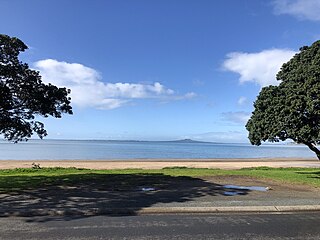
Stanmore Bay covers 5.74 km2 (2.22 sq mi) [1] and had an estimated population of 13,290 as of June 2024, [2] with a population density of 1,972 people per km2.
Historical population| Year | | |
|---|
| 2006 | 10,164 | — |
|---|
| 2013 | 9,225 | −1.38% |
|---|
| 2018 | 10,212 | +2.05% |
|---|
| 2023 | 10,770 | +1.07% |
|---|
The 2006 population is for a larger area of 7.40 km2 which includes Arkles Bay.
Source: [5] [6] |
Stanmore Bay had a population of 10,770 in the 2023 New Zealand census, an increase of 558 people (5.5%) since the 2018 census, and an increase of 1,545 people (16.7%) since the 2013 census. There were 5,220 males, 5,505 females and 42 people of other genders in 3,975 dwellings. [7] 2.8% of people identified as LGBTIQ+. The median age was 38.1 years (compared with 38.1 years nationally). There were 2,211 people (20.5%) aged under 15 years, 1,812 (16.8%) aged 15 to 29, 5,052 (46.9%) aged 30 to 64, and 1,698 (15.8%) aged 65 or older. [6]
People could identify as more than one ethnicity. The results were 85.2% European (Pākehā); 11.9% Māori; 3.5% Pasifika; 11.2% Asian; 1.5% Middle Eastern, Latin American and African New Zealanders (MELAA); and 2.3% other, which includes people giving their ethnicity as "New Zealander". English was spoken by 96.3%, Māori language by 1.6%, Samoan by 0.3%, and other languages by 14.7%. No language could be spoken by 2.5% (e.g. too young to talk). New Zealand Sign Language was known by 0.2%. The percentage of people born overseas was 31.4, compared with 28.8% nationally.
Religious affiliations were 30.9% Christian, 1.6% Hindu, 0.5% Islam, 0.3% Māori religious beliefs, 0.6% Buddhist, 0.6% New Age, 0.1% Jewish, and 1.3% other religions. People who answered that they had no religion were 56.9%, and 7.4% of people did not answer the census question.
Of those at least 15 years old, 1,611 (18.8%) people had a bachelor's or higher degree, 4,491 (52.5%) had a post-high school certificate or diploma, and 1,941 (22.7%) people exclusively held high school qualifications. The median income was $47,200, compared with $41,500 nationally. 1,290 people (15.1%) earned over $100,000 compared to 12.1% nationally. The employment status of those at least 15 was that 4,644 (54.3%) people were employed full-time, 1,164 (13.6%) were part-time, and 213 (2.5%) were unemployed. [6]
Individual statistical areas| Name | Area
(km2) | Population | Density
(per km2) | Dwellings | Median age | Median
income |
|---|
| Vipond | 1.38 | 2,889 | 2,093 | 1,116 | 40.6 years | $44,300 [8] |
| Stanmore Bay West | 0.99 | 2,646 | 2,673 | 951 | 36.7 years | $50,300 [9] |
| Stanmore Bay East | 1.34 | 2,844 | 2,122 | 1,056 | 37.7 years | $45,100 [10] |
| Whangaparāoa Central | 2.03 | 2,388 | 1,176 | 855 | 37.2 years | $49,900 [11] |
| New Zealand | | | | | 38.1 years | $41,500 |
|---|

The South Wairarapa District is a district at the south-east tip of the North Island of New Zealand, governed by the South Wairarapa District Council. The district comprises the southernmost part of the Wairarapa, and is part of the Wellington Region.

The Thames-Coromandel District is a territorial authority district in the North Island of New Zealand, covering all the Coromandel Peninsula and extending south to Hikutaia.

Hauraki District is a territorial authority governed by the Hauraki District Council within the Waikato region of New Zealand. The seat of the council is at Paeroa.

Western Bay of Plenty District is a territorial district within the Bay of Plenty Region of New Zealand. The district envelops Tauranga city by land, and includes Matakana Island, at the entrance to Tauranga Harbour.

Southland District is a New Zealand territorial authority district that covers most of the southern end of the South Island as well as Stewart Island.

Orewa is a settlement in the northern Auckland Region of New Zealand. It is a suburb of the Hibiscus Coast, just north of the base of the Whangaparāoa Peninsula and 40 kilometres (25 mi) north of central Auckland. The Northern Motorway, part of State Highway 1, passes just inland of Orewa and extends through the twin Johnston Hill tunnels to near Puhoi.

Central Otago District is local government district in New Zealand. It is administered by the Central Otago District Council, and it is in the Otago region, the top tier of local government in New Zealand. The major towns in the district are Alexandra, Cromwell, Roxburgh, Clyde and Ranfurly. The district covers 9,968 km2 (3,849 sq mi), making it the fourth-largest district in New Zealand by area, and is home to 26,500 people as of June 2024.

Westland District is a territorial authority district on the West Coast of New Zealand's South Island. It is administered by the Westland District Council. The district's population is 9,430.
Grey District is a district in the West Coast Region of New Zealand that covers Greymouth, Runanga, Blackball, Cobden, and settlements along the Grey River. It has a land area of 3,474.31 square kilometres (1,341.44 sq mi). The seat of the Grey District Council, the local government authority that administers the district, is at Greymouth, where 58.4% of the district's population live.

Clutha District is a local government district of southern New Zealand, with its headquarters in the Otago town of Balclutha. Clutha District has a land area of 6,334.47 km2 (2,445.75 sq mi) and an estimated population of 19,300 as of June 2024. Clutha District occupies the majority of the geographical area known as South Otago.

Mackenzie District is a local government district on New Zealand's South Island, administered by the Mackenzie District Council. It is part of the larger Canterbury Region. The region takes its name from the Mackenzie Basin, an elliptical intermontane basin which covers much of inland Canterbury.
Dairy Flat is a northern rural district located 8 km south of Orewa in the North Island of New Zealand and 28 km north of central Auckland. Until the early 1990s most of the district was in dairy farms of 40 to 60 hectares, but with the growth of Auckland and the extension of the Northern Motorway into the area, these are being gradually overtime subdivided into lifestyle blocks of around 2 to 5 hectares, many of which are grazing sheep, horses, beef cattle or deer. Although it still retains a rural character, it is counted as part of the Auckland urban area in official statistics.

Taupō District is a territorial authority district in New Zealand. It covers 6,333 km² of land, and a further 610 km² of lake area, including Lake Taupō, New Zealand's largest lake, and Lake Rotoaira. The district stretches from the small town of Mangakino in the northwest to the Tongariro National Park in the south, and east into the Kaingaroa Forest. The district's population is largely located in the two main centres, Taupō and Tūrangi.

Silverdale is a village approximately 30 km north of Auckland in the North Island of New Zealand. It is located on the north bank of the Weiti River and lies to the west of the Whangaparaoa Peninsula.
Raumanga is a suburb of Whangārei in the Northland Region of New Zealand. It is the site of Northland Polytechnic's main campus.

Red Beach is a suburb surrounding the beach of the same name on the Hibiscus Coast, Auckland, New Zealand, at the base of the Whangaparaoa Peninsula. The suburb of Silverdale is to the south-west, and Orewa to the north.

Whangarei District is a territorial authority district in the Northland Region of New Zealand that is governed by the Whangarei District Council. The district is made up in area largely by rural land, and includes a fifth of the Northland Region. It extends southwards to the southern end of Bream Bay, northwards to Whangaruru and almost to the Bay of Islands, and westwards up the Mangakahia River valley past Pakotai and almost to Waipoua Forest. It includes the Hen and Chicken Islands and the Poor Knights Islands.

Wairoa District is a territorial authority district within the Hawke's Bay Region in the North Island of New Zealand. The Wairoa District Council is headquartered in the largest town, Wairoa. The district covers the northern half of the Hawke's Bay coast, extending from Māhia Peninsula to Lake Waikaremoana, and south to the mouth of the Waikare River.

Waimate District is a territorial authority district located in the Canterbury Region of the South Island of New Zealand. The main town is Waimate, while there are many smaller rural communities dispersed throughout the area. Its boundary to the south is the Waitaki River, to the west Lake Benmore and to the north-east the Pareora River.
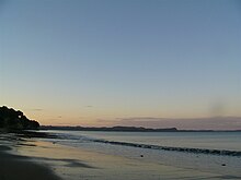
Arkles Bay is one of the northernmost suburbs of the contiguous Auckland metropolitan area located in New Zealand. It is located on the southern side of the Whangaparaoa Peninsula, in the Hibiscus Coast, located 25 kilometres (16 mi) north of the Auckland CBD. It is part of the Albany Ward area for local government purposes. Arkles Bay is known for its sheltered beaches, suitable for swimming and paddle boarding.