
The North Shore is one of the major geographical regions of Auckland, the largest city in New Zealand. The area is defined as the northern shores of the Waitematā Harbour as far north as the Ōkura River.
Hakarimata Range is a range of hills on the western edge of Ngāruawāhia township, in the Waikato region of New Zealand, overlooking the confluence of the Waikato and Waipā Rivers. The Hakarimata Range is separated from the Taupiri Range by the Taupiri Gorge, through which the Waikato River flows.
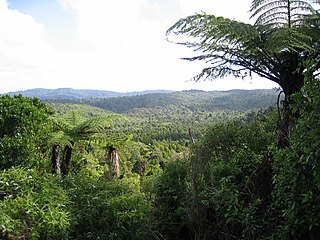
The Waitākere Ranges is a mountain range in New Zealand. Located in West Auckland between metropolitan Auckland and the Tasman Sea, the ranges and its foothills and coasts comprise some 27,720 hectares of public and private land. The area, traditionally known to Māori as Te Wao Nui o Tiriwa, is of local, regional, and national significance. The Waitākere Ranges includes a chain of hills in the Auckland Region, generally running approximately 25 kilometres (16 mi) from north to south, 25 km west of central Auckland. The ranges are part of the Waitākere Ranges Regional Park.

Orewa is a settlement in the northern Auckland Region of New Zealand. It is a suburb of the Hibiscus Coast, just north of the base of the Whangaparāoa Peninsula and 40 kilometres (25 mi) north of central Auckland. The Northern Motorway, part of State Highway 1, passes just inland of Orewa and extends through the twin Johnston Hill tunnels to near Puhoi.

East Coast Bays is a string of small suburbs that form the northernmost part of the North Shore, part of the contiguous Auckland metropolitan area in New Zealand. The suburbs line the north-east coast of the city along the shore of the Hauraki Gulf and Rangitoto Channel. They include, from north to south, Long Bay, Torbay, Waiake Bay, Browns Bay, Rothesay Bay, Murrays Bay, Mairangi Bay, Campbells Bay and Castor Bay. Most of the East Coast Bays are covered under the East Coast Bays subdivision of the Hibiscus and Bays local board area.
Torbay is a northern suburb of Auckland, New Zealand. It is located in the upper East Coast Bays of the city's North Shore, and is governed by Auckland Council.
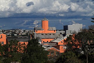
Chatswood is a suburb in the city of Auckland, New Zealand, in the middle-eastern side of the North Shore. It contains a primary school and many parks. To the south of Chatswood is Kendall's Bay, a small bay of the Waitematā Harbour. The suburb is under the governance of Auckland Council. The Royal New Zealand Navy's Kauri Point Armament Depot is located in Chatswood. Chelsea Sugar Refinery is located in Chatswood.

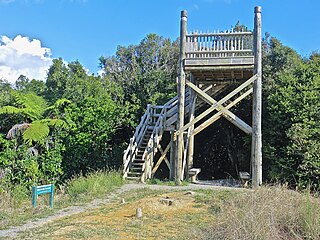
The Ōkura River, also known as the Ōkura Estuary, is a river in the north of the Auckland Region in the North Island of New Zealand. The river rises in the low hills to the south of Silverdale and flows into Karepiro Bay on the Hauraki Gulf / Tīkapa Moana. The river is extremely tidal with only a narrow channel being navigable by small craft at low tide. The area is popular for horse riding, riders wait till low tide and then ford the boating channel to ride the estuary and beaches on the northern side.
Ōkura is a rural settlement to the north of Auckland City, New Zealand. It is under the local governance of the Auckland Council. The official name is spelled with a macron.

Mount Auckland officially known as Atuanui / Mount Auckland is a hill in the northern Auckland region, near the shore of the Kaipara Harbour.

Long Bay is one of the northernmost suburbs of the North Shore, part of the contiguous Auckland metropolitan area located in New Zealand.
Le Roys Bush is a public reserve between Birkenhead and Northcote in Auckland, New Zealand.

Kauri dieback is a forest dieback disease of the native kauri trees of New Zealand that is suspected to be caused by the oomycete Phytophthora agathidicida. Symptoms can include root rot and associated rot in a collar around the base of the tree, bleeding resin, yellowing and chlorosis of the leaves followed by extensive defoliation, and finally, death.

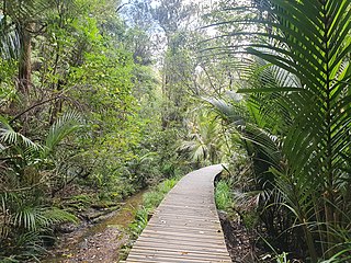
Alice Eaves Scenic Reserve, known colloquially as "Eaves Bush", is a 16ha forest located at the northern end of Orewa, in Auckland, New Zealand. It is named after Alice Caroline Eaves, whose family bequeathed the land to the nation in 1960.

The Long Bay-Okura Marine Reserve is a 980-hectare (2,400-acre) protected area at Long Bay on the North Shore in the Auckland Region of New Zealand. It was created by Order in Council in 1995.

Aotea Conservation Park is a 12,300 hectare protected area on Great Barrier Island in New Zealand's Hauraki Gulf. It was established in 2015, and comprises 43 percent of the island.
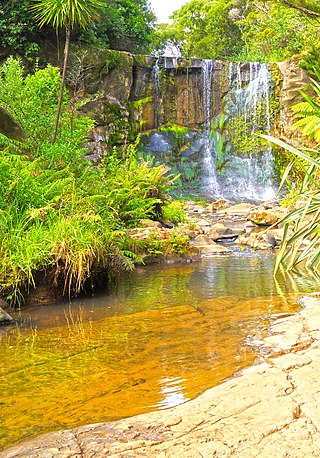
Mokoroa Falls is a waterfall located between Muriwai and the Waitākere Ranges in Auckland's west coast in New Zealand. It is located in the Goldie Bush Scenic Reserve.

Glenfern Sanctuary Regional Park is a regional park situated near Port Fitzroy on Great Barrier Island in New Zealand's Hauraki Gulf.

The Goldie Bush Scenic Reserve, also known as Goldies Bush and Te Taiapa, is a forested area of West Auckland, New Zealand. Located south-east of Muriwai, the reserve is home to the Mokoroa Falls.
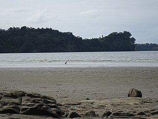
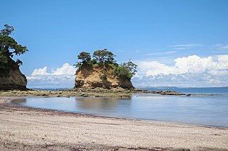
Karepiro Bay is a bay of the Hauraki Gulf / Tīkapa Moana in the Auckland Region, New Zealand. It found between the Whangaparāoa Peninsula and North Shore, and is the mouth of the Weiti River and Ōkura River.


