
Manukau City was a territorial authority district in Auckland, New Zealand, that was governed by the Manukau City Council. The area is also referred to as "South Auckland", although this term never possessed official recognition and does not encompass areas such as East Auckland, which was within the city boundary. It was a relatively young city, both in terms of legal status and large-scale settlement – though in June 2010, it was the third largest in New Zealand, and the fastest growing. In the same year, the entire Auckland Region was amalgamated under a single city authority, Auckland Council.

Territorial authorities are the second tier of local government in New Zealand, below regional councils. There are 67 territorial authorities: 13 city councils, 53 district councils and the Chatham Islands Council. District councils serve a combination of rural and urban communities, while city councils administer the larger urban areas. Five territorial authorities also perform the functions of a regional council and thus are unitary authorities. The Chatham Islands Council is a sui generis territorial authority that is similar to a unitary authority.

Papakura District was a local council territory in New Zealand's Auckland Region that was governed by the Papakura District Council from 1989 until 2010. The area makes up the southernmost part of the Auckland metropolitan area.
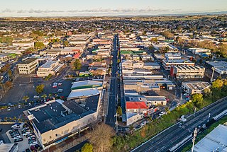
Pukekohe is a town in the Auckland Region of the North Island of New Zealand. Located at the southern edge of the Auckland Region, between the southern shore of the Manukau Harbour and the mouth of the Waikato River. The hills of Pukekohe and nearby Bombay Hills form the natural southern limit of the Auckland region. Pukekohe is located within the political boundaries of the Auckland Council, following the abolition of the Franklin District Council on 1 November 2010.
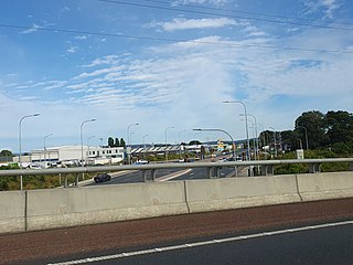
Takanini is a southern suburb of Auckland, New Zealand. It is located on the shores of the Pahurehure Inlet, 28 kilometres southeast of the Auckland CBD.

South Auckland is one of the major geographical regions of Auckland, the largest city in New Zealand. The area is south of the Auckland isthmus, and on the eastern shores of the Manukau Harbour. The area has been populated by Tāmaki Māori since at least the 14th century, and has important archaeological sites, such as the Ōtuataua stonefield gardens at Ihumātao, and Māngere Mountain, a former pā site important to Waiohua tribes.

Manurewa is a suburb in South Auckland, New Zealand, located 6 km (3.7 mi) south of Manukau Central, and 26 km (16 mi) southeast of the Auckland City Centre. It is home to the Auckland Botanic Gardens, which receives over a million visitors a year. Manurewa has a high proportion of non-European ethnicities, making it one of the most multi-cultural suburbs in New Zealand. Employment for many is at the many companies of nearby Wiri, Papakura, and at the steel mill at Glenbrook.

Conifer Grove is an upper-middle class suburb of Auckland, in northern New Zealand. Located on the eastern shores of the Pahurehure Inlet, on the Manukau Harbour, under authority of the Auckland Council. Established in 1974 at the former site of a farm, the suburb makes up the western side of the Takanini urban area and is in the Manurewa-Papakura ward of Auckland. It includes the Waiata Shores subdivision developed by Fletcher Living in 2018, at the site of the former Manukau Golf Course.

Pahurehure is a suburb of Auckland, in northern New Zealand. It is located on the south-eastern shores of the Manukau Harbour, under the authority of the Auckland Council. The suburb makes up the southernmost part of the Auckland urban area.

Wattle Downs is a suburb of Auckland, New Zealand.

Papakura is a suburb of South Auckland, in northern New Zealand. It is located on the shores of the Pahurehure Inlet, approximately 32 kilometres (20 mi) south of the Auckland City Centre. It is under the authority of the Auckland Council.

Auckland Council Libraries, usually simplified to Auckland Libraries, is the public library system for the Auckland Region of New Zealand. It was created when the seven separate councils in the Auckland region merged in 2010. It is currently the largest public-library network in the Southern Hemisphere with 55 branches from Wellsford to Waiuku. Currently from March 2021, the region has a total of 56 branches.

Auckland is a large metropolitan city in the North Island of New Zealand. It has an urban population of about 1,531,400. It is located in the greater Auckland Region, the area governed by Auckland Council, which includes outlying rural areas and the islands of the Hauraki Gulf, and which has a total population of 1,798,300 as of June 2024. It is the most populous city of New Zealand and the fifth largest city in Oceania. While Europeans continue to make up the plurality of Auckland's population, the city became multicultural and cosmopolitan in the late-20th century, with Asians accounting for 34.9% of the city's population in 2023. Auckland has the fourth largest foreign-born population in the world, with 39% of its residents born overseas. With its sizable population of Pasifika New Zealanders, the city is also home to the largest ethnic Polynesian population in the world. The Māori-language name for Auckland is Tāmaki Makaurau, meaning "Tāmaki desired by many", in reference to the desirability of its natural resources and geography.
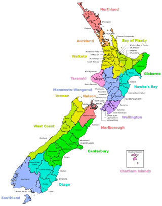
A district in New Zealand is a territorial authority area governed by a district council as a second-tier of local government in New Zealand, below regional councils. They were formed as a result of the local government reforms in 1989. There are 53 districts in New Zealand, and they do not include the 12 city councils, the Auckland Council, and the Chatham Islands Council. District councils serve a combination of rural and urban communities, while city councils administer the larger urban areas. Three districts are unitary authorities also performing the functions of a regional council.

Māngere East or Mangere East is a suburb of Auckland, New Zealand, under the governance of Auckland Council. It is located to the south of Favona, north of Papatoetoe, west of Middlemore, east of Māngere and Māngere Bridge, and southwest of Ōtāhuhu.
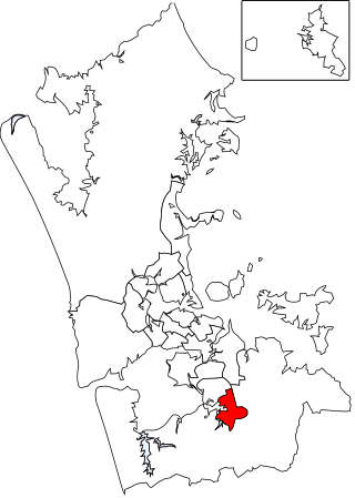
The Papakura Local Board is one of the 21 local boards of the Auckland Council. It is overseen by the Manurewa-Papakura ward councillor.
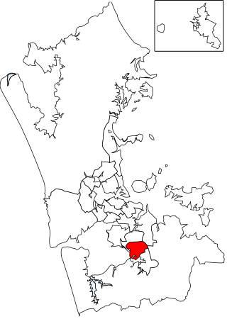
The Manurewa Local Board is one of the 21 local boards of the Auckland Council. It is overseen by the Manurewa-Papakura ward councillor.

Te Waiohua or Te Wai-o-Hua is a Māori iwi (tribe) confederation that thrived in the early 17th century. The rohe was primarily the central Tāmaki Makaurau area and they had pā at Te Tātua a Riukiuta, Puketāpapa, Te Ahi-kā-a-Rakataura, Maungakiekie, Maungawhau, Tītīkōpuke, Ōhinerau, Rangitotoiti, Taurarua, Rarotonga, Ōtāhuhu, Te Pane o Mataaoho, Ihumātao, Matukutūreia and Matukutūruru, until the 1740s, when the paramount Waiohua chief, Kiwi Tāmaki, was defeated by the Ngāti Whātua hapū, Te Taoū. The descendants of the Waiohua confederation today include Ngāti Te Ata Waiohua, Ngāti Tamaoho and Te Ākitai Waiohua.

Waitematā is a local government area covering the most central suburbs of Auckland, in New Zealand's Auckland Region. It is governed by the Waitematā Local Board and Auckland Council, and is located within the council's Waitematā and Gulf Ward.


