
Waiuku is a rural town in the Auckland Region of New Zealand. It is located at the southern end of the Waiuku River, which is an estuarial arm of the Manukau Harbour, and lies on the isthmus of the Āwhitu Peninsula, which extends to the northeast. It is 40 kilometres southwest of Auckland city centre, and 12 kilometres north of the mouth of the Waikato River.

South Auckland is one of the major geographical regions of Auckland, the largest city in New Zealand. The area is south of the Auckland isthmus, and on the eastern shores of the Manukau Harbour. The area has been populated by Tāmaki Māori since at least the 14th century, and has important archaeological sites, such as the Ōtuataua stonefield gardens at Ihumātao, and Māngere Mountain, a former pā site important to Waiohua tribes.

Māngere is a major suburb in South Auckland, New Zealand, located on mainly flat land on the northeastern shore of the Manukau Harbour, to the northwest of Manukau City Centre and 15 kilometres south of the Auckland city centre. It is the location of Auckland Airport, which lies close to the harbour's edge to the south of the suburb.

Manurewa is a suburb in South Auckland, New Zealand, located 6 km (3.7 mi) south of Manukau Central, and 26 km (16 mi) southeast of the Auckland City Centre. It is home to the Auckland Botanic Gardens, which receives over a million visitors a year. Manurewa has a high proportion of non-European ethnicities, making it one of the most multi-cultural suburbs in New Zealand. Employment for many is at the many companies of nearby Wiri, Papakura, and at the steel mill at Glenbrook.

Conifer Grove is an upper-middle class suburb of Auckland, in northern New Zealand. Located on the eastern shores of the Pahurehure Inlet, on the Manukau Harbour, under authority of the Auckland Council. Established in 1974 at the former site of a farm, the suburb makes up the western side of the Takanini urban area and is in the Manurewa-Papakura ward of Auckland. It includes the Waiata Shores subdivision developed by Fletcher Living in 2018, at the site of the former Manukau Golf Course.

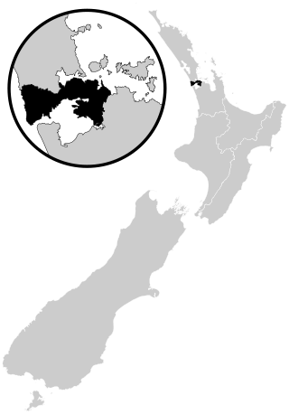
Pahurehure is a suburb of Auckland, in northern New Zealand. It is located on the south-eastern shores of the Manukau Harbour, under the authority of the Auckland Council. The suburb makes up the southernmost part of the Auckland urban area.

Wattle Downs is a suburb of Auckland, New Zealand.

Papakura is a suburb of South Auckland, in northern New Zealand. It is located on the shores of the Pahurehure Inlet, approximately 32 kilometres (20 mi) south of the Auckland City Centre. It is under the authority of the Auckland Council.
Tāmaki Makaurau is a New Zealand parliamentary Māori electorate returning one Member of Parliament to the New Zealand House of Representatives. It was first formed for the 2002 election. The electorate covers central and southern Auckland, and southern parts of western Auckland. It derives its name from the Māori-language name for Auckland; Makaurau is a descriptive epithet referring to the value and desirability of the land.

Ngāti Te Ata Waiohua is a Māori iwi from the area around the Manukau Harbour in the Auckland Region of New Zealand.
The Pukekiwiriki, also known as Red Hill, is the northernmost volcano of the South Auckland volcanic field in New Zealand, located east of Papakura, which erupted an estimated one million years ago. The hill was the site of a major Tāmaki Māori pā, and the Te Ākitai Waiohua village Te Aparangi in the 19th century.
This is a timeline of the history of the city of Auckland in New Zealand.

Te Ākitai Waiohua is a Māori iwi of the southern part of the Auckland Region of New Zealand.

Te Waiohua or Te Wai-o-Hua is a Māori iwi (tribe) confederation that thrived in the early 17th century. The rohe was primarily the central Tāmaki Makaurau area and they had pā at Te Tātua a Riukiuta, Puketāpapa, Te Ahi-kā-a-Rakataura, Maungakiekie, Maungawhau, Tītīkōpuke, Ōhinerau, Rangitotoiti, Taurarua, Rarotonga, Ōtāhuhu, Te Pane o Mataaoho, Ihumātao, Matukutūreia and Matukutūruru, until the 1740s, when the paramount Waiohua chief, Kiwi Tāmaki, was defeated by the Ngāti Whātua hapū, Te Taoū. The descendants of the Waiohua confederation today include, Ngāti Te Ata Waiohua and Te Ākitai Waiohua.
Kiwi Tāmaki was a Māori warrior and paramount chief of the Waiohua confederation in Tāmaki Makaurau. The third generation paramount chief of Waiohua, Kiwi Tāmaki consolidated and extended Waiohua power over Tāmaki Makaurau, making it one of the most prosperous and populated areas of Aotearoa. Kiwi Tāmaki's seat of power was at Maungakiekie, which was the most elaborate pā complex in Aotearoa.

The Pūkaki Creek, also known as the Pūkaki Inlet, is an estuarine river of the Auckland Region of New Zealand's North Island. It flows south from its sources in Māngere and Papatoetoe, entering into the Manukau Harbour. The creek is adjacent to Auckland Airport and Pūkaki Marae.
Ngā Oho, also known as Ngā Ohomatakamokamo-o-Ohomairangi, is the name of a historical iwi (tribe) of Māori who settled in the Auckland Region. In the 17th century, Ngā Oho and two other tribes of shared heritage, Ngā Riki and Ngā Iwi, formed the Waiohua confederation of tribes.

Portages in New Zealand, known in Māori as Tō or Tōanga Waka, are locations where waka (canoes) could easily be transported overland. Portages were extremely important for early Māori, especially along the narrow Tāmaki isthmus of modern-day Auckland, as they served as crucial transportation and trade links between the east and west coasts. Portages can be found across New Zealand, especially in the narrow Northland and Auckland regions, and the rivers of the Waikato Region.

The Puhinui Creek, also known as the Puhinui Stream or Te Puhinui, is a major stream in South Auckland, in the Auckland Region of New Zealand's North Island. It flows westwards from Totara Park through Manukau, then southwest at Wiri to the Manukau Harbour.
The Pahurehure Inlet is an inlet of the Manukau Harbour of the Auckland Region of New Zealand's North Island. It is one of the three major inlets of the Manukau Harbour, alongside the Māngere Inlet and Waiuku Inlet.


