Related Research Articles

Malé is the capital and most populous city of the Maldives. With a population of 252,768 and an area of 8.30 square kilometres (3.20 sq mi), it is also one of the most densely populated cities in the world. The city is geographically located at the southern edge of North Malé Atoll. Administratively, the city consists of a central island, an airport island, and four other islands governed by the Malé City Council.

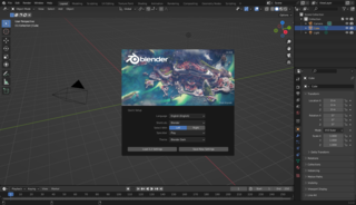
Blender is a free and open-source 3D computer graphics software tool set used for creating animated films, visual effects, art, 3D-printed models, motion graphics, interactive 3D applications, virtual reality, and, formerly, video games. Blender's features include 3D modelling, UV mapping, texturing, digital drawing, raster graphics editing, rigging and skinning, fluid and smoke simulation, particle simulation, soft body simulation, sculpting, animation, match moving, rendering, motion graphics, video editing, and compositing.

The Hutt Valley is the large area of fairly flat land in the Hutt River valley in the Wellington region of New Zealand. Like the river that flows through it, it takes its name from Sir William Hutt, a director of the New Zealand Company in early colonial New Zealand.

The Berkeley Open Infrastructure for Network Computing is an open-source middleware system for volunteer computing. Developed originally to support SETI@home, it became the platform for many other applications in areas as diverse as medicine, molecular biology, mathematics, linguistics, climatology, environmental science, and astrophysics, among others. The purpose of BOINC is to enable researchers to utilize processing resources of personal computers and other devices around the world.

The Kaipara District is located in the Northland Region in northern New Zealand.

Simrishamn is a locality and the seat of Simrishamn Municipality, Skåne County, Sweden with 6,527 inhabitants in 2010. Despite its small population, Simrishamn is, for historical reasons, usually still referred to as a city.

The Northern Fleet is the fleet of the Russian Navy in the Arctic.

Māngere Bridge, officially also called the Manukau Harbour Crossing, is a dual motorway bridge over the Manukau Harbour in south-western Auckland, New Zealand, crossing between the suburb also known as Māngere Bridge and the suburb of Onehunga.

The Great Southern Rail Trail is a 68-kilometre rail trail from Leongatha to Welshpool in South Gippsland, Victoria, Australia. This mostly flat or gently undulating trail goes through lush dairy farmland, areas of remnant bush and lowland scrub. It climbs from the foothills of Fish Creek up past Mount Hoddle and then down a steep descent through dense forest out into magnificent views of Wilsons Promontory and Corner Inlet, continuing on to Foster. before ending at Welshpool.

Cancale is a commune in the Ille-et-Vilaine department in Brittany in northwestern France. It is known as the birthplace of Saint Jeanne Jugan.

The Ballona Creek Bike Path is a 6.7-mile (10.8 km) Class I bicycle path and pedestrian route in California. The bike path follows the north bank of Ballona Creek until it reaches Santa Monica Bay at the Pacific Ocean. The route is defined by, and recognized for, the dramatic contrast between the channelized waterway’s stark “geometric concrete forms” and the abundant wildlife of the verdant Ballona Wetlands.

Pahurehure is a suburb of Auckland, in northern New Zealand. It is located on the south-eastern shores of the Manukau Harbour, under the authority of the Auckland Council. The suburb makes up the southernmost part of the Auckland urban area.
Harrelson Boulevard is a four-lane highway in Myrtle Beach, South Carolina, named for Myrtle Beach's first mayor Dr. W. Leroy Harrelson Sr., who was elected to office in 1938. It starts at U.S. 17, and goes to Myrtle Beach International Airport and runs near Coastal Grand Mall. The highway is also the southern terminus for Grissom Parkway. It replaced the two-lane Jetport Road.
Southern Cross group, a collection of independent, health-oriented businesses in New Zealand, operates on not-for-profit principles and is New Zealand's largest non-public health care organisation. The Group's businesses include health insurance, private hospitals and healthcare, travel insurance and pet insurance. The Group encompasses the Southern Cross Medical Care Society and the Southern Cross Health Trust and their respective subsidiaries.
The road network in Jamaica consists of almost 21,000 kilometres (13,000 mi) of roads, of which over 15,000 kilometres (9,300 mi) is paved. The numbering scheme used covers freeways, primary roads, secondary roads, parochial roads and unclassified roads.

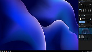
Budgie is a desktop environment that currently uses GNOME technologies such as GTK and is developed by contributors from numerous communities such as Solus, Arch Linux, Manjaro, openSUSE Tumbleweed and Ubuntu Budgie. Budgie's design emphasizes simplicity, minimalism, and elegance. The GTK library used for all releases up to Budgie 10 will be replaced with the Enlightenment Foundation Library (EFL) for the upcoming Budgie 11 release.

The Park to Playa Trail in Los Angeles County, California is a 13-mile (21 km) pedestrian and bicycle route that connects the Baldwin Hills parklands to the Pacific Ocean. According to the Los Angeles Times, “Good views of L.A. are guaranteed on the dirt-and-paved track from Baldwin Hills to Playa del Rey.”

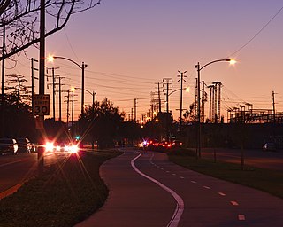
The Chandler Boulevard Bike Path is a Class I rail trail off-street bike route that runs from North Hollywood to Burbank in Los Angeles County, California.
References
- ↑ "Newly opened Southern Path allows for picturesque harbour views, supports active travel modes". Waka Kotahi NZ Transport Agency. 2021-05-24. Retrieved 2022-09-22.
- ↑ "Last piece of Auckland's SCI project finished". Contractor Mag. 2021-05-24. Retrieved 2022-09-22.
- ↑ "Active: Southern Path's picturesque harbour views". New Zealand Construction News. 2021-07-28. Retrieved 2022-09-22.
Coordinates: 37°03′31″S174°55′20″E / 37.058733°S 174.922176°E