
The national parks of New Zealand are protected natural areas administered by the Department of Conservation (DOC). Although the national parks contain some of New Zealand's most beautiful scenery, the first few established were all focused on mountain scenery. Since the 1980s the focus has been on developing a more diverse representation of New Zealand landscapes. The parks are all culturally significant and many also contain historic features. Tongariro National Park is one of the World Heritage Sites that are of both cultural and natural significance, while four of the South Island national parks form Te Wahipounamu, another World Heritage Site. There are currently 13 national parks; a 14th, Te Urewera National Park, was disestablished in 2014.

Nelson Lakes National Park is in the South Island of New Zealand, at the northern end of the Southern Alps. It was formed after the passing of the National Parks Act in 1952. It was created in 1956. The park contains beech forests, multiple lakes, snow-covered mountains and valleys created by glaciers during the ice ages.
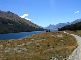
Mavora Lakes is a protected area in the South Island of New Zealand consisting of two lakes: North Mavora and South Mavora. The lakes are drained by the Mararoa River. The area is managed by the Department of Conservation, and is part of Te Wahipounamu, a World Heritage Area.

Protected areas of New Zealand receive protection to preserve their environmental, historical or cultural value. The method and aims of protection vary according to the importance of the resource and whether it has public or private status.
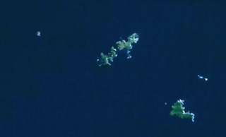
The Mokohinau Islands (Pokohinau) are a small group of islands that lie off the northeast coast of New Zealand's North Island. The islands are 100 km (62 mi) northeast of Auckland, 21 km (13 mi) northwest of Great Barrier Island and approximately 52 km (32 mi) east of Bream Head. The main islands of the group include Fanal Island (Motukino), Burgess Island (Pokohinu), Flax Island (Hokoromea), and Trig Island (Atihau). Most of them are managed by the Department of Conservation as nature reserves and wildlife sanctuaries. Landing is not allowed without a permit, with the exception of Burgess Island, much of which is managed as a scenic reserve by the Department of Conservation. The remainder of Burgess Island is Crown Land and is administered by the Ministry of Transport. The total land area of the Mokohinau Islands is 160 ha.

Whirinaki Te Pua-a-Tāne Conservation Park is a publicly accessible conservation park in the North Island of New Zealand. The park is centered on the town of Minginui and part of the eastern boundary flanks Te Urewera. The Whirinaki Forest is one of the world's last prehistoric rainforests.

The Sugar Loaf Islands are a collection of five small uninhabited islands and several sea stacks near Port Taranaki, Taranaki, New Zealand.

Pureora Forest Park is a 760-square-kilometre (290 sq mi) protected area in the North Island of New Zealand. Within its rich rainforest are an abundance of 1,000-year-old podocarp trees. It is "recognised as one of the finest rain forests in the world". Established in 1978, after a series of protests and tree sittings, the park is one of the largest intact tracts of native forest in the North Island and has high conservation value due to the variety of plant life and animal habitats. New Zealand's largest totara tree is located nearby on private land.
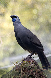
The North Island kōkako is an endangered forest bird which is endemic to the North Island of New Zealand. It is grey in colour, with a small black mask. It has blue wattles. Because of its wattle, the bird is sometimes locally called the blue-wattled crow, although it is not a corvid.

Trounson Kauri Park is a mainland island in the Northland Region of New Zealand. Characterised by its Kauri trees, it was named after James Trounson, who gifted the forest to the Department of Conservation.
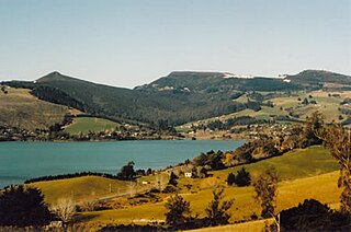
Mainland islands are areas on the North Island and South Island of New Zealand, set aside as reserves for endemic and native species, in a similar way to island reserves. Some mainland islands are managed by the Department of Conservation, while others are run by private trusts in collaboration of universities and local communities.

Island reserves or island sanctuaries are offshore islands of New Zealand, set aside by the New Zealand Government as reserves for endemic and native species.
Boundary Stream Mainland Island is a mainland island in the Hawke's Bay Region of New Zealand.
Paengaroa Mainland Island or Paengaroa Scenic Reserve is a mainland island in the Manawatū-Whanganui Region of New Zealand.
Rotoiti Mainland Island or Rotoiti Nature Recovery Project is a mainland island in the Tasman District of New Zealand.
Te Urewera Mainland Island is a mainland island in the Bay of Plenty Region of New Zealand. It covers 212,673 hectares of native forest in northern Te Urewera.
Te Papanui Conservation Park is a mainland island in the Otago Region of New Zealand.
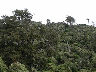
Pakuratahi Forest is a regional park located in Upper Hutt in the Wellington Region at the southern end of New Zealand's North Island. It is administered by Wellington Regional Council.
Northland Conservation Park is a group of protected areas in the Northland Region of New Zealand's North Island.

Westhaven Marine Reserve is a marine reserve covering an area of 536 hectares in the Whanganui Inlet at the top of New Zealand's South Island. It was established in 1994 and is administered by the Department of Conservation.


