The animals of New Zealand, part of its biota, have an unusual history because, before the arrival of humans, less than 900 years ago, the country was mostly free of mammals, except those that could swim there or fly there (bats). However, as recently as the Miocene, it was home to the terrestrial Saint Bathans mammal, implying that mammals had been present since the island had broken away from other landmasses. The absence of mammals meant that all of the ecological niches occupied by mammals elsewhere were occupied instead by either insects or birds, leading to an unusually large number of flightless birds, including the kiwi, the weka, the moa, the takahē, and the kākāpō.

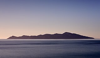
Kapiti Island, sometimes written as Kāpiti Island, is an island nature reserve located 5.6 km (3 mi) off the west coast of the lower North Island of New Zealand and within the Kāpiti Coast District. Parts of the island were previously farmed, but it is now a predator-free sanctuary for endemic birds, including many endangered birds. The island is 10 km (6.2 mi) long, running southwest/northeast, and roughly 2 km (1.2 mi) wide, being more or less rectangular in shape, and has an area of 19.65 km2 (7.59 sq mi).

The kererū, also known as kūkupa, New Zealand pigeon or wood pigeon is a species of pigeon native to New Zealand. Johann Friedrich Gmelin described the bird in 1789 as a large, conspicuous pigeon up to 50 cm (20 in) in length and 550–850 g (19–30 oz) in weight, with a white breast and iridescent green–blue plumage. Two subspecies have been recognised; the second—the Norfolk pigeon of Norfolk Island—became extinct in the early 20th century. Kererū pairs are monogamous, breeding over successive seasons and remaining together when not breeding. They construct nests with twigs in trees, with a single egg clutch.

The biodiversity of New Zealand, a large island country located in the south-western Pacific Ocean, is varied and distinctive. The species of New Zealand accumulated over many millions of years as lineages evolved in the local circumstances. New Zealand's pre-human biodiversity exhibited high levels of species endemism, but has experienced episodes of biological turnover. Global extinction approximately 65 Ma resulted in the loss of fauna such as non-avian dinosaurs, pterosaurs and marine reptiles e.g. mosasaurs, elasmosaurs and plesiosaurs. The ancient fauna is not well known, but at least one species of terrestrial mammal existed in New Zealand around 19 Ma. For at least several million years before the arrival of humans, the islands had no terrestrial mammals except for bats and seals, the main component of the terrestrial fauna being insects and birds. It was not until the 14th century that new species were introduced by humans.

The stitchbird or hihi is a honeyeater-like bird endemic to the North Island and adjacent offshore islands of New Zealand. Its evolutionary relationships have long puzzled ornithologists, but it is now classed as the only member of its own family, the Notiomystidae. It is rare, being extirpated everywhere except Little Barrier Island, but has been reintroduced to two other island sanctuaries and four locations on the North Island mainland. Current population estimations for mature individuals in the wild are 2,500–3,400.
An ecological island is a term used in New Zealand, and increasingly in Australia, to refer to an area of land isolated by natural or artificial means from the surrounding land, where a natural micro-habitat exists amidst a larger differing ecosystem. In New Zealand the term is used to refer to one of several types of nationally protected areas.

Orokonui Ecosanctuary, called Te Korowai o Mihiwaka in Māori, is an ecological island wildlife reserve developed by the Otago Natural History Trust in the Orokonui Valley between Waitati and Pūrākaunui, New Zealand, 20 kilometres (12 mi) to the north of central Dunedin.

The Pitt shag, also known as the Pitt Island shag or Featherstone's shag, is a species of bird in the family Phalacrocoracidae. It is endemic to Pitt Island where its natural habitats are open seas and rocky shores. The bird with the color of a dark body, gray chest, yellow eyes and feet can be found in small groups in their breeding habitat or alone within 18 km from their territory searching for food. The species was close to extinction in 1905 but actions of conservation have been done ever since. The Pitt shag is threatened by habitat loss due to predation and climate change causing a decline from 1997 to 2012, but there is a recovery plan by the Department of Conservation.

Deinacrida rugosa, commonly called the Cook Strait giant wētā or Stephens Island wētā, is a species of insect in the family Anostostomatidae. The scientific name Deinacrida means "terrible grasshopper" and rugosa means "wrinkled". It is endemic to New Zealand.

The North Island robin is a species of Australasian robin endemic to the North Island of New Zealand. It and the South Island robin of the South Island and Stewart Island were once considered conspecific, but mitochondrial DNA sequences have shown that the two lineages split prior to the Pleistocene, and support the classification as two different species.

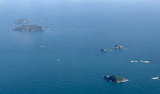
The Noises are a collection of islands lying northeast of Rakino Island in Auckland's Hauraki Gulf, off the coast of the North Island of New Zealand. The largest and most forested islands are Ōtata and Motuhoropapa; Orarapa and Maria/Ruapuke are also significant. After a rat eradication campaign in the 1960s, Maria was the first New Zealand island to become predator-free. The lack of invasive predators, intact native forest, and large numbers of breeding seabirds give the Noises significant conservation value. There has however been a marked decline in marine biodiversity surrounding the islands from over-fishing.

The Brook Waimārama Sanctuary is a nearly 700 hectare mainland "ecological island" sanctuary located 6 km south of Nelson, New Zealand. The sanctuary is the largest fenced sanctuary in New Zealand's South Island and the second largest in the country; it is the only sanctuary to feature mature New Zealand beech forest.

Bushy Park is a native forest reserve and bird sanctuary located in the Manawatū-Whanganui region of the North Island of New Zealand. The reserve is located eight kilometres (5.0 mi) inland from Kai Iwi and has an area of approximately 99 hectares, including the Bushy Park Homestead and grounds. The forest has a diverse range of native plant species, with canopy trees including northern rātā, rimu, tawa, and pukatea. In 1962, the forest was gifted to the Royal Forest and Bird Protection Society of New Zealand by the former owner G. F. Moore, along with the homestead and its surrounds. The reserve is now managed by the Bushy Park Trust, in partnership with Forest & Bird and local iwi Ngā Rauru Kītahi. The forest reserve and homestead were renamed as Bushy Park Tarapuruhi in 2019.

The North Island saddleback is a forest-dwelling passerine bird species endemic to the North Island of New Zealand. It was once considered conspecific with the South Island saddleback. The IUCN lists the species as Near Threatened, while it is listed as a "relict" species in the New Zealand Threat Classification System. Saddlebacks are known in Māori as tīeke.
Ngā Uruora - Kāpiti Project is a community conservation project set up in Paekākāriki, New Zealand in 1997 by Fergus Wheeler. It is named after the book Ngā Uruora: The Groves of Life - Ecology & History in a New Zealand Landscape by ecologist Geoff Park. The main aims of Ngā Ururoa are protecting and restoring the Kāpiti Coast's unique kohekohe forest, re-establishing forests through planting programmes, and undertaking pest and weed control.

James Robert Lynch is a New Zealand cartoonist and conservationist. Lynch is best known as the founder of eco-sanctuary Zealandia in Wellington.
Wainuiomata Water Collection Area is a reserve located near Wainuiomata, Lower Hutt in the Wellington Region at the southern end of New Zealand's North Island. It is administered by Wellington Regional Council, for exclusive use by Wellington Water as a water catchment reserve. The park covers the catchments of the Wainuiomata River and the Ōrongorongo River. It adjoins Remutaka Forest Park and Wainuiomata Regional Park.
Puketahā is a proposed wildlife sanctuary to be established in a water catchment reserve in Wainuiomata, New Zealand.

Sanctuary Mountain Maungatautari, is a protected natural area in Waikato Region, New Zealand where the biodiversity of 3,400 ha of forest is being restored. The sanctuary covers the mountain peak, Maungatautari.


