The Hutt River flows through the southern North Island of New Zealand. It flows south-west from the southern Tararua Range for 56 kilometres (35 mi), forming a number of fertile floodplains, including Kaitoke, central Upper Hutt and Lower Hutt.

Wainuiomata is a large dormitory suburb of Lower Hutt, in the Wellington metropolitan area in New Zealand. Its population was estimated as being 20,250 as of June 2024, with a density of 1,600 people per km2. European settlement of Wainuiomata began in the 1850s with timber-felling and farming and began to grow in the 1920s. After World War 2 there was rapid population expansion, with Wainuiomata earning the nickname 'Nappy Valley' because of the large number of families with young children. From the late 1980s the economy slowed and the population decreased, but since about 2020 there has been a housing boom and corresponding increase in population. Wainuiomata is noted for being the origin of New Zealand's kōhanga reo movement.

Zealandia, formerly known as the Karori Wildlife Sanctuary, is a protected natural area in Wellington, New Zealand, the first urban completely fenced ecosanctuary, where the biodiversity of 225 ha of forest is being restored. The sanctuary was previously part of the water catchment area for Wellington, between Wrights Hill and the Brooklyn wind turbine on Polhill.

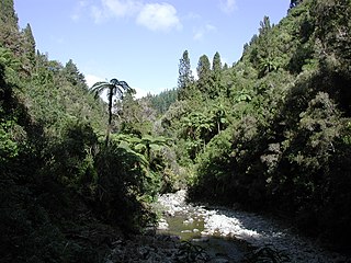
The Ōrongorongo River runs for 32 kilometres (20 mi) southwest through the Ōrongorongo Valley in the southern Remutaka Ranges of the North Island of New Zealand. The river and its associated catchments lie within the bounds of the Remutaka Forest Park, which is administered by the Department of Conservation.

The Wainuiomata River runs southwest through the Wainuiomata Valley located in the southern Remutaka Range in the North Island, New Zealand.
Wellington Regional Council, branded as Greater Wellington Regional Council, is the regional council overseeing the Wellington Region of New Zealand's lower North Island. It is responsible for public transport under the brand Metlink, environmental and flood protection, and the region's water supply. As of 2023, it is the majority owner of CentrePort Wellington with a 77% shareholding.

Regional parks of New Zealand are protected areas administered by regional councils, the top tier of local government. Regional parks are found across five regions of New Zealand: the Auckland Region, Waikato Region, Bay of Plenty Region, Wellington Region and Canterbury Region. Regional parks in the Auckland and Waikato regions are administered by the Auckland Council, while parks in other areas are administered by regional councils: the Bay of Plenty Regional Council, Greater Wellington Regional Council, and Canterbury Regional Council.
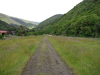
The Remutaka Rail Trail is a walking and cycling track in the North Island of New Zealand. It runs between Maymorn and Cross Creek, and follows 22 kilometres (14 mi) of the original route of the Wairarapa Line over the Remutaka Range between the Mangaroa Valley and the Wairarapa, including the world-famous Rimutaka Incline. Parts of the trail are also used by vehicles both from the regional council and from forestry companies with tree plantations in the area; members of the public have limited vehicular access from the Kaitoke end to a car park, go-kart track and gun range. Access is also granted by permission to horse riders. Touring coaches have been used upon occasion to convey tourists and other visitors to various parts of the route.

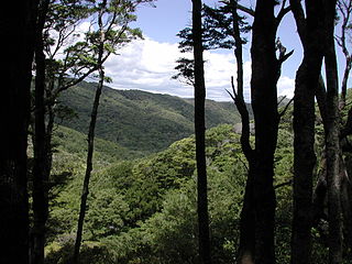
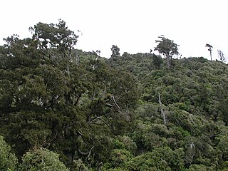
Remutaka Forest Park is a protected area near Wellington, New Zealand. Popular access points are south of Wainuiomata and in the upper Hutt Valley. The park covers 220 square kilometres (85 sq mi), encompassing the Catchpool Valley and the Ōrongorongo Valley at the southern end of the Remutaka Range. Established in 1972, the park contains several short walks and six huts that can be booked and accessed by longer bush tramps. The park is one part of several local conservation areas, as it borders the Pakuratahi Forest and the Tararua Range.
East Harbour Regional Park is a regional park stretching from Baring Head along the east side of the Wellington Harbour along the east side of Eastbourne. It is located in Lower Hutt City, in the Wellington Region of New Zealand's North Island.

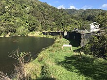
Kaitoke Regional Park is regional park located at Kaitoke, northeast of Upper Hutt, in the Wellington Region of New Zealand's southern North Island. It is administered by Wellington Regional Council, alongside the adjacent Hutt Water Collection Area.

The Manaia River is a river of the Coromandel Peninsula in New Zealand's North Island. It flows north from its sources in the Coromandel Range, reaching the Hauraki Gulf at Manaia Harbour, 10 kilometres (6 mi) southwest of Coromandel.
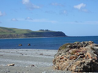
Baring Head is a headland, located between Wellington Harbour and Palliser Bay at the southern end of the North Island of New Zealand. It marks the southern end of Fitzroy Bay.
James Robert Lynch is a New Zealand cartoonist and conservationist. Lynch is best known as the founder of eco-sanctuary Zealandia in Wellington.
Akatarawa Forest is a regional park in the Upper Hutt within the Wellington Region at the southern tip of the North Island of New Zealand. It encompasses 15,000 hectares of native and plantation forest. It includes the headwaters of the Maungakotukutuku Steam, Akatarawa River West and the Whakatīkei River.

Water supply in the Wellington region involves the provision of drinking water services in the Greater Wellington region of New Zealand.

Hutt Water Collection Area is a reserve located in Upper Hutt in the Wellington Region at the southern end of New Zealand's North Island. It is administered by Wellington Regional Council and is located alongside the larger Kaitoke Regional Park.
Pākuratahi Forest is a regional park located in Upper Hutt in the Wellington Region at the southern end of New Zealand's North Island. It is administered by Wellington Regional Council.

Wainuiomata Regional Park is a regional park located near Wainuiomata, Lower Hutt in the Wellington Region of New Zealand. It is administered by Wellington Regional Council. The name of the park was changed from Wainuiomata Recreation Area to Wainuiomata Regional Park in January 2022.
Puketahā is a proposed wildlife sanctuary to be established in a water catchment reserve in Wainuiomata, New Zealand.