Related Research Articles

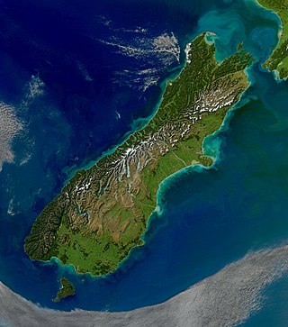
The South Island is the largest of the three major islands of New Zealand in surface area, the others being the smaller but more populous North Island and sparsely populated Stewart Island. It is bordered to the north by Cook Strait, to the west by the Tasman Sea, to the south by the Foveaux Strait and Southern Ocean, and to the east by the Pacific Ocean. The South Island covers 150,437 square kilometres (58,084 sq mi), making it the world's 12th-largest island, constituting 56% of New Zealand's land area. At low altitudes, it has an oceanic climate. The major centres are Christchurch, with a metropolitan population of 521,881, and the smaller Dunedin. The economy relies on agriculture, fishing, tourism, and general manufacturing and services.

The West Coast is a region of New Zealand on the west coast of the South Island. It is administered by the West Coast Regional Council, and is known co-officially as Te Tai Poutini. It comprises the territorial authorities of Buller District, Grey District and Westland District. The principal towns are Westport, Greymouth and Hokitika. The region, one of the more remote areas of the country, is also the most sparsely populated. With a population of just 32,900 people, the West Coast is the least populous region in New Zealand. The population in the region grew by 0.4% over the year to July 2023.

Rakiura National Park is a nature reserve park located on Stewart Island / Rakiura, New Zealand. It is the newest national park of New Zealand and opened in 2002. The protected area covers about 85% of the island.

The Department of Conservation is the public service department of New Zealand charged with the conservation of New Zealand's natural and historical heritage.

Fiordland National Park is a national park in the south-west corner of South Island of New Zealand. It is the largest of the 13 national parks in New Zealand, with an area covering 12,607 km2 (4,868 sq mi), and a major part of the Te Wāhipounamu a UNESCO World Heritage Site established in 1990. The park is administered by the Department of Conservation. The southern ranges of the Southern Alps cover most of Fiordland National Park, combined with the deep glacier-carved valleys.

Karamea is a town on the West Coast of the South Island of New Zealand. It is the northernmost settlement of any real size on the West Coast, and is located 96 kilometres (60 mi) northeast by road from Westport. Apart from a narrow coastal strip, the town of Karamea and its local area are completely surrounded to the south, east and north by Kahurangi National Park.
Forest & Bird, also known by its formal name as the Royal Forest and Bird Protection Society of New Zealand, is an environmental organisation specialising in the protection and conservation of New Zealand's indigenous flora and fauna and unique wild places and natural ecosystems. Forest & Bird consists of 47 branches located in urban and rural centres throughout New Zealand. Branches are actively engaged in conservation projects and advocacy on a community, regional and national basis. Forest & Bird has offices and staff located in Auckland, Christchurch, Wellington, Nelson and Dunedin. Forest & Bird publishes a quarterly magazine Forest & Bird, one of New Zealand's definitive natural history and conservation publications.

Nelson Lakes National Park is in the South Island of New Zealand, at the northern end of the Southern Alps. It was created in 1956. The park contains beech forests, multiple lakes, snow-covered mountains and valleys created by glaciers during the ice ages.

Kahurangi National Park is a national park in the northwest of the South Island of New Zealand. It is the second largest of the thirteen national parks of New Zealand. It was gazetted in 1996 and covers 5,193 km2 (2,005 sq mi), ranging from the Buller River near Murchison in the south, to the base of Farewell Spit in Golden Bay in the north. The park has no single dominant landform, but includes an unusually wide variety of landscapes, including mountain ranges, rivers, gorges, raised peneplains and karst features such as caves and arches. Many of the landforms within the park are considered to be nationally or internationally significant.

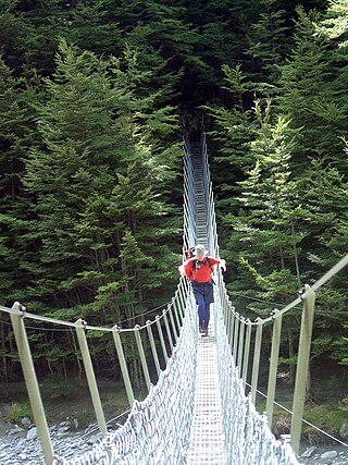
The Heaphy Track is a popular tramping and mountain biking track in the north west of the South Island of New Zealand. It is located within the Kahurangi National Park and classified as one of New Zealand's ten Great Walks by the Department of Conservation. Named after Charles Heaphy, the track is 78.4 kilometres (48.7 mi) long and is usually walked in four or five days. The track is open for shared use with mountain bikers in the winter season from 1 May to 30 September each year. The southern end of the track is at Kōhaihai, north of Karamea on the northern West Coast, and the northern end is in the upper valley of the Aorere River, Golden Bay.

Tramping, known elsewhere as backpacking, rambling, hill walking or bushwalking, is a popular activity in New Zealand.

The Nelson Coast temperate forests is an ecoregion in New Zealand.

Golden Bay / Mohua is a large shallow bay in New Zealand's Tasman District, near the northern tip of the South Island. An arm of the Tasman Sea, the bay lies northwest of Tasman Bay / Te Tai-o-Aorere and Cook Strait. It is protected in the north by Farewell Spit, a 26 km (16 mi) long arm of fine golden sand that is the country's longest sandspit. The Aorere and Tākaka rivers are the major waterways to flow into the bay from the south and the west.

The Cobb Reservoir is a hydro storage lake fed by the Cobb River in the Tasman District of the South Island of New Zealand. The reservoir feeds the Cobb Power Station and is 819 metres (2,687 ft) above sea level but drops significantly with low rainfall. Cobb Reservoir is the highest hydro storage lake in New Zealand, and is entirely surrounded by Kahurangi National Park. The reservoir, dam, penstock and powerhouse are excluded from the national park.

Mount Richmond Forest Park is a forest park in New Zealand, administered by the Department of Conservation.

Kahurangi Marine Reserve is a marine reserve administered by the Department of Conservation, covering 8,419 hectares offshore of Kahurangi National Park in the Buller District of New Zealand's West Coast Region.

Westhaven Marine Reserve is a marine reserve covering an area of 536 hectares in the Whanganui Inlet at the top of New Zealand's South Island. It was established in 1994 and is administered by the Department of Conservation.

The Wangapeka Track is a tramping track in the north-west of the South Island of New Zealand. It is one of the main tramping tracks in the Kahurangi National Park, a protected area managed by the Department of Conservation. The route traverses the southern end of the park from the historic Wangapeka goldfields area west of Tapawera to the coastal plains of the West Coast at Little Wanganui. The route is 59 km (37 mi) long and crosses the Wangapeka and Little Wanganui saddles, each over 1,000 m (3,300 ft) in elevation. The track passes through the valleys of the Wangapeka River, Karamea River, Taipō River and Little Wanganui River. The majority of the track is in river valleys and under forest cover, with small sections in tussock land at Stag Flat and the Little Wanganui Saddle. It typically takes walkers 4–6 days to complete the route.
The Wharepapa / Arthur Range is a mountain range partially marking the boundary between the Tasman District and West Coast Region of New Zealand's South Island. The range is at the eastern extent of the Tasman Mountains which make up much of the island's northwest, making it easily visible from across the low-lying Waimea Plains further to the east. The range's location and its many uses make it a significant site for local Māori, including the iwi of Te Ātiawa and Ngāti Rārua. This includes the prominent peaks of Mount Arthur and Pukeone / Mount Campbell, which both hold mana in their own right and have become part of the identity of the aforementioned iwi.

Sams Creek, previously known as Rogers Creek or incorrectly as Roger Creek, is a stream in Golden Bay / Mohua in the Tasman District of New Zealand. Since the 1980s, the creek has had prominence due to gold mining proposals, and the area around Sams Creek was subsequently not included in Kahurangi National Park when it was formed in 1996.
References
- 1 2 3 4 "Kahurangi National Park Management Plan (incorporating the 2009/2010 partial review and 2016/2017 amendment)" (PDF). Department of Conservation. June 2001. Retrieved 9 November 2024.
- ↑ "New forest park". The Press . 17 September 1970. Archived from the original on 3 August 2022. Retrieved 3 August 2022– via Papers Past.
- ↑ Walrond, Carl (7 September 2010). "Nelson places – North-west Nelson". Te Ara – the Encyclopedia of New Zealand. New Zealand Ministry for Culture and Heritage Te Manatu. Archived from the original on 9 September 2022. Retrieved 19 December 2022.
- ↑ Nathan, Simon (2 March 2009). "Conservation – a history – Changing organisations and ideas, 1985–2006". Te Ara – the Encyclopedia of New Zealand. Retrieved 9 November 2024.
- ↑ Hindmarsch, Gerard (July–September 1995). "Kahurangi; Our newest National Park". New Zealand Geographic (27).
- ↑ "Place name detail: North-west Nelson Forest Park". New Zealand Gazetteer. New Zealand Geographic Board . Retrieved 9 November 2024.
- ↑ Marshall, Denis (5 April 1996). "Kahurangi National Park gazettal". New Zealand Government . Retrieved 9 November 2024.