
Abel Tasman National Park is a national park at the north end of New Zealand's South Island. It covers 237.1 km2 (91.5 sq mi) of land between Golden Bay / Mohua and Tasman Bay / Te Tai-o-Aorere, making it the smallest of New Zealand's national parks. Despite this, the park is one of the most visited, partially due to the popularity of the Abel Tasman Coast Track which spans 60 km (37 mi) along the eastern and northern coastal areas of the park.

Warkworth is a town on the Northland Peninsula in the upper North Island of New Zealand. It is in the northern part of the Auckland Region, 64 km (40 mi) north of Auckland and 98 km (61 mi) south of Whangārei, at the head of Mahurangi Harbour. State Highway 1 runs past it.
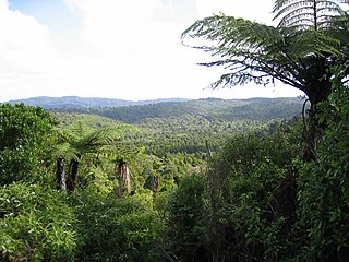
The Waitākere Ranges is a mountain range in New Zealand. Located in West Auckland between metropolitan Auckland and the Tasman Sea, the ranges and its foothills and coasts comprise some 27,720 hectares of public and private land. The area, traditionally known to Māori as Te Wao Nui o Tiriwa, is of local, regional, and national significance. The Waitākere Ranges includes a chain of hills in the Auckland Region, generally running approximately 25 kilometres (16 mi) from north to south, 25 km west of central Auckland. The ranges are part of the Waitākere Ranges Regional Park.

Orewa is a settlement in the northern Auckland Region of New Zealand. It is a suburb of the Hibiscus Coast, just north of the base of the Whangaparāoa Peninsula and 40 kilometres (25 mi) north of central Auckland. The Northern Motorway, part of State Highway 1, passes just inland of Orewa and extends through the twin Johnston Hill tunnels to near Puhoi.
Torbay is a northern suburb of Auckland, New Zealand. It is located in the upper East Coast Bays of the city's North Shore, and is governed by Auckland Council.
The Hibiscus Coast is a populated area on a stretch of the Hauraki Gulf coast in New Zealand's Auckland Region. It has a population of 69,070, making it the 10th most populous urban area in New Zealand, and the second most populous in the Auckland Region, behind Auckland itself. As an urban area delineated by Statistics New Zealand, the Hibiscus Coast consists of Hatfields Beach, Orewa, Silverdale and Whangaparāoa Peninsula. The Auckland Council's Hibiscus Coast subdivision of the Hibiscus and Bays includes the neighbouring communities of Waiwera and Stillwater, and Milldale in Rodney, is also described as a part of the Hibiscus Coast.

Regional parks of New Zealand are protected areas administered by regional councils, the top tier of local government. Regional parks are found across several regions of New Zealand: the Auckland Region, Waikato Region, Bay of Plenty Region, Hawkes Bay Region, Wellington Region and Canterbury Region. Regional parks in the Auckland and Waikato regions are administered by the Auckland Council, while parks in other areas are administered by regional councils: the Bay of Plenty Regional Council, Hawke's Bay Regional Council, Greater Wellington Regional Council, and Canterbury Regional Council.

Snells Beach is a small coastal town in the north of Auckland Region in the North Island of New Zealand. It is situated on the eastern coast of the Mahurangi Peninsula and its namesake beach faces east across Kawau Bay to Kawau Island. The nearest town is Warkworth, 8 km (5.0 mi) to the west, which is linked by 8 buses a day and also Mahu City Express twice a day.

Tāwharanui Peninsula is a finger of land projecting into the Hauraki Gulf from the east coast of the much larger North Auckland Peninsula of New Zealand. It separates Ōmaha Bay to the north from Kawau Bay and Kawau Island to the south. The nearest sizable town is Warkworth.

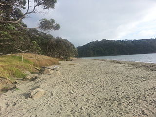
Long Bay is one of the northernmost suburbs of the North Shore, part of the contiguous Auckland metropolitan area located in New Zealand.
The Puhoi River is a river of the Auckland Region of New Zealand's North Island. It flows southeast from its sources 10 kilometres (6 mi) southwest of Warkworth, passing through the town of Puhoi before reaching the coast of Whangaparaoa Bay seven kilometres north of Orewa.

Rodney Ward is a local government area in the northernmost part of New Zealand's Auckland Region, created along with the Auckland Council in 2010. The area was previously part of Rodney District; it does not include the Hibiscus Coast, which was also part of Rodney District but is now in Albany ward. The Rodney Local Board area has the same boundaries as Rodney Ward.
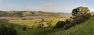
Wenderholm Regional Park is a regional park north of Auckland in New Zealand's North Island. It is situated between the estuaries of the Puhoi River and the Waiwera River, on the east coast of New Zealand's North Island and features a homestead known as Couldrey House, and a carved pouwhenua.

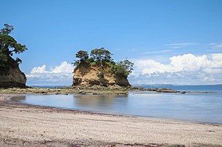
Scandrett Regional Park is a regional park located on the north east tip of the Mahurangi Peninsula, north of the city of Auckland, New Zealand. It encompasses Mullet Point and includes regenerating coastal forest, rocky headlands that protrude into Kawau Bay, Scandretts Bay beach and a precinct of historic farm buildings. The people of Auckland own the park through the Auckland Council.

Mahurangi Regional Park is a regional park situated on the north-eastern coast of the Auckland Region of New Zealand's North Island. It is located in Rodney, north of the main Auckland urban area, and is owned and operated by Auckland Council.

Te Ārai Regional Park is a regional park situated in the Auckland Region of New Zealand's North Island. It is owned and operated by Auckland Council.

Te Rau Pūriri Regional Park is a regional park situated in the Auckland Region of New Zealand's North Island. It is owned and operated by Auckland Council.
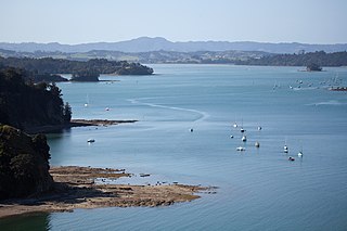
Mahurangi Harbour is a natural harbour in New Zealand. It is located on the north-eastern coast of the Auckland Region near the town of Warkworth, and empties into the Hauraki Gulf.

The Waiwera River is a stream of the Auckland Region of New Zealand's North Island, near the township of Waiwera.

Couldrey House is a mid-19th century historic homestead located in the Wenderholm Regional Park. Couldrey House was originally built and owned by Robert Graham. The house has hosted many notable individuals including Queen Elizabeth II. In the 1980s the house was opened to the public and it currently functions as a museum.

