
Haka are a variety of ceremonial dances in Māori culture. Haka are often performed by a group, with vigorous movements and stamping of the feet with rhythmically shouted accompaniment. Haka have been traditionally performed by both men and women for a variety of social functions within Māori culture. They are performed to welcome distinguished guests, or to acknowledge great achievements, occasions, or funerals.
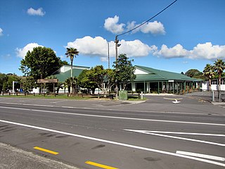
Warkworth is a town on the Northland Peninsula in the upper North Island of New Zealand. It is in the northern part of the Auckland Region. It is located on State Highway 1, 64 km (40 mi) north of Auckland and 98 km (61 mi) south of Whangārei, and is at the head of Mahurangi Harbour.

Orewa is a settlement in the northern Auckland Region of New Zealand. It is a suburb of the Hibiscus Coast, just north of the base of the Whangaparāoa Peninsula and 40 kilometres (25 mi) north of central Auckland. The Northern Motorway, part of State Highway 1, passes just inland of Orewa and extends through the twin Johnston Hill tunnels to near Puhoi.
The Hibiscus Coast is a populated area on a stretch of the Hauraki Gulf coast in New Zealand's Auckland Region. It has a population of 64,660, making it the 10th most populous urban area in New Zealand, and the second most populous in the Auckland Region, behind Auckland itself. As an urban area delineated by Statistics New Zealand, the Hibiscus Coast consists of Hatfields Beach, Orewa, Silverdale and Whangaparāoa Peninsula. The Auckland Council's Hibiscus Coast subdivision of the Hibiscus and Bays includes the neighbouring communities of Waiwera and Stillwater, and Milldale in Rodney, is also described as a part of the Hibiscus Coast.
Waimauku is a small locality in the Auckland Region of New Zealand. It comes under the jurisdiction of Auckland Council, and is in the council's Rodney ward. Waimauku is approximately 4 kilometres west of Huapai on State Highway 16 at the junction with the road to Muriwai Beach. Helensville is 16 km to the north-west. Waimauku is a Māori word which is literally translated as wai: stream and mauku: varieties of small ferns.

Regional parks of New Zealand are protected areas administered by regional councils, the top tier of local government. Regional parks are found across five regions of New Zealand: the Auckland Region, Waikato Region, Bay of Plenty Region, Wellington Region and Canterbury Region. Regional parks in the Auckland and Waikato regions are administered by the Auckland Council, while parks in other areas are administered by regional councils: the Bay of Plenty Regional Council, Greater Wellington Regional Council, and Canterbury Regional Council.

Ngāti Pāoa is a Māori iwi (tribe) that has extensive links to the Hauraki and Waikato tribes of New Zealand. Its traditional lands stretch from the western side of the Hauraki Plains to Auckland. They also settled on Hauraki Gulf islands such as Waiheke.

Te Kawerau ā Maki, Te Kawerau a Maki, or Te Kawerau-a-Maki is a Māori iwi (tribe) of the Auckland Region of New Zealand. Predominantly based in West Auckland, it had 251 registered adult members as of June 2017. The iwi holds land for a new marae and papakāinga at Te Henga that was returned in 2018; and land for a secondary marae at Te Onekiritea that was returned in 2015. it has no wharenui yet.

Te Matatini is a nationwide Māori performing arts festival and competition for kapa haka performers from all of New Zealand. The name was given by Professor Wharehuia Milroy, a composite of Te Mata meaning "the face" and tini denoting "many" — hence the meaning of Te Matatini is "many faces".
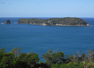
Mahurangi Island, also known as Goat Island, is located 1.1 kilometres (0.68 mi) to the north-east of Hahei on the Coromandel Peninsula in New Zealand's North Island. The uninhabited island is 6 hectares in size.

Scandrett Regional Park is a regional park located on the north east tip of the Mahurangi Peninsula, north of the city of Auckland, New Zealand. It encompasses Mullet Point and includes regenerating coastal forest, rocky headlands that protrude into Kawau Bay, Scandretts Bay beach and a precinct of historic farm buildings. The people of Auckland own the park through the Auckland Council.

Ngāti Manuhiri is a Māori iwi of the Mahurangi Peninsula area of New Zealand. They have an interest in the region from the Okura River in the south to Mangawhai in the north, and extending out to Great Barrier Island. They are descended from Manuhiri, one of the sons of Maki, founder of the Te Kawerau iwi. They have a marae near Leigh.
Kaipara ki Mahurangi is an electorate to the New Zealand House of Representatives. It was created for the 2020 election.

Mahurangi Regional Park is a regional park situated on the north-eastern coast of the Auckland Region of New Zealand's North Island. It is located in Rodney, north of the main Auckland urban area, and is owned and operated by Auckland Council.

Scotts Landing, also called Mahurangi East, is a rural settlement in the Auckland Region of New Zealand. It is at the end of a narrow peninsula on the eastern side of Mahurangi Harbour. Algies Bay is to the north.
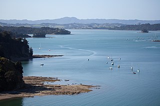
Mahurangi Harbour is a natural harbour in New Zealand. It is located on the north-eastern coast of the Auckland Region near the town of Warkworth, and empties into the Hauraki Gulf.

The Waiwera River is a stream of the Auckland Region of New Zealand's North Island, near the township of Waiwera.

Te Muri Regional Park is a regional park north of Auckland in New Zealand's North Island. It is situated between the estuaries of the Puhoi River and Te Muri-O-Tarariki Stream, on the east coast of New Zealand's North Island. The park is bordered by two other regional parks: Mahurangi West Regional Park to the north, and Wenderholm Regional Park to the south.


