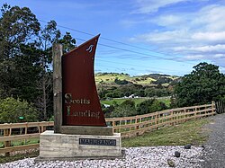
Scotts Landing, also called Mahurangi East, is a rural settlement in the Auckland Region of New Zealand. It is at the end of a narrow peninsula on the eastern side of Mahurangi Harbour. Algies Bay is to the north.[3]
Casnell Island (Motu Maunganui), accessible from Scotts Landing at low tide via a causeway, was a pā site in the 16th century.[4]
In 1852, the Scott homestead was constructed, later burning down in a fire.[5] This was replaced by a new Georgian-style house, built in 1877.[6][7][5]
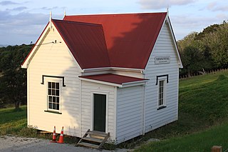
Mahurangi Heads School operated from 1869.[8] It closed in the 1920s or 1930s, but the school building was still standing about 1941.[9]
Demographics
Statistics New Zealand describes Scotts Landing-Mahurangi East as a rural settlement, which covers 2.56km2 (0.99sqmi)[1] and had an estimated population of 180 as of June 2024,[2] with a population density of 70 people per km2. Scotts Landing-Mahurangi East is part of the larger Mahurangi Peninsula statistical area.[10]
Casnell Island, with Scotts Landing visible behind it on the left
Scotts Landing-Mahurangi East had a population of 207 in the 2023 New Zealand census, an increase of 30 people (16.9%) since the 2018 census, and an increase of 15 people (7.8%) since the 2013 census. There were 102 males, 102 females and 3 people of other genders in 87 dwellings.[13] 2.9% of people identified as LGBTIQ+. The median age was 63.1 years (compared with 38.1 years nationally). There were 24 people (11.6%) aged under 15 years, 12 (5.8%) aged 15 to 29, 87 (42.0%) aged 30 to 64, and 81 (39.1%) aged 65 or older.[12]
People could identify as more than one ethnicity. The results were 98.6% European (Pākehā), 8.7% Māori, 1.4% Pasifika, and 1.4% Asian. English was spoken by 100.0%, Māori language by 1.4%, and other languages by 7.2%. The percentage of people born overseas was 26.1, compared with 28.8% nationally.
Religious affiliations were 27.5% Christian, 1.4% Buddhist, 1.4% New Age, and 1.4% other religions. People who answered that they had no religion were 60.9%, and 8.7% of people did not answer the census question.
Of those at least 15 years old, 54 (29.5%) people had a bachelor's or higher degree, 87 (47.5%) had a post-high school certificate or diploma, and 18 (9.8%) people exclusively held high school qualifications. The median income was $45,300, compared with $41,500 nationally. 30 people (16.4%) earned over $100,000 compared to 12.1% nationally. The employment status of those at least 15 was that 54 (29.5%) people were employed full-time and 42 (23.0%) were part-time.[12]
Greater Wellington, also known as the Wellington Region, is a non-unitary region of New Zealand that occupies the southernmost part of the North Island. The region covers an area of 8,049 square kilometres (3,108 sq mi), and has a population of 550,600.
The South Wairarapa District is a district at the south-east tip of the North Island of New Zealand, governed by the South Wairarapa District Council. The district comprises the southernmost part of the Wairarapa, and is part of the Wellington Region.
The Thames-Coromandel District is a territorial authority district in the North Island of New Zealand, covering all the Coromandel Peninsula and extending south to Hikutaia.
Hauraki District is a territorial authority governed by the Hauraki District Council within the Waikato region of New Zealand. The seat of the council is at Paeroa.
Waikato District is a territorial authority of New Zealand, in the northern part of Waikato region, North Island. Waikato District is administered by the Waikato District Council, with headquarters in Ngāruawāhia.
Waitomo District is a territorial authority, located in the Waikato region, at the north of the King Country area in the North Island of New Zealand. A small part of the district, the locality of Tiroa, however, lies in the Manawatū-Whanganui region.
Western Bay of Plenty District is a territorial district within the Bay of Plenty Region of New Zealand. The district envelops Tauranga city by land, and includes Matakana Island, at the entrance to Tauranga Harbour.
Southland District is a New Zealand territorial authority district that covers most of the southern end of the South Island as well as Stewart Island.
Westland District is a territorial authority district on the West Coast of New Zealand's South Island. It is administered by the Westland District Council. The district's population is 9,430.
Grey District is a district in the West Coast Region of New Zealand that covers Greymouth, Runanga, Blackball, Cobden, and settlements along the Grey River. It has a land area of 3,474.31 square kilometres (1,341.44 sq mi). The seat of the Grey District Council, the local government authority that administers the district, is at Greymouth, where 58.4% of the district's population live.
Clutha District is a local government district of southern New Zealand, with its headquarters in the Otago town of Balclutha. Clutha District has a land area of 6,334.47 km2 (2,445.75 sq mi) and an estimated population of 19,300 as of June 2024. Clutha District occupies the majority of the geographical area known as South Otago.
Kaukapakapa is a town in the North Island of New Zealand. It is situated in the Rodney ward of the Auckland Region and is around 50 kilometres (31 mi) northwest of Auckland. State Highway 16 passes through the town, connecting it to Helensville about 12 kilometres (7.5 mi) to the south-west, and Araparera about 14 kilometres (8.7 mi) to the north. The North Auckland Line also passes through Kaukapakapa. The Kaukapakapa River flows from the town to the Kaipara Harbour to the west.
Tikipunga is one of the biggest suburbs in Whangārei, New Zealand. It is in the north-east part of the city and has the landmark Whangārei Falls nearby.
Waiwera is a small town in the north of the Auckland Region in New Zealand. Waiwera is 6 km north of Orewa, 6 km south-east of Puhoi, 23 km south-east of Warkworth and approximately 35 km from the Auckland City centre. The settlement lies at the outlet of a river also called Waiwera. Less than 1 kilometre north of the Waiwera turn-off lies the turn-off to Wenderholm Regional Park which is situated on the far side of the headland to the north of the Waiwera River outlet.
Whangarei District is a territorial authority district in the Northland Region of New Zealand that is governed by the Whangarei District Council. The district is made up in area largely by rural land, and includes a fifth of the Northland Region. It extends southwards to the southern end of Bream Bay, northwards to Whangaruru and almost to the Bay of Islands, and westwards up the Mangakahia River valley past Pakotai and almost to Waipoua Forest. It includes the Hen and Chicken Islands and the Poor Knights Islands.
Wairoa District is a territorial authority district within the Hawke's Bay Region in the North Island of New Zealand. The Wairoa District Council is headquartered in the largest town, Wairoa. The district covers the northern half of the Hawke's Bay coast, extending from Māhia Peninsula to Lake Waikaremoana, and south to the mouth of the Waikare River.
Waimate District is a territorial authority district located in the Canterbury Region of the South Island of New Zealand. The main town is Waimate, while there are many smaller rural communities dispersed throughout the area. Its boundary to the south is the Waitaki River, to the west Lake Benmore and to the north-east the Pareora River.
Sandspit is a settlement in the Auckland Region of New Zealand. It is on the Mahurangi Peninsula, about 65 kilometres north of the city centre. It has experienced substantial increases in property values during the first two decades of the 21st century.
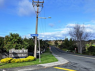
Algies Bay is a northern coastal suburb of Auckland, in New Zealand. It is on the Mahurangi Peninsula about 68 kilometres north of the city centre.
Mahurangi West is a rural settlement in the Auckland Region of New Zealand. Puhoi is to the west, Mahurangi Harbour is to the east, and the western part of Mahurangi Regional Park is southeast.
This page is based on this Wikipedia article Text is available under the CC BY-SA 4.0 license; additional terms may apply. Images, videos and audio are available under their respective licenses.