New Zealand English (NZE) is the variant of the English language spoken and written by most English-speaking New Zealanders. Its language code in ISO and Internet standards is en-NZ. English is the first language of the majority of the population.
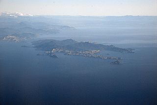
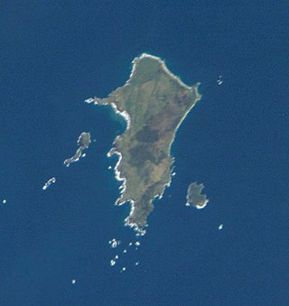
D'Urville Island, Māori name Rangitoto ki te Tonga, is the largest island in the Marlborough Sounds, on the northern coast of the South Island of New Zealand. It was named after the French explorer Jules Dumont d'Urville. With an area of approximately 150 square kilometres (58 sq mi), it is the eighth-largest island of New Zealand, and has around 52 permanent residents. The local authority is the Marlborough District Council.

Great Barrier Island lies in the outer Hauraki Gulf, New Zealand, 100 kilometres (62 mi) north-east of central Auckland. With an area of 285 square kilometres (110 sq mi) it is the sixth-largest island of New Zealand and fourth-largest in the main chain. Its highest point, Mount Hobson, is 627 metres (2,057 ft) above sea level. The local authority is the Auckland Council.

Banks Peninsula is a peninsula of volcanic origin on the east coast of the South Island of New Zealand. It has an area of approximately 1,150 square kilometres (440 sq mi) and encompasses two large harbours and many smaller bays and coves. The South Island's largest city, Christchurch, is immediately north of the peninsula.
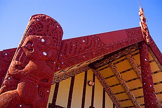
Māori culture is the customs, cultural practices, and beliefs of the indigenous Māori people of New Zealand. It originated from, and is still part of, Eastern Polynesian culture. Māori culture forms a distinctive part of New Zealand culture and, due to a large diaspora and the incorporation of Māori motifs into popular culture, it is found throughout the world. Within Māoridom, and to a lesser extent throughout New Zealand as a whole, the word Māoritanga is often used as an approximate synonym for Māori culture, the Māori-language suffix -tanga being roughly equivalent to the qualitative noun-ending -ness in English. Māoritanga has also been translated as "[a] Māori way of life." The term kaupapa, meaning the guiding beliefs and principles which act as a base or foundation for behaviour, is also widely used to refer to Māori cultural values.

The Chatham Islands are an archipelago in the Pacific Ocean about 800 km (430 nmi) east of New Zealand's South Island. They are administered as part of New Zealand. The archipelago consists of about 10 islands within an approximate 60 km (30 nmi) radius, the largest of which are Chatham Island and Pitt Island (Rangiauria). They include New Zealand's easternmost point, the Forty-Fours. Some of the islands, formerly cleared for farming, are now preserved as nature reserves to conserve some of the unique flora and fauna.

Taupō, sometimes written Taupo, is a town located in the central North Island of New Zealand. It is situated on the edge of Lake Taupō, which is the largest freshwater lake in New Zealand. Taupō was constituted as a borough in 1953. It has been the seat of Taupō District Council since the council was formed in 1989.

Whakaari / White Island, also known as White Island or Whakaari, is an active andesite stratovolcano situated 48 km (30 mi) from the east coast of the North Island of New Zealand, in the Bay of Plenty. The island covers an area of approximately 325 ha, which is just the peak of a much larger submarine volcano.

Russell, also known by the Māori name Kororāreka, is a town in the Bay of Islands, in New Zealand's far north. It was the first permanent European settlement and seaport in New Zealand.
Rotorua is a city in the Bay of Plenty Region of New Zealand's North Island. It is sited on the southern shores of Lake Rotorua, from which it takes its name. It is the seat of the Rotorua Lakes District, a territorial authority encompassing Rotorua and several other nearby towns. It has an estimated resident population of 58,900, making it the country's 13th largest urban area, and the Bay of Plenty's second-largest urban area behind Tauranga.

The Kāpiti Coast District, is a local government district of the Wellington Region in the lower North Island of New Zealand, 50 km north of Wellington City. The district is named after Kapiti Island, a prominent island 5 kilometres (3.1 mi) offshore.
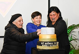
Te Wiki o te Reo Māori is a government-sponsored initiative intended to encourage New Zealanders to promote the use of the Māori language which is an official language of the country. Māori Language Week is part of a broader movement to revive the Māori language. It has been celebrated since 1975 and is currently spearheaded by Te Puni Kōkiri and the Māori Language Commission, with many organisations including schools, libraries, and government departments participating.
Pitt Island is the second largest island in the Chatham Archipelago, New Zealand. It is called Rangiauria in Māori and Rangiaotea in Moriori.
Moutohora Island is a small uninhabited island located off the Bay of Plenty coast of New Zealand's North Island, about 9 kilometres (5.6 mi) north of the town of Whakatāne. The 1.43 km2 (0.55 sq mi) island is a remnant of a complex volcano which has eroded, leaving two peaks. This is still an area of volcanic activity and there are hot springs on the island in Sulphur Valley, McEwans Bay, and Sulphur Bay.

Paraparaumu is a town in the south-western North Island of New Zealand. It lies on the Kāpiti Coast, 55 kilometres (34 mi) north of the nation's capital city, Wellington. It is also known to residents as Pram or Paraparam.
The Anglican Church in Aotearoa, New Zealand and Polynesia, formerly the Church of the Province of New Zealand, is a province of the Anglican Communion serving New Zealand, Fiji, Tonga, Samoa, and the Cook Islands. Since 1992 the church has consisted of three tikanga or cultural streams: Aotearoa, New Zealand, and Polynesia. The church's constitution says that, among other things, it is required to "maintain the right of every person to choose any particular cultural expression of the faith". As a result, the church's General Synod has agreed upon the development of the three-person primacy based on this three tikanga system; it has three primates, each representing a tikanga, who share authority.

New Zealand is an island country in the southwestern Pacific Ocean. It consists of two main landmasses—the North Island and the South Island —and over 700 smaller islands. It is the sixth-largest island country by area and lies east of Australia across the Tasman Sea and south of the islands of New Caledonia, Fiji, and Tonga. The country's varied topography and sharp mountain peaks, including the Southern Alps, owe much to tectonic uplift and volcanic eruptions. New Zealand's capital city is Wellington, and its most populous city is Auckland.
Migration to New Zealand began only very recently in human history - with Polynesian settlement in New Zealand, then uninhabited, about 1250 CE to 1280 CE. European migration provided a major influx, especially following the signing of the Treaty of Waitangi in 1840. Subsequent immigrants have come chiefly from the British Isles, but also from continental Europe, the Pacific, the Americas and Asia.

Goat Island or Te Hāwere-a-Maki is a tiny island in New Zealand located close to the North Island coast, north of Auckland, northeast of Warkworth, and directly west of Little Barrier Island. It is within Cape Rodney-Okakari Point Marine Reserve, New Zealand's first marine reserve.
The New Zealand Māori Council is a body that represents and consults the Māori people of New Zealand. As one of the oldest Māori representative groups, the council exerts pressure on New Zealand governments to protect Treaty of Waitangi rights.

