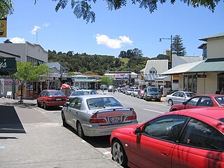
Warkworth is a town on the Northland Peninsula in the upper North Island of New Zealand. It is in the northern part of the Auckland Region. It is located on State Highway 1, 64 km (40 mi) north of Auckland and 98 km (61 mi) south of Whangārei, and is at the head of Mahurangi Harbour.

Ngāti Whātua is a Māori iwi (tribe) of the lower Northland Peninsula of New Zealand's North Island. It comprises a confederation of four hapū (subtribes) interconnected both by ancestry and by association over time: Te Uri-o-Hau, Te Roroa, Te Taoū, and Ngāti Whātua-o-Ōrākei. The four hapū can act together or separately as independent tribes.

Matakana Island is located in the western Bay of Plenty in New Zealand's North Island. A long, flat barrier island, it is 20 kilometres (12 mi) in length but rarely more than 3 kilometres (1.9 mi) wide. The island has been continuously populated for centuries by Māori tribes that are mostly associated with Ngāi Te Rangi.
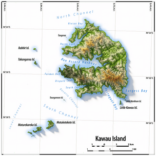
Kawau Island is in the Hauraki Gulf, close to the north-eastern coast of the North Island of New Zealand. At its closest point it lies 1.4 km (0.87 mi) off the coast of the Northland Peninsula, just south of Tāwharanui Peninsula, and about 8 km (5.0 mi) by sea journey from Sandspit Wharf, and shelters Kawau Bay to the north-east of Warkworth. It is 40 km (25 mi) north of Auckland. Mansion House in the Kawau Island Historic Reserve is an important historic tourist attraction. Almost every property on the Island relies on direct access to the sea. There are only two short roads serving settlements at Schoolhouse Bay and South Cove, and most residents have private wharves for access to their front door steps.
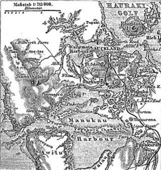
The human history of the Auckland metropolitan area stretches from early Māori settlers in the 14th century to the first European explorers in the late 18th century, over a short stretch as the official capital of (European-settled) New Zealand in the middle of the 19th century to its current position as the fastest-growing and commercially dominating metropolis of the country.

Snells Beach is a small coastal town in the north of Auckland Region in the North Island of New Zealand. It is situated on the eastern coast of the Mahurangi Peninsula and its namesake beach faces east across Kawau Bay to Kawau Island. The nearest town is Warkworth, 8 km (5.0 mi) to the west, which is linked by 8 buses a day and also Mahu City Express twice a day.

Rodney is a local government area in the northernmost part of New Zealand's Auckland Region, governed by the Rodney Local Board and Auckland Council. It currently aligns with the council's Rodney Ward.
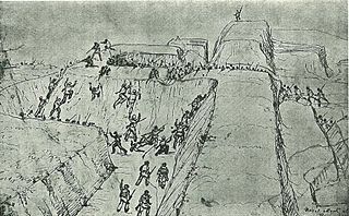
The Battle of Rangiriri was a major engagement in the invasion of Waikato, which took place on 20–21 November 1863 during the New Zealand Wars. More than 1400 British troops defeated about 500 warriors of the Kingitanga, which was resisting the expansion of British settlement and colonial rule in the North Island. The battle cost both sides more than any other engagement of the land wars and also resulted in the capture of 180 Māori prisoners, further reducing the Kingitanga ability to oppose the far larger British force.

Matakana is a small town in the Rodney Ward of Auckland Council of New Zealand. Warkworth lies about 9 km to the south-west, Snells Beach the same distance to the south, Ōmaha is about 7 km to the east, and Leigh about 13 km to the north-east. The Matakana River flows through the town and into Kawau Bay to the south-east.

Rodney Ward is a local government area in the northernmost part of New Zealand's Auckland Region, created along with the Auckland Council in 2010. The area was previously part of Rodney District; it does not include the Hibiscus Coast, which was also part of Rodney District but is now in Albany ward. The Rodney Local Board area has the same boundaries as Rodney Ward.
Rodney Local Board is one of the 21 local boards of Auckland Council, and is administered by the ward councillor representing Rodney Ward. Located in the northern part of the Auckland region, it is named after the former Rodney District which existed before its amalgamation into Auckland Council in 2010. Nine elected Local Board members sit on the board.
Matakana is a former New Zealand parliamentary electorate in the Thames-Coromandel District, which existed for one parliamentary term from 1993 to 1996, and was held by Graeme Lee. In 1994, Lee defected from the National Party to the Christian Democrat Party.
Wenderholm Regional Park is a regional park north of Auckland in New Zealand's North Island. It is situated between the estuaries of the Puhoi River and the Waiwera River, on the east coast of New Zealand's North Island and features a homestead known as Couldrey House, and a carved pouwhenua.

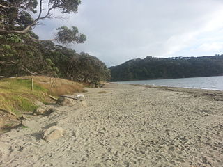
Scandrett Regional Park is a regional park located on the north east tip of the Mahurangi Peninsula, north of the city of Auckland, New Zealand. It encompasses Mullet Point and includes regenerating coastal forest, rocky headlands that protrude into Kawau Bay, Scandretts Bay beach and a precinct of historic farm buildings. The people of Auckland own the park through the Auckland Council.

Mansion House on Kawau Island, New Zealand, is a house that was owned by Sir George Grey from 1862 to 1888. Built in 1845 as the house for the manager of a copper mine on the island, it was extended significantly by Grey during his ownership. Mansion House is a heritage listed building. It is open to the public as part of the Kawau Island Historic Reserve administered by the Department of Conservation.

Ngāti Whātua Ōrākei or Ngāti Whātua-o-Ōrākei is an Auckland-based Māori hapū (sub-tribe) in New Zealand. Together with Te Uri-o-Hau, Te Roroa and Te Taoū, it comprises the iwi (tribe) of Ngāti Whātua. These four hapū can act together or separately as independent tribes. The hapū's rohe is mostly in Tāmaki Makaurau, the site of present-day Auckland. Ngāti Whātua Ōrākei has around 6,000 members whose collective affairs are managed by the Ngāti Whātua Ōrākei Trust.

Rainbows End is a rural settlement at the end of Green Road between the Oak River and Matakana River in Auckland Region. Matakana is 4.5 km (2.8 mi) to the north. Sandspit is across the Oak River directly south.
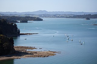
Mahurangi Harbour is a natural harbour in New Zealand. It is located on the north-eastern coast of the Auckland Region near the town of Warkworth, and empties into the Hauraki Gulf.

The Auckland wine region is a New Zealand wine-growing area and geographical indication centred around New Zealand's largest city, Auckland. The GI covers the area delineated by the greater Auckland Region, and has a total vineyard area in 2022 of 285 hectares.


