
The national parks of New Zealand are protected natural areas administered by the Department of Conservation (DOC). The first national parks established in the country were all focused on mountain scenery. Since the 1980s the focus has been on developing a more diverse representation of New Zealand landscapes. The parks are all culturally significant and many also contain historic features. Tongariro National Park is one of the World Heritage Sites that are of both cultural and natural significance, while four of the South Island national parks form Te Wahipounamu, another World Heritage Site. There are currently 13 national parks; a 14th, Te Urewera National Park, was disestablished in 2014.
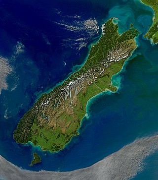
The South Island, also officially named Te Waipounamu, is the larger of the two major islands of New Zealand in surface area, the other being the smaller but more populous North Island. It is bordered to the north by Cook Strait, to the west by the Tasman Sea, and to the south and east by the Pacific Ocean. The South Island covers 150,437 square kilometres (58,084 sq mi), making it the world's 12th-largest island, constituting 56% of New Zealand's land area. At low altitudes, it has an oceanic climate.

Aoraki / Mount Cook National Park is a national park located in the central-west of the South Island of New Zealand. It was established in October 1953 and takes its name from the highest mountain in New Zealand, Aoraki / Mount Cook. The area of the park is 707 km2 (273 sq mi), and it shares a border with Westland Tai Poutini National Park along the Main Divide of the Southern Alps. The national park consists of reserves that were established as early as 1885 to protect the area's significant landscape and vegetation. Glaciers cover 40% of the park, including the county's largest glacier, Haupapa / Tasman Glacier. In 1990, the park was included in the area designated as the Te Wāhipounamu World Heritage Site. The park is managed by the Department of Conservation (DOC) alongside Ngāi Tahu, the iwi who are mana whenua in the region.

The Department of Conservation is the public service department of New Zealand charged with the conservation of New Zealand's natural and historical heritage.

Nelson Lakes National Park is in the South Island of New Zealand, at the northern end of the Southern Alps. It was created in 1956. The park contains beech forests, multiple lakes, snow-covered mountains and valleys created by glaciers during the ice ages.

Kahurangi National Park in the northwest of the South Island of New Zealand is the second largest of the thirteen national parks of New Zealand. It was gazetted in 1996 and covers 5,193 km2 (2,005 sq mi), ranging from the Buller River near Murchison in the south, to the base of Farewell Spit in Golden Bay in the north. The park has no single dominant landform, but includes an unusually wide variety of landscapes, including mountain ranges, rivers, gorges, raised peneplains and karst features such as caves and arches. Many of the landforms within the park are considered to be nationally or internationally significant.

Abel Tasman National Park is a national park at the north end of New Zealand's South Island. It covers 237.1 km2 (91.5 sq mi) of land between Golden Bay / Mohua and Tasman Bay / Te Tai-o-Aorere, making it the smallest of New Zealand's national parks. Despite this, the park is one of the most visited, partially due to the popularity of the Abel Tasman Coast Track which spans 60 km (37 mi) along the eastern and northern coastal areas of the park.

Protected areas of New Zealand are areas that are in some way protected to preserve their environmental, scientific, scenic, historical, cultural or recreational value. There are about 10,000 protected areas, covering about a third of the country. The method and aims of protection vary according to the importance of the resource and whether it is publicly or privately owned.
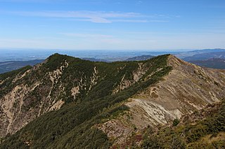
Conservation park is a type of specially protected status for land held by the Crown in New Zealand for conservation purposes. The status is set up under the Conservation Act 1987 and the parks are administered by the Department of Conservation (DoC).

Whirinaki Te Pua-a-Tāne Conservation Park is a publicly accessible conservation park in the North Island of New Zealand. The park is centered on the town of Minginui and part of the eastern boundary flanks Te Urewera. The Whirinaki Forest is one of the world's last prehistoric rainforests.
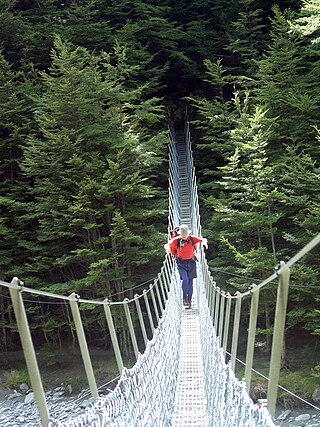
Tramping, known elsewhere as backpacking, rambling, hill walking or bushwalking, is a popular activity in New Zealand.

Aorangi Forest Park is a 194-square-kilometre (75 sq mi) protected area in the Wellington Region of New Zealand administered by the Department of Conservation (DOC). It had been called the Haurangi Forest Park but DOC changed to reflect the Māori name of the range protected by the park.

Aniseed Valley is a locality running between the Tasman district and Marlborough Region in the South Island of New Zealand. It is located around the Roding River southeast of Hope. The main road in the area is Aniseed Valley Road, which starts at State Highway 6 at Hope.
Long Island-Kokomohua Marine Reserve is a marine reserve, in the Marlborough Region of New Zealand's South Island. It covers an area of 619 hectares at the entrance to the Queen Charlotte Sound in the Marlborough Sounds. It was the first marine reserve established on the South Island.
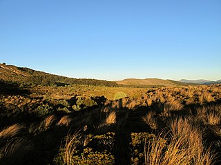
Kaimanawa Forest Park is a protected area south of Lake Taupō and east of Mount Tongariro in the Taupō Volcanic Zone. It is situated in the Rangitikei District and Manawatū-Whanganui Region of New Zealand's North Island.

Raukumara Conservation Park or Raukūmara Conservation Park is a protected area in the Gisborne District of New Zealand's North Island.
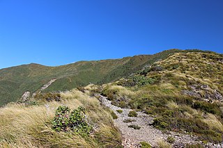
Ruahine Forest Park is a protected area in New Zealand's North Island, predominantly in Rangitikei District in Manawatū-Whanganui.
Northland Conservation Park is a group of protected areas in the Northland Region of New Zealand's North Island.
Maniniaro / Angelus Peak is a mountain in Nelson Lakes National Park, near the northwestern extent of New Zealand's main divide. Although it is not the tallest peak in the Angelus Ridge or the wider Travers Range, Maniniaro remains a popular tramping destination and is significant to the Ngāti Apa ki te Rā Tō iwi, who claim mana whenua within the area. According to Ngāti Apa ki te Rā Tō beliefs, the mountain is intrinsically linked with nearby Rotomaninitua / Lake Angelus, with the two both said to represent the footprints of the iwi's ancestors as they embarked on their journey back to Hawaiki. It is also near both major lakes of the national park, being roughly 6 kilometres (3.7 mi) from the southern ends of both Lakes Rotoiti and Rotoroa.
The Wharepapa / Arthur Range is a mountain range partially marking the boundary between the Tasman District and West Coast Region of New Zealand's South Island. The range is at the eastern extent of the Tasman Mountains which make up much of the island's northwest, making it easily visible from across the low-lying Waimea Plains further to the east. The range's location and its many uses make it a significant site for local Māori, including the iwi of Te Ātiawa and Ngāti Rārua. This includes the prominent peaks of Mount Arthur and Pukeone / Mount Campbell, which both hold mana in their own right and have become part of the identity of the aforementioned iwi.


