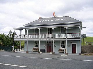
Towai is a locality in the Northland Region of the North Island of New Zealand. State Highway 1 passes just to the east. Kawakawa is 16 km northwest, and Whakapara is 17 km southeast. The North Auckland Line passes through Towai.
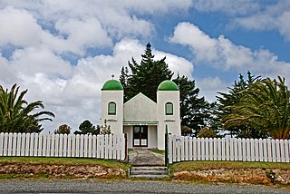
Te Kao is a village on the Aupouri Peninsula of Northland, New Zealand. Te Aupōuri are mana whenua over Te Kao and the surrounding district, and it is the principal settlement of the iwi (tribe). Te Aupōuri's Post-Settlement Governance Entity, Te Runanga Nui o Te Aupōuri, has an office at Te Kao, along with the iwi's marae and urupa. State Highway 1 passes through the district. Cape Reinga is 46 km to the north, and Houhora is 24 km to the south. The Aupouri Forest and Ninety Mile Beach are to the west.
Pukepoto is a town in Northland, New Zealand. It lies south west of Kaitaia and north east of Ahipara. The Herekino Forest lies to the south east.
Whirinaki is a locality on the Whirinaki River in the south Hokianga, in Northland, New Zealand. The name means "to lean against a support". Highway 12 runs through it. Opononi lies to the south west, and Rawene lies to the north east.
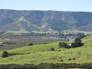
Whangape Harbour is a harbour on the west coast of Northland, New Zealand. There is a settlement called Whangape on the northern side of the harbour. Another, called Pawarenga, is located on the southern side. Kaitaia is 42 km north east.
Waimā is a community in the south Hokianga area of Northland, New Zealand. State Highway 12 runs through the area. The Waima River flows through the Waima Valley into the Hokianga Harbour. Rawene is to the north west, and Kaikohe is to the north east.
Aranga is a locality in Northland, New Zealand. State Highway 12 passes through it. Ōmāpere is 47 km northwest, and Dargaville is 42 km southeast. The Waipoua Forest is to the north. Maunganui Bluff and the Tasman Sea are to the west, with the small settlement of Aranga Beach lying at the northern end of Ripiro Beach.
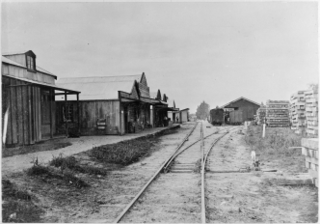
Kaihu is a locality and settlement in Northland, New Zealand. The Kaihu River runs through the Kaihu Valley into the Wairoa River near Dargaville, approximately 32 km south east. State Highway 12 runs along the valley and passes through Kaihu settlement. Aranga is about 10 km north west. The Kaihu Forest is to the east and the Marlborough Forest is to the north.

Tinopai is a settlement on the Komiti Bay, part of the Hukatere Peninsula in the northern Kaipara Harbour in Northland, New Zealand. The Otamatea River flows from the north east past Tinopai and into the harbour. Matakohe is 23 km (14 mi) to the north.
Motatau or Mōtatau is a locality in the Northland Region of the North Island of New Zealand. Maromaku is to the east. The Taikirau Stream flows from east through Motatau and then runs northwest to join the Waiharakeke Stream. The North Auckland Line runs through Motatau.
Pakotai is a locality in the Mangakahia River Valley of Northland, New Zealand. Kaikohe is about 37 km to the north, and Maungatapere is about 34 km to the south east.
Pipiwai is a locality in the Te Horo valley in Northland, New Zealand. Whangārei is about 35 km to the southeast. Titoki is about 16 km to the south.

Whananaki is a locality on the east coast of Northland, New Zealand. Whangārei is to the southwest. Te Wairahi Stream flows from the northwest into Whananaki Inlet, a wide tidal estuary which separates Whananaki from Whananaki South. Sandy Bay lies to the southeast. A long wooden footbridge connects Whananaki North and Whananaki South, with an alternative connection being a 6-kilometre-long (3.7 mi) road that crosses the river above the estuary. Hikurangi is about 22 km southwest of Whananaki South.

Canvastown is a locality at the point where the Wakamarina River joins the Pelorus River, in Marlborough, New Zealand. State Highway 6 runs through the area. Rai Valley is 17 km to the northwest. Havelock is 10 km to the east.
Kakaramea is a town in South Taranaki, New Zealand. State Highway 3 passes through it. Patea is about 6 km to the south-east, and Hāwera is about 20 km to the north-west.
Matapu is a locality located in South Taranaki District within the southern Taranaki Region of New Zealand. Hāwera is to the south-east, Eltham to the north-east, Kaponga to the north-west and Manaia to the south-west.
Waitōtara is a town in South Taranaki, New Zealand. Waverley is 10 km to the north-west, and Whanganui is 34 km to the south-east. State Highway 3 passes through it. The Waitōtara River flows past the east side of the town.
Mimi is a locality in northern Taranaki, in the North Island of New Zealand. It is located on State Highway 3 close to the shore of the North Taranaki Bight, 6 kilometres north-east of Urenui and 26 km south-west of Ahititi. The Mimi River flows past the settlement into the North Taranaki Bight.
Ratapiko is a locality in Taranaki, New Zealand. Kaimata is about six kilometres to the north-west.
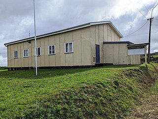
Glorit is a rural community in the Auckland Region of New Zealand's North Island. State Highway 16 runs through the area, connecting to Tauhoa 12 km to the north and Helensville to the south.


