Redwoodtown

Last updated

Redwoodtown
St Mary's Catholic Church, Blenheim, New Zealand 15.jpg
St Mary's Catholic Church
Redwoodtown
Coordinates: 41°31′41″S173°57′14″E / 41.528°S 173.954°E / -41.528; 173.954
CountryNew Zealand
City Blenheim, New Zealand
Local authority Marlborough District Council
Electoral ward
  • Blenheim General Ward
  • Marlborough Māori Ward
Area
[1]
  Land433 ha (1,070 acres)
Population
 (June 2023) [2]
  Total11,040
Springlands Blenheim Central
Fairhall
Pfeil oben.svg
Pfeil links.svgRedwoodtownPfeil rechts.svg
Pfeil unten.svg
Riverlands
Witherlea

Redwoodtown is a suburb to the south of Blenheim's central business district. [3] [4]

Contents

Demographics

Redwoodtown covers 4.33 km2 (1.67 sq mi) [1] and had an estimated population of 11,040 as of June 2023, [2] with a population density of 2,550 people per km2.

Historical population
YearPop.±% p.a.
20069,384    
20139,720+0.50%
201810,401+1.36%
Source: [5]

Before the 2023 census, the suburb had a larger boundary, covering 5.09 km2 (1.97 sq mi). [1] Using that boundary, Redwoodtown had a population of 10,401 at the 2018 New Zealand census, an increase of 681 people (7.0%) since the 2013 census, and an increase of 1,017 people (10.8%) since the 2006 census. There were 4,302 households, comprising 5,028 males and 5,370 females, giving a sex ratio of 0.94 males per female, with 1,833 people (17.6%) aged under 15 years, 1,755 (16.9%) aged 15 to 29, 4,431 (42.6%) aged 30 to 64, and 2,373 (22.8%) aged 65 or older.

Ethnicities were 84.8% European/Pākehā, 14.2% Māori, 4.5% Pasifika, 5.5% Asian, and 2.5% other ethnicities. People may identify with more than one ethnicity.

The percentage of people born overseas was 17.8, compared with 27.1% nationally.

Although some people chose not to answer the census's question about religious affiliation, 51.4% had no religion, 37.5% were Christian, 0.3% had Māori religious beliefs, 0.9% were Hindu, 0.2% were Muslim, 0.9% were Buddhist and 1.7% had other religions.

Of those at least 15 years old, 1,143 (13.3%) people had a bachelor's or higher degree, and 2,076 (24.2%) people had no formal qualifications. 882 people (10.3%) earned over $70,000 compared to 17.2% nationally. The employment status of those at least 15 was that 4,164 (48.6%) people were employed full-time, 1,200 (14.0%) were part-time, and 213 (2.5%) were unemployed. [5]

Individual statistical areas in 2018
NameArea
(km2)
PopulationDensity
(per km2)
HouseholdsMedian age
(years)
Median
income
Whitney West1.902,6521,3961,07741.7 NZ$ 31,500 [6]
Whitney East1.062,3942,25899344.0 NZ$ 29,000 [7]
Redwoodtown West1.062,6132,4651,08343.7 NZ$ 26,700 [8]
Redwoodtown East1.072,7422,5631,14942.2 NZ$ 29,200 [9]
New Zealand37.4 NZ$ 31,800

Education

Redwoodtown School and Richmond View School are full primary (years 1-8) schools with rolls of 298 and 328 respectively. [10] [11] Richmond View is a state integrated school with a Christian perspective. [12]

Whitney Street School is a state contributing primary (Year 1-6) primary school. It has a roll of 329.

All these schools are coeducational. Rolls are as of February 2024. [13]

Related Research Articles

<span class="mw-page-title-main">Mount Wellington, New Zealand</span> Suburb in Auckland, New Zealand

Mount Wellington is a suburb in East Auckland, New Zealand, located 10 kilometres southeast of the city centre. It is surrounded by the suburbs of Stonefields, Tamaki, Panmure, Penrose, and Ellerslie, and by the Tamaki River. The suburb is named after the volcanic peak of Maungarei / Mount Wellington. Sylvia Park is a large business park and shopping centre located in the suburb.

<span class="mw-page-title-main">Richmond, Tasman</span> Town in Tasman District, New Zealand

Richmond is a town and the seat of the Tasman District Council in New Zealand. It lies 13 kilometres (8 mi) south of Nelson in the South Island, close to the southern extremity of Tasman Bay. The town, first settled by Europeans in 1842, was named in 1854 after the town of Richmond on Thames near London. The town has an estimated population of 19,200 as of June 2023.

<span class="mw-page-title-main">Halswell</span> Suburb of Christchurch, New Zealand

Originally a separate village, Halswell is now a residential suburb of Christchurch, New Zealand, located 9 kilometres (5.6 mi) southwest of Cathedral Square on State Highway 75.

<span class="mw-page-title-main">Hornby, New Zealand</span> Suburb of Christchurch, New Zealand

Hornby is a major residential and retail suburb at the western edge of Christchurch, New Zealand. The suburb is directly connected to other parts of Christchurch and the South Island by a number of main arterial routes, including State Highway 1 and the Christchurch Southern Motorway.

<span class="mw-page-title-main">Homai</span> Suburb in Auckland, New Zealand

Homai is a suburb of Auckland in New Zealand surrounded by Manukau Central, Wiri, Hillpark, Clendon Park and Manurewa. It was formerly under the local governance of the Manukau City Council. It has since been integrated with the rest of Auckland under Auckland Council in 2010.

Pakuranga Heights is an Auckland suburb.

<span class="mw-page-title-main">Western Heights, Auckland</span> Suburb in Auckland, New Zealand

Western Heights is a neighbourhood of Henderson, in West Auckland, New Zealand. Western Heights School and the nearby shops are the centre of the community. Western Heights is a "frontier suburb", separating suburban Auckland from lifestyle farming blocks, orchards and the Waitākere Ranges.

<span class="mw-page-title-main">Lincoln, Auckland</span> Suburb in Auckland, New Zealand

Lincoln is a suburb in West Auckland, New Zealand. It is also the filming location of Shortland Street. The suburb is sometimes called Lincoln North or treated as part of Henderson North to avoid confusion with Lincoln in Canterbury.

<span class="mw-page-title-main">Hillcrest, Hamilton</span> Suburb of Hamilton, New Zealand

Hillcrest is a suburb in southeastern Hamilton in New Zealand. The suburb is home to the University of Waikato and consequently has a large student population. It is located on the east side of the Hamilton Town Belt, a series of public parks that run from the Hamilton Gardens to Ruakura in its eastern section.

<span class="mw-page-title-main">Richmond, Christchurch</span> Suburb of Christchurch, New Zealand

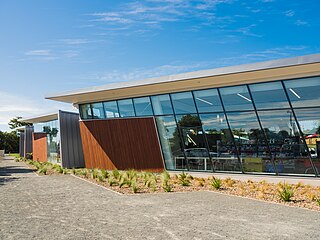
Richmond is a minor suburb of Christchurch, New Zealand.

<span class="mw-page-title-main">Red Beach, New Zealand</span> Suburb in Auckland, New Zealand

Red Beach is a suburb surrounding the beach of the same name on the Hibiscus Coast, Auckland, New Zealand, at the base of the Whangaparaoa Peninsula. The suburb of Silverdale is to the south-west, and Orewa to the north.

Te Hapara is a suburb of the New Zealand city of Gisborne. It is located in the northwest of the city. It contains one primary school, Te Hapara School, which is located in Mill Road.

Hoon Hay is an outer suburb of Christchurch, New Zealand, located at the base of the Port Hills and about 5 kilometres southwest of Cathedral Square. The area was named by Captain Wickham Talbot Harvey, a captain of the British Royal 10th Hussars, who moved to the area in 1852 and named it after the farm in Hoon, Derbyshire where he grew up. Harvey only stayed in the area for four years, before a fire destroyed his property and prompted him to return to the United Kingdom. Further fires in the following years destroyed the woodland which was on the property, including several large tōtara, causing it to be converted into farmland. Remnants of this forest remain visible in the area, including with tree stumps being discovered during flood mitigation work on the Ōpāwaho / Heathcote River.

<span class="mw-page-title-main">Clendon Park</span> Suburb in Auckland, New Zealand

Clendon Park is a suburb of Auckland in northern New Zealand. It is located to the west of Manurewa and north of Weymouth. The suburb is in the Manurewa-Papakura ward, one of the 21 local boards of Auckland Council.

<span class="mw-page-title-main">Māngere East</span> Suburb in Auckland, New Zealand

Māngere East or Mangere East is a suburb of Auckland, New Zealand, under the governance of Auckland Council. It is located to the south of Favona, north of Papatoetoe, west of Middlemore, east of Māngere and Māngere Bridge, and southwest of Ōtāhuhu.

Tamatea is a suburb in the west of the city of Napier, in the Hawke's Bay Region of New Zealand's eastern North Island.

<span class="mw-page-title-main">Taupō Central</span> Central business district of Taupō, New Zealand

Taupō Central is the central suburb and business district of Taupō in the Waikato region of New Zealand's North Island.

Marchwiel is a suburb of Timaru, Canterbury, New Zealand. It is one of 24 suburbs within the Timaru District.

<span class="mw-page-title-main">Rānui</span> Suburb in Auckland, New Zealand

Rānui is a suburb of West Auckland, New Zealand, which is under the local governance of Auckland Council. The area is densely populated but close to the western fringe of the Auckland urban area.

Randwick Park is a suburb of Auckland, New Zealand.

References

  1. 1 2 3 "ArcGIS Web Application". statsnz.maps.arcgis.com. Retrieved 6 April 2024.
  2. 1 2 "Population estimate tables - NZ.Stat". Statistics New Zealand . Retrieved 25 October 2023.
  3. Peter Dowling, ed. (2004). Reed New Zealand Atlas. Reed Books. pp. map 61. ISBN   0-7900-0952-8.
  4. Roger Smith, GeographX (2005). The Geographic Atlas of New Zealand. Robbie Burton. pp. map 139. ISBN   1-877333-20-4.
  5. 1 2 "Statistical area 1 dataset for 2018 Census". Statistics New Zealand. March 2020. Whitney West (307800), Whitney East (308100), Redwoodtown West (308200) and Redwoodtown East (308400).
  6. 2018 Census place summary: Whitney West
  7. 2018 Census place summary: Whitney East
  8. 2018 Census place summary: Redwoodtown West
  9. 2018 Census place summary: Redwoodtown East
  10. Education Counts: Redwoodtown School
  11. Education Counts: Richmond View School
  12. "Special character". Richmond View School. Archived from the original on 10 April 2004.
  13. "New Zealand Schools Directory". New Zealand Ministry of Education. Retrieved 14 March 2024.