Edward George Earle Lytton Bulwer-Lytton, 1st Baron Lytton, PC was an English writer and politician. He served as a Whig member of Parliament from 1831 to 1841 and a Conservative from 1851 to 1866. He was Secretary of State for the Colonies from June 1858 to June 1859, choosing Richard Clement Moody as founder of British Columbia. A noted philhellene, Bulwer-Lytton was offered the Crown of Greece in 1862 after King Otto abdicated, but he declined. He was created Baron Lytton of Knebworth in 1866.

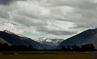
The Copland River is a river on the West Coast of the South Island of New Zealand. It flows for 20 kilometres (12 mi) from its headwaters in the Southern Alps / Kā Tiritiri o te Moana to its confluence with the Karangarua River.

Otehake River is located on the West Coast of the South Island of New Zealand. It flows northward through the Arthur's Pass National Park and into the Taramakau River.

The Conway River is part of the traditional boundary between the Canterbury and Marlborough regions in the South Island of New Zealand.
Karetu is a community in the Northland Region of the North Island of New Zealand. Kawakawa is to the west, and Waikare is northeast. The Karetu River flows from the Russell Forest in the southeast through Karetu, and joins the Kawakawa River shortly before it flows into the Bay of Islands.
Waitaria Bay is a locality in the Marlborough region of New Zealand. It lies on the northern side of Kenepuru Sound in the Marlborough Sounds.
Huirangi is a settlement in Taranaki, New Zealand. Waitara lies about 7 kilometres to the north. The Waitara River flows to the east of the settlement, with the Bertrand Road suspension bridge providing access to the other side.
Mimi is a locality in northern Taranaki, in the North Island of New Zealand. It is located on State Highway 3 close to the shore of the North Taranaki Bight, 6 kilometres north-east of Urenui and 26 km south-west of Ahititi. The Mimi River flows past the settlement into the North Taranaki Bight.

Maruia is a locality in the West Coast region of New Zealand. The Shenandoah Highway passes through it. Murchison is 65 km north, the Lewis Pass is 39 km to the south-east, and Reefton is 63 km west by road. The Maruia River flows past to the west.

Tomarata is a locality in the Auckland Region of New Zealand. Wellsford lies to the south-west, Te Ārai to the north, and Pākiri to the south-east. Tomarata Lake is nearby and is popular for boating, water skiing, kayaking and swimming. It is also used as a place to picnic and has a trail that follows the edge of the lake for hiking.

The Cust River is a river in the Canterbury region of New Zealand. It flows east across the upper Canterbury Plains from its source north of the town of Oxford, New Zealand, flowing into the Cam River / Ruataniwha close to the town of Rangiora. The small town of Cust lies on the banks of the river. The lower part of the river, to the south-west of Rangiora, is diverted into a channel and called the "Main Drain". The channel was built in 1862 to drain the swampy land between Rangiora and the Waimakariri River, and when it was enlarged in 1868 it accidentally captured the Cust.
The Deepdale River is a river of New Zealand located in the Tasman Region of the South Island.

The Donne River is a river in the Southland Region of New Zealand. It arises in the Darran Mountains, and flows south-west to join the Cleddau River. State Highway 94 crosses the Donne just before it reaches the Cleddau. The river was named by W. G. Grave in 1907 after Thomas Edward Donne, the General Manager of the Tourism Department.
The Doon River is a river in Fiordland, in the Southland Region of New Zealand. It arises near Mount Donald and flows south-east into the south-west arm of Lake Te Anau.
The Douglas River, formerly known as the Twain, is a river of the West Coast of New Zealand's South Island. Its source is high in the Southern Alps / Kā Tiritiri o te Moana, five kilometres (3.1 mi) south of Mount Sefton, and its upper reaches are fed by water from the Douglas Glacier. It flows west for 18 kilometres (11 mi), joined by runoff from the Horace Walker Glacier, before joining the waters of the Karangarua River. The Douglas River's entire course is within Westland Tai Poutini National Park. The river and glacier are named after Charles Edward Douglas, a 19th-century explorer and mountaineer.
The Gorge River is a river on the West Coast of New Zealand. It arises in the Hope Blue River Range and flows south-west into the Tasman Sea. Its tributaries include the Duncan River and Jerry River. It passes through Cascade Forest. Its mouth is about 15 km north-east of Awarua Point. The Gorge Islands are very small islands near the mouth. At its mouth, it is a fast tidal river.
The Eyre River is a river in the Canterbury region of New Zealand. It arises in the Puketeraki Range and flows south-east into the Waimakariri River near Christchurch International Airport. The connection with the Waimakariri is via a diversion channel running south-west, replacing the Eyre's original easterly flow. The river is named after Edward John Eyre, the Lieutenant-Governor of New Munster from 1848 to 1853.
Canterbury's Esk River is a tributary of the Waimakariri River. It rises in the Dampier Range near Esk Head, and flows southwest on the western side of the Puketeraki Range to reach the upper Waimakariri some 20 kilometres (12 mi) north of Springfield.
Burleigh is a suburb in inner Blenheim, in the Marlborough region of the South Island of New Zealand.

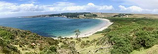
Port Hutt is a small settlement and beach on Chatham Island, in New Zealand's Chatham Islands chain. It is located in the northwest of the island, near the northern end of the large indentation of Petre Bay, some 24 km from the island's largest settlement Waitangi.


