
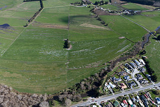
Lake Roxburgh is an artificial lake, created by the Roxburgh Dam, the earliest of the large hydroelectric projects in the southern South Island of New Zealand. It lies on the Clutha River, some 160 km (99 mi) from Dunedin. It covers an area of some 6 km2 (2.3 sq mi), and extends for nearly 30 km (19 mi) towards the town of Alexandra. The town of Roxburgh lies 5 kilometres (3.1 mi) south of the Dam.

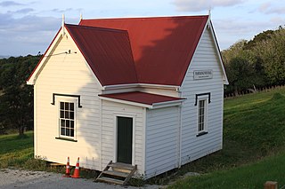
Cave is a town located in the Timaru District, South Island, New Zealand. It is approximately 23 kilometres (14 mi) north-west of Timaru on State Highway 8. St. David's Memorial Church was commissioned by Thomas Burnett and designed by Herbert W. Hall. Built in 1930, it is registered as a category I heritage building with Heritage New Zealand.
Pounawea is a small town in The Catlins, an area of the southern South Island of New Zealand. It is located four kilometres southwest of Owaka, at the mouth of the Catlins River. It is a popular holiday spot with a seasonal population, there are numerous cribs at the settlement.
Doyleston is a minor Canterbury town in the South Island of New Zealand. It was named after Joseph Hastings Doyle, a publican from Christchurch who moved to the locality. Doyleston promised to be one of the main townships in the Ellesmere area, but before long Leeston overtook it and some businesses moved there. Doyleston had a school for many years, but it consolidated with Leeston School in the late 1930s.

Whitecliffs is a village located in the Selwyn District of the Canterbury region of New Zealand's South Island. It has also been known as South Malvern, and the name of Whitecliffs comes from terrace cliffs above the Selwyn River / Waikirikiri.

Moana is a small town in the West Coast Region of the South Island of New Zealand. It is situated on the northern shore of Lake Brunner, and is beside the outflow of the lake into the Arnold River. There is a pedestrian suspension bridge crossing the Arnold from the town to access the lake shore across the river, with some short easy bush walks on each side.
Spencerville is a semi-rural town on the east coast of Canterbury, New Zealand north of Christchurch. The town backs on to Bottle Lake Forest and includes a large park and 80 hectare camping ground. These amenities, as well as wetlands and an animal and bird park make the town a popular camping area for Christchurch residents.
Millbrook Resort is a luxury resort near Queenstown, New Zealand. It is located 4 kilometres to the west of the historic gold-mining town of Arrowtown. The resort covers 650 acres of the Wakatipu Basin - a glacial valley bordered by the Crown Range, The Remarkables and Lake Wakatipu.
Wallacetown is a small town in Southland, in the South Island of New Zealand. Wallacetown is to the west of Invercargill, on high ground between the Makarewa and Ōreti rivers, near the Ōreti's estuary. Both rivers are popular for trout and whitebait fishing. It is considered to be a satellite town of Invercargill. It is served by State Highway 99, which skirts the town's northern edge.
Pukenui is a locality on the southwest side of Houhora Harbour on the Aupouri Peninsula of Northland, New Zealand. State Highway 1 runs through it. The name means "large hill" in the Māori language.

Tuamarina is a small town in Marlborough, New Zealand. State Highway 1 runs through the area. The Tuamarina River joins the Wairau River just south of the settlement. Picton is about 18 km to the north, and Blenheim is about 10 km to the south.

Sefton is a small town in the Waimakariri District, New Zealand, about 23 miles from Christchurch.

Woodbourne is a rural settlement in Marlborough, New Zealand. It is located on State Highway 6, 8 kilometres (5 mi) west of Blenheim, and 4 km (2 mi) east of Renwick. Woodbourne Airport is the major airport for Marlborough, and RNZAF Base Woodbourne shares the airport's runways.

Shelly Beach, officially known as Aotea / Shelly Beach, is a settlement and beach located on the eastern side of Te Korowai-o-Te-Tonga Peninsula and the southwest side of Kaipara Harbour, North Auckland. In 2018, a seawall and five groynes were constructed to fight erosion.
Pisa Moorings is a small town in the Central Otago District of Otago region of New Zealand's South Island. It is located between Lake Dunstan on its east and State Highway 6 on its west. Cromwell is 9 km southwest and Wānaka is 45 km north by road.

Waipu Cove is a locality and bay of Bream Bay in the Whangarei District and Northland Region of New Zealand. It is about 9 km southeast of Waipu and 5 km northwest of Langs Beach. It has a long sandy beach.
Mahurangi West is a rural settlement in the Auckland Region of New Zealand. Puhoi is to the west, Mahurangi Harbour is to the east, and the western part of Mahurangi Regional Park is southeast.

Waiomu is a settlement on the west coast of the Coromandel Peninsula of New Zealand, between Tapu to the north and Te Puru to the south. State Highway 25 runs through it.

Thornton Bay is a settlement on the west coast of the Coromandel Peninsula of New Zealand, between Te Puru to the north and Whakatete Bay to the south. State Highway 25 runs through it. Ngarimu Bay immediately to the south is considered to be part of the same urban area by Statistics New Zealand.

Fairview or Fairview Estate is a rural settlement in the Western Bay of Plenty District and Bay of Plenty Region of New Zealand's North Island. It is about 5.5 km south of Katikati, and is marketed as a lifestyle subdivision.

