The Poor Knights Islands are a group of islands off the east coast of the Northland Region of the North Island of New Zealand. They lie 50 kilometres (31 mi) to the northeast of Whangārei, and 22 kilometres (14 mi) offshore halfway between Bream Head and Cape Brett. Uninhabited since the 1820s, they are a nature reserve and popular underwater diving spot, with boat tours typically departing from Tutukaka. The Poor Knights Islands Marine Reserve surrounds the island.
Wellington Province, governed by the Wellington Provincial Council, was one of the provinces of New Zealand from 1853 until the abolition of provincial government in 1876. It covered much of the southern half of the North Island until November 1858, when Hawke's Bay Province split off, taking about a third of its area.

Moturoa / Rabbit Island is a small island that lies across the southernmost part of Tasman Bay / Te Tai-o-Aorere, on the northern coast of New Zealand's South Island. The long narrow island runs east–west for 8 kilometres (5 mi), and covers 15 km2 (5.8 sq mi).
Port Gore is a bay and natural harbour at the northern end of the Marlborough Sounds in New Zealand. It is close to the northern tip of the South Island, at the western end of Cook Strait. It is directly west of the entrance to Queen Charlotte Sound.
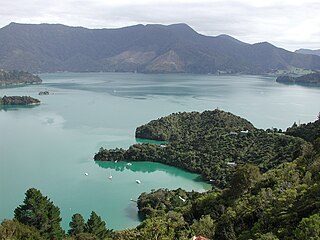
Kenepuru Sound is one of the larger of the Marlborough Sounds in the South Island of New Zealand. The drowned valley is an arm of Pelorus Sound / Te Hoiere, it runs for 25 kilometres (16 mi) from the northeast to southwest, joining Pelorus Sound a quarter of the way down the latter's path to the Cook Strait.
Clifford Bay is a bay in the northeast of the South Island of New Zealand, in the Marlborough Region. It lies between Cloudy Bay to the northwest, and Cape Campbell. The bay's most notable feature is the solar salt extraction works at Lake Grassmere, close to the southern end of the bay.

Cape Terawhiti is the southwesternmost point of the North Island of New Zealand.

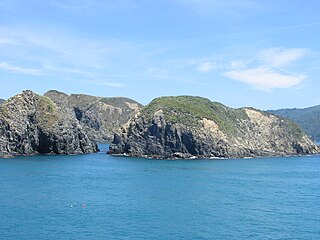
Long Island is located in Queen Charlotte Sound, one of the Marlborough Sounds of New Zealand. James Cook recorded its original name as Hamote.

HMNZS Wellington was a Leander-class frigate of the Royal Navy and the Royal New Zealand Navy (RNZN). Originally commissioned in 1969 for the Royal Navy as HMS Bacchante, she joined the RNZN in 1982. She was decommissioned in 1999 and sunk in 2005.
Aroha Island is a small island near Rangitane, which is about 12 km (7.5 mi) by road from Kerikeri in the Kerikeri Inlet, Bay of Islands, Northland, New Zealand. The island covers an area of 12 ha. It is owned and managed by the Queen Elizabeth II National Trust and is a major habitat for the North Island brown kiwi. It is linked to the mainland via a causeway.

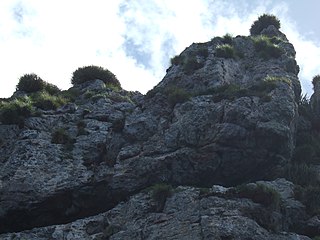
Aorangaia Island is an island in the Northland Region of New Zealand, part of the Poor Knights Islands. It has a highest point of 102 metres (335 ft) and is 21 kilometres (13 mi) from the New Zealand mainland.

The Titahi Bay Transmitter, which until 16 February 2016 was New Zealand's second tallest structure, transmitted AM radio signals from a 220 metres tall radio mast insulated against ground at Titahi Bay in New Zealand. The station which previously had three masts, now consists of only one mast with a height of 137 metres. A third – smaller – mast with a height of 53 metres was toppled on 10 November 2015. The tower's surrounding buildings were opened in 1937. Five radio programmes broadcast on four frequencies from the tower:
- Radio New Zealand National on 567 kHz
- Star and AM Network on 657 kHz
- Newstalk ZB on 1035 kHz
- Te Upoko O Te Ika on 1161 kHz

Mokopuna Island is a small uninhabited island in Wellington Harbour, New Zealand. It is about 200 metres (219 yd) on its long axis and about 80 metres (87 yd) across. It lies immediately north of the much larger Matiu/Somes Island, from which it is separated by a channel about 50 metres (55 yd) wide.

Taurikura is a small, rural township in the Whangarei District, approximately 30 kilometres (19 mi) south east of Whangārei city in Northland, New Zealand. The town is located on the shores of Calliope Bay at the base of 420-metre-high (1,380 ft) Mount Manaia which, along with Bream Head and the Hen Island, collectively form the ancient remnants of a very large andesitic volcano.

The Boulder Bank is a very unusual naturally formed landform in Nelson, New Zealand. It is a 13 kilometre long stretch of rocky substrate which begins at the Mackay Bluff and ends at the Cut of the Nelson Harbour. Haulashore Island was once a part of the Boulder Bank, but the Cut made it an island, and it is no longer connected to the Boulder Bank. The Boulder Bank separates Tasman Bay and the Nelson Haven and is managed as a scenic reserve by the Department of Conservation. Land access is gained along Boulder Bank Drive, signposted at the northern end of Nelson Haven on State Highway 6.
West Head is the name of three separate headlands on New Zealand's South Island.

Cape Brett Peninsula is a 15 km (9.3 mi) long peninsula in the Bay of Islands, in the Northland Region of New Zealand.

Forsyth Island lies in the outer Marlborough Sounds of New Zealand's South Island and is separated from the mainland by the 300m wide Allen Strait. The island comprises a mixture of farm land and native bush on hills rising to over 350 metres (1,148 ft) with views into the Marlborough Sounds and east towards the North Island.
