
Aoraki / Mount Cook is the highest mountain in New Zealand. Its height, as of 2014, is listed as 3,724 metres. It sits in the Southern Alps, the mountain range that runs the length of the South Island. A popular tourist destination, it is also a favourite challenge for mountain climbers. Aoraki / Mount Cook consists of three summits: from south to north, the Low Peak, the Middle Peak and the High Peak. The summits lie slightly south and east of the main divide of the Southern Alps, with the Tasman Glacier to the east and the Hooker Glacier to the southwest. Mount Cook is ranked 10th in the world by topographic isolation.
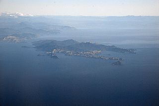
D'Urville Island, Māori name Rangitoto ki te Tonga, is the largest island in the Marlborough Sounds, on the northern coast of the South Island of New Zealand. It was named after the French explorer Jules Dumont d'Urville. With an area of approximately 150 square kilometres (58 sq mi), it is the eighth-largest island of New Zealand, and has around 52 permanent residents. The local authority is the Marlborough District Council.
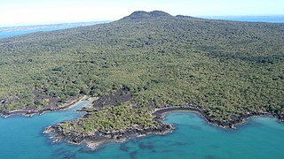
Rangitoto Island is a volcanic island in the Hauraki Gulf near Auckland, New Zealand. The 5.5 km (3.4 mi) wide island is a symmetrical shield volcano cone capped by central scoria cones, reaching a height of 260 m (850 ft). Rangitoto is the youngest and largest of the approximately 50 volcanoes of the Auckland volcanic field, having erupted in two phases about 1450 CE and 1500 CE and covering an area of 2,311 ha. It is separated from the mainland of Auckland's North Shore by the Rangitoto Channel. Since World War II, it has been linked by a causeway to the much older, non-volcanic Motutapu Island.

Doubtful Sound / Patea is a fiord in Fiordland, in the far south west of New Zealand. It is located in the same region as the smaller but more famous and accessible Milford Sound / Piopiotahi. It took second place after Milford Sound as New Zealand's most famous tourism destination.
The Jordan River is a name given to two minor rivers in the South Island of New Zealand, one in Marlborough, the other in Tasman. Further south, there is also 4 km (2.5 mi) stream in Otago named River Jordan.
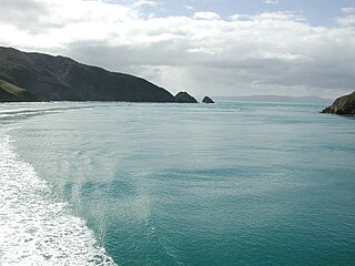
Tory Channel is one of the drowned valleys that form the Marlborough Sounds in New Zealand. Inter-island ferries normally use it as the principal channel between Cook Strait and the Marlborough Sounds.

Haupapa / Tasman Glacier is the largest glacier in New Zealand, and one of several large glaciers which flow south and east towards the Mackenzie Basin from the Southern Alps in New Zealand's South Island.
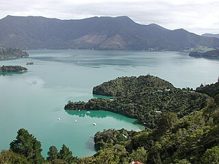
Kenepuru Sound is one of the larger of the Marlborough Sounds in the South Island of New Zealand. The drowned valley is an arm of Pelorus Sound / Te Hoiere, it runs for 25 kilometres (16 mi) from the northeast to southwest, joining Pelorus Sound a quarter of the way down the latter's path to the Cook Strait.

Allports Island is a small uninhabited island located in Queen Charlotte Sound in Marlborough, New Zealand. It reaches a height of 79 metres (259 ft) and is 1 kilometre (0.62 mi) from the New Zealand mainland. An even smaller unnamed island lies immediately to the east of it. Both islands are covered in native bush.
Anatakupu Island is an island in the Marlborough District of New Zealand. A navigational beacon is proposed for the island for sailors travelling along French Pass.
Maungatapu is a mountain in New Zealand located on the border of the Nelson, New Zealand and Marlborough Regions. It lies in the Bryant Range. The mountain is 1014 metres high. Maungatapu is Māori for "sacred mountain". The mountain was the location of the infamous Maungatapu murders.

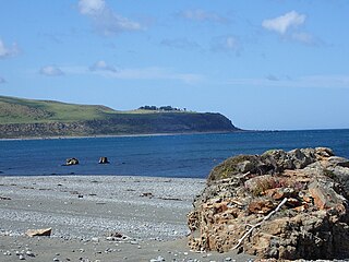
French Pass is a narrow and treacherous stretch of water that separates D'Urville Island, at the north end of the South Island of New Zealand, from the mainland coast. At one end is Tasman Bay, and at the other end the outer Pelorus Sound / Te Hoiere leads out to Cook Strait.
The Puhi Puhi River is a river of the Marlborough Region of New Zealand's South Island. It flows southwest, roughly paralleling the Pacific Ocean coast, from its source 12 kilometres (7 mi) west of the mouth of the Waiau Toa / Clarence River, and reaches its outflow into the Hāpuku River 5 kilometres (3 mi) from the latter's mouth at Hapuku. One of the tributaries is the Clinton River.
Rangitoto Range is in the Pureora Forest Park in the North Island of New Zealand. Its main peaks are Ranginui, Mt Baldy and Rangitoto. It has the headwaters of the Waipā, Puniu and Mōkau Rivers and forms the eastern boundary of the King Country. Streams on the eastern slopes drain into the Waikato River.
Stephenson Island, also called Mahinepua Island, is the larger of a pair of small islands 3,275 metres (2.035 mi) off the northern coast of New Zealand in Whangaroa Bay. It is approximately 1.5 miles (2.4 km) long and 0.5 miles (0.80 km) wide, positioned with the major axis running northwest to southeast. The area is 112 hectares (0.43 sq mi). Immediately to the northwest lies the smaller Cone Island. Satellite imagery indicates that the islands are partially forested and contain only two sites with buildings as discernible signs of habitation.

Tonga Island is a small (0.15 km2) island in Tasman Bay / Te Tai-o-Aorere, off the northern coast of the South Island of New Zealand. It lies within the Abel Tasman National Park, about 1 kilometre (0.62 mi) off Onetahuti Beach. The island has a flourishing fur seal colony, and is surrounded by the Tonga Island Marine Reserve, which was inaugurated in 1993.

Wainui Bay is within Golden Bay / Mohua, and at the south-eastern end of Golden Bay, in the Tasman Region of the South Island, New Zealand.
Fitzroy Bay is a bay close to the entrance of Wellington Harbour in New Zealand. It lies to the southeast of the entrance to the harbour, between Pencarrow Head and Baring Head. Lake Kohangatera drains into the bay through Gollans Stream.
Rangitoto is a rural community in the Waitomo District and Waikato region of New Zealand's North Island.
The Nelson Marlborough District Health Board was a district health board with the focus on providing healthcare to the Nelson, Tasman and Marlborough districts of New Zealand. In July 2022, it was merged into the national health service Te Whatu Ora.


