
Kaitoke, part of Upper Hutt City, is a locality in the southern North Island of New Zealand. It is located at the northern end of the Hutt Valley, 45 kilometres northeast of Wellington City and six kilometres from the northern end of the Upper Hutt urban area. It also lies at the southern end of the Tararua Ranges.

Lake Rotoroa lies within the borders of Nelson Lakes National Park in the South Island, New Zealand. The lake is fed by the D'Urville and Sabine rivers.

Molesworth Station is a high country cattle station. It is located behind the Inland Kaikōura Mountain range in the South Island's Marlborough District. It is New Zealand's largest farm, at over 1,800 square kilometres and supports the country's biggest herd of cattle. It also hosts government science programs, such as research into bovine tuberculosis and related research into possums. The station helps rabbit population reduction.

Manapouri is a small town in Southland / Fiordland, in the southwest corner of the South Island, in New Zealand. The township is the westernmost municipality in New Zealand. Located at the edge of the Fiordland National Park, on the eastern shore of Lake Manapouri, close to its outflow into the Waiau River, tourist boat services are based in the town.

Mount Cook Village, officially Aoraki / Mount Cook, is located within New Zealand's Aoraki / Mount Cook National Park at the end of State Highway 80, only 15 kilometres (9.3 mi) south of the summit of the country's highest mountain, also called Aoraki / Mount Cook, in the Southern Alps.

Kaingaroa Forest covers 2,900 square kilometres (1,100 sq mi) of the Bay of Plenty Region of New Zealand, and is the largest forest plantation in New Zealand, and the second largest in the Southern Hemisphere. The forest stretches from Lake Taupō in the south to Kawerau to the north and has roughly 20 million trees. The headquarters of the forest are at the small settlement of Kaingaroa, Bay of Plenty, 50 kilometres (31 mi) southeast of Rotorua. Prior to planting the area was a tussock and scrub plateau, formed on volcanic ash.

Cape Turnagain is a prominent headland on the east coast of New Zealand's North Island, part way between Hawke Bay and Cook Strait, between the mouths of the Porangahau and Ākitio Rivers.

The Kaweka Range of mountains is located in inland Hawke's Bay in the eastern North Island of New Zealand. It forms part of the mountainous spine of the North Island which extends from Wellington to East Cape, including the Tararua and Ruahine ranges.
Mohaka is a small settlement in the northern Hawke's Bay region of the eastern North Island of New Zealand. It is located on the coast of Hawke Bay, 20 kilometres southwest of Wairoa.
Te Pōhue is a small settlement in inland Hawke's Bay, in New Zealand's eastern North Island. It lies on State Highway 5, 31 kilometres inland from Whirinaki.
Whatatutu is a small settlement in the northeast of New Zealand's North Island. It is located north of Te Karaka on the upper reaches of the Waipaoa River, close to its meeting with its tributaries, the Mangatu River and Waingaromia River.
Minginui is a town in Whakatāne District and Bay of Plenty Region on New Zealand's North Island.

Pureora Forest Park is a 760-square-kilometre (290 sq mi) protected area in the North Island of New Zealand. Within its rich rainforest are an abundance of 1,000-year-old podocarp trees. It is "recognised as one of the finest rain forests in the world". Established in 1978, after a series of protests and tree sittings, the park is one of the largest intact tracts of native forest in the North Island and has high conservation value due to the variety of plant life and animal habitats. New Zealand's largest totara tree is located nearby on private land.
Kuripapango is a locality in the Hawke's Bay region of New Zealand, situated 76.6 km from Napier and 78.6 km from Taihape. It is on the Napier-Taihape Road more known as the Gentle Annie which rises to 4,101 feet (1,250 m) at its peak.

Iwitahi is a rural locality in the Taupō District and Bay of Plenty Region of New Zealand's North Island. It is situated on State Highway 5 between Taupō and Napier, about 20 km southeast of Taupō. It is a farming area, largely surrounded by forest, close to the plains of the upper Rangitaiki River. The locality was formerly known as Iwatahi.
Lauder is a small settlement in the Otago Region of the South Island of New Zealand. It is located in Central Otago, 8 km northeast of Omakau, on the main route between Alexandra and Ranfurly, State Highway 85. The settlement was named after the town of the same name in southern Scotland, one of many Otago sites to be named after places in the Scottish borders by John Turnbull Thomson.
Whakatu is a rural community in the Hastings District and Hawke's Bay Region of New Zealand's North Island. It is located 8 kilometres (5.0 mi) north-east of the centre of Hastings. A large industrial area is enclosed by a bend in the Clive River, and the closure of the freezing works in Whakatu in 1986 cost the region 2000 full-time and seasonal jobs. State Highway 2 and the Palmerston North–Gisborne Line pass through Whakatu.
Mōtū is a rural community in the Gisborne District of New Zealand's North Island. It is located north of Matawai and State Highway 2. The community is centred around Mōtū River and Mōtū Falls.
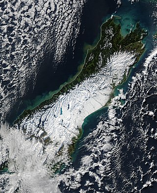
The South Island, with an area of 150,437 km2 (58,084 sq mi), is the largest landmass of New Zealand; it contains about one-quarter of the New Zealand population and is the world's 12th-largest island. It is divided along its length by the Southern Alps, the highest peak of which is Aoraki / Mount Cook at 3,724 metres (12,218 ft), making it 9th-highest island, with the high Kaikōura Ranges to the northeast. There are eighteen peaks of more than 3,000 metres (9,800 ft) in the South Island. The east side of the island is home to the Canterbury Plains while the West Coast is famous for its rough coastlines such as Fiordland, a very high proportion of native bush, and Fox and Franz Josef Glaciers. The dramatic landscape of the South Island has made it a popular location for the production of several films, including The Lord of the Rings trilogy and The Chronicles of Narnia: The Lion, the Witch and the Wardrobe. It lies at similar latitudes to Tasmania, and parts of Patagonia in South America.

The North Island, also officially named Te Ika-a-Māui, is one of the two main islands of New Zealand, separated from the larger but much less populous South Island by the Cook Strait. The island's area is 113,729 square kilometres (43,911 sq mi), making it the world's 14th-largest island. It has a population of 3,997,300, accounting for approximately 77% of the total residents of New Zealand.

