
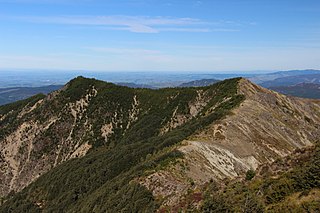
Fiordland is a geographical region of New Zealand in the south-western corner of the South Island, comprising the westernmost third of Southland. Most of Fiordland is dominated by the steep sides of the snow-capped Southern Alps, deep lakes, and its steep, glacier-carved and now ocean-flooded western valleys. The name "Fiordland" comes from a variant spelling of the Scandinavian word for this type of steep valley, "fjord". The area of Fiordland is dominated by, and very roughly coterminous with, Fiordland National Park, New Zealand's largest National Park.

Fiordland National Park occupies the southwest corner of the South Island of New Zealand. It is by far the largest of the 13 national parks in New Zealand, with an area of 12,607 square kilometres (4,868 sq mi), and a major part of the Te Wahipounamu World Heritage Site. The park is administered by the Department of Conservation.

Tiritiri Matangi Island is located in the Hauraki Gulf of New Zealand, 3.4 km (2.1 mi) east of the Whangaparaoa Peninsula in the North Island and 30 km (19 mi) north east of Auckland. The 2.2 km2 (1 sq mi) island is an open nature reserve managed by the Supporters of Tiritiri Matangi Incorporated, under the supervision of the Department of Conservation and is noted for its bird life, including takahē, North Island kōkako and kiwi. It attracts between 30,000 and 32,000 visitors a year, the latter figure being the maximum allowed by the Auckland Conservation Management Strategy.

Te Urewera is a protected area and former national park in the area of Te Urewera, near the east coast of New Zealand's North Island. It was established as a national park in 1954 and disestablished as such in 2014, when it was replaced by a legal entity named Te Urewera. It was the largest of four national parks in the North Island and the most isolated rainforest in the region. Covering an area of approximately 2,127 km2, it was in the north of the Hawke's Bay region of the North Island.

Resolution Island or Tau Moana (Māori) is the largest island in the Fiordland region of southwest New Zealand, covering a total of 208 km2 (80 sq mi). It is the country's seventh largest island, and the second largest uninhabited island. Resolution Island is separated from the mainland of the South Island by Tamatea / Dusky Sound, Te Puaitaha / Breaksea Sound, and Acheron Passage. The island is part of the Fiordland National Park.

Te Waewae Bay is the westernmost of three large bays lying on the Foveaux Strait coast of Southland, New Zealand, the others being Oreti Beach and Toetoes Bay. Twenty-seven kilometres in length, the western end of the bay is mountainous, with the southern terminus of the Southern Alps and Fiordland National Park.

Protected areas of New Zealand receive protection to preserve their environmental, historical or cultural value. The method and aims of protection vary according to the importance of the resource and whether it has public or private status.
Conservation park is a type of specially protected status for land held by the Crown in New Zealand for conservation purposes. The status is set up under the Conservation Act 1987 and the parks are administered by the Department of Conservation (DoC).

Secretary Island is an island in southwestern New Zealand, lying entirely within Fiordland National Park. Roughly triangular in shape, it lies between Doubtful Sound / Patea in the south and Te Awa-o-Tū / Thompson Sound in the north, with its west coast facing the Tasman Sea. To the east of the island, Pendulo Reach connects Te Awa-o-Tū / Thompson Sound with Doubtful Sound / Patea. Steeply sloped, the entirely bush-clad island rises to a chain of several peaks higher than 1000 metres. The highest of these is the 1,196-metre (3,924 ft) Mount Grono, the highest peak in the main New Zealand chain not located in the North or South Island. The island also contains three lakes. The largest, Secretary Lake, over 600 metres (2,000 ft) long, is located beneath Mount Grono at an altitude of 550 metres (1,800 ft).

Rotokura / Cable Bay is a bay and small settlement 18 kilometres (11 mi) north-east of Nelson in New Zealand. The settlement at the head of the bay is at the southern end of a thin strip of land or causeway connecting Pepin Island with the South Island.

Te Whanganui-A-Hei Marine Reseve is in the southern part of Mercury Bay on the Coromandel Peninsula in New Zealand covering an area of 840 hectares. On the coast of the mainland, it stretches from Cook Bluff in the north-west to the northern end of Hahei Beach in the south-east. Its offshore extremes run from Motukorure Island through Waikaranga Island to Okorotere Island and the northern end of Mahurangi Island.
The 2000 New Zealand rugby league season was the 93rd season of rugby league that had been played in New Zealand. The main feature of the year was the inaugural season of the Bartercard Cup competition that was run by the New Zealand Rugby League. The Canterbury Bulls won the Cup by defeating the Otahuhu Leopards 38–24 in the Grand Final.
Bird Islands Conservation Park is a 3.69-square-kilometre (1.42 sq mi) protected area in eastern Spencer Gulf, South Australia. It is located at Warburto Point on Yorke Peninsula, about 10 km (6.2 mi) south of the town of Wallaroo. In 1991, land additions were made to the park to include the intertidal zone of both islands. In 1999, a larger, mainland section was added to support mangroves, samphire and coastal fringe vegetation.

Trounson Kauri Park is a mainland island in the Northland Region of New Zealand. Characterised by its Kauri trees, it was named after James Trounson, who gifted the forest to the Department of Conservation.

The Lammerlaw Range is in the Otago region of New Zealand. It is an important watershed, and the source of many of the tributaries in the Taieri and lower Clutha River systems. The origins of the placename are Scottish. Windfarms have been sited in the area. The area includes distinctive geology including ribbon fens and peat habitats. The Lammerlaw and Lammermoor Ranges also include tussock grasslands. Parts of the ranges are in Te Papanui Conservation Park. The endangered Eldon's galaxias is found in the range.
Mainland islands are areas on the North Island and South Island of New Zealand, set aside as reserves for endemic and native species, in a similar way to island reserves. Some mainland islands are managed by the Department of Conservation, while others are run by private trusts in collaboration of universities and local communities.
Boundary Stream Mainland Island is a mainland island in the Hawke's Bay Region of New Zealand.
Paengaroa Mainland Island or Paengaroa Scenic Reserve is a mainland island in the Manawatū-Whanganui Region of New Zealand.
Te Urewera Mainland Island is a mainland island in the Bay of Plenty Region of New Zealand. It covers 212,673 hectares of native forest in northern Te Urewera.
Whakarewarewa Conservation Park or Whakarewarewa Forest Park is a mainland island in the Bay of Plenty Region of New Zealand. It lies close to SH 30 to the southwest of Rotorua.
