
Protected areas of New Zealand are areas that are in some way protected to preserve their environmental, scientific, scenic, historical, cultural or recreational value. There are about 10,000 protected areas, covering about a third of the country. The method and aims of protection vary according to the importance of the resource and whether it is publicly or privately owned.

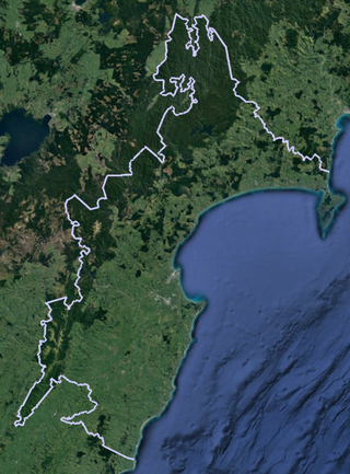
The Mohaka river is on the North Island of New Zealand in the east central region of Hawke’s Bay. Mohaka is a Maori word, roughly translated it means “place for dancing”. The iwi associated with the Mohaka River are Ngāti Pāhauwera, Ngāti Hineuru, Ngāti Tūwharetoa and Mana Ahuriri. The headwaters are found in the Kaweka and Kaimanawa ranges. From the range it winds southeast before twisting northeast and finally southeast again to empty into the Pacific Ocean near the town of Mohaka. There are many gorges on the Mohaka; some as steep as 200m. Its main tributaries are the Waipunga, Taharua, Hautapu rivers. The full length is 172 kilometres (107 mi) and it drains a basin of 2,357 square kilometres (910 sq mi).
The Waipawa River is a braided river of southern Hawke's Bay, in New Zealand's eastern North Island. It flows southeast from the slopes of 1,687 m (5,535 ft) Te Atuaoparapara in the Ruahine Range, past the town of Waipawa, before joining the Tukituki River. The river rises at the 1,326 m (4,350 ft) Waipawa Saddle, which is also the source of the Waikamaka River. The Mangaonuku Stream is a tributary on the northern bank, west of Waipawa, near Ruataniwha. The Waipawa's flow is generally greater than that of the Tukituki River, into which it flows.
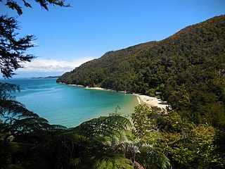
Tinline Bay is a cove and beach located within The Abel Tasman National Park in the South Island of New Zealand.

Harataonga Bay is a coastal feature and area on the northeast coast of Great Barrier Island in New Zealand's Hauraki Gulf, approximately 51 nautical miles northeast of central Auckland. Most of the area is in the Harataonga Recreation Reserve, with some of the hinterland forming the Harataonga Scenic Reserve.

Trounson Kauri Park is a 586 hectares reserve. It was the Department of Conservation's first mainland island in the Northland Region of New Zealand. Characterised by its kauri trees, it was named after James Trounson, who gifted the forest to the Department of Conservation.

Anaura Bay is a bay and community in the Gisborne District of New Zealand's North Island. It is located just south of Tokomaru Bay and north of Tolaga Bay.
The Maungaharuru Range is located 34 km from Napier in the New Zealand region of Hawke's Bay. The name means in the mountain that resounded in Te Reo Māori due to the bird population.
Aongatete is a settlement and rural community in the Western Bay of Plenty District and Bay of Plenty Region of New Zealand's North Island. It is located on State Highway 2, south of Katikati and north-west of Ōmokoroa. The landscape consists of a long valley descending into the Tauranga Harbour.

Ulva Island-Te Wharawhara Marine Reserve is a marine reserve covering an area of 1,075 hectares south-west and north-east of Ulva Island, in the Paterson Inlet of New Zealand's Stewart Island. It was established in 2004 and is administered by the Department of Conservation.

Medlands Beach is in Oruawharo Bay on the east coast of Great Barrier Island in the Auckland Region of New Zealand. Auckland Council describes it as the most accessible beach on the island. It is one of the island's main tourist areas but is little developed. The small settlement of Medlands consists of permanent houses and holiday baches, some behind the dunes, sheltered from winds from the sea, and others elevated for a view.
Mainland islands are areas on the North Island and South Island of New Zealand, set aside as reserves for endemic and native species, in a similar way to island reserves. Some mainland islands are managed by the Department of Conservation, while others are run by private trusts in collaboration with universities and local communities.
Paengaroa Mainland Island or Paengaroa Scenic Reserve is a mainland island in the Manawatū-Whanganui Region of New Zealand.
Rotoiti Mainland Island or Rotoiti Nature Recovery Project is a mainland island in the Tasman District of New Zealand.
Whakarewarewa Conservation Park or Whakarewarewa Forest Park is a mainland island in the Bay of Plenty Region of New Zealand. It lies close to SH 30 to the southwest of Rotorua.
Te Papanui Conservation Park is a mainland island in the Otago Region of New Zealand.
Hautai Marine Reserve is a marine reserve offshore from the Westland District and West Coast Region of New Zealand's South Island.

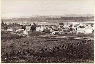
Piripiri is a sparsely populated area in the Tararua District, in the Manawatū-Whanganui Region, on State Highway 2 and the Palmerston North–Gisborne line. It is 3 mi 8 ch (5.0 km) north of Dannevirke, and has 150 people scattered over a meshblock of 21.8 km2 (8.4 sq mi).

Tauparikākā Marine Reserve is a marine reserve located offshore about 20 kilometres (12 mi) north of Haast on the West Coast of New Zealand's South Island. It covers the area immediately offshore from Ship Creek, which is also known as Tauparikākā in Māori.
Te Angiangi Marine Reserve is a marine reserve covering a marine area of 446 hectares in the Hawke's Bay Region of New Zealand's North Island. It was established in 1997 and is administered by the Department of Conservation.
