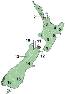
New Zealand is divided into sixteen regions for local government purposes. Eleven are administered by regional councils, and five are administered by unitary authorities, which are territorial authorities that also perform the functions of regional councils. The Chatham Islands Council is similar to a unitary authority, authorised under its own legislation.

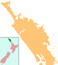
Whangarei is the northernmost city in New Zealand and the regional capital of Northland Region. It is part of the Whangarei District, a local body created in 1989 from the former Whangarei City, Whangarei County and Hikurangi Town councils, to administer both the city proper and its hinterland. The city population was estimated to be 58,800 in June 2018, an increase from 47,000 in 2001.
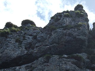
The Poor Knights Islands are a group of islands off the east coast of the Northland Region of the North Island of New Zealand. They lie 50 kilometres (31 mi) to the north-east of Whangarei, and 22 kilometres (14 mi) offshore halfway between Bream Head and Cape Brett. Uninhabited since the 1820s, they are a nature reserve and popular underwater diving spot, with boat tours typically departing from Tutukaka. The Poor Knights Islands Marine Reserve surrounds the island. Beaglehole (1955) comments that the origin of the island name is not clear, and speculates that the name could be related to the Poor Knights of Windsor, or, that the islands were named for their resemblance to Poor Knight's Pudding, a bread-based dish topped with egg and fried, popular at the time of discovery by Europeans.

New Zealand has over three dozen marine reserves spread around the North, the South Island, and neighbouring islands, and on outlying island groups. They are governed by the Marine Reserves Act 1971 and administered by the Department of Conservation with assistance from the Ministry of Fisheries, New Zealand Customs and the New Zealand Defence Forces.

The Poor Knights Islands Marine Reserve is a protected area off the coast of the North Island of New Zealand. The reserve, established in 1981 and covering an area of 2400 ha, is administered by the Department of Conservation. It surrounds the Poor Knights Islands and adjacent rock stacks. It is one of the world's ten most popular sites for scuba diving. with dive trips regularly leaving from the town of Tutukaka.
Marine protected areas (MPA) are protected areas of seas, oceans, estuaries or large lakes. These marine areas can come in many forms ranging from wildlife refuges to research facilities. MPAs restrict human activity for a conservation purpose, typically to protect natural or cultural resources. Such marine resources are protected by local, state, territorial, native, regional, national, or international authorities and differ substantially among and between nations. This variation includes different limitations on development, fishing practices, fishing seasons and catch limits, moorings and bans on removing or disrupting marine life. In some situations, MPAs also provide revenue for countries, potentially equal to the income that they would have if they were to grant companies permissions to fish.

Whangarei Airport is a small airport 4 nautical miles to the south east of Whangarei city, in the suburb of Onerahi, on the east coast of Northland in the North Island of New Zealand. The airport has a single terminal with two gates.
The Onerahi Branch, sometimes known as the Grahamstown Railway, was a branch line railway in the Northland Region of New Zealand. It operated from 1911 until 1933 and linked the city of Whangarei to the nearby harbour in Onerahi.

Mount Manaia is a dominant landmark approximately 30 kilometres southeast of Whangarei city on the Whangarei Heads peninsula.
Northport is a commercial port at Marsden Point, at the entrance to the Whangarei Harbour in New Zealand. The port is located next to the Marsden Point Oil Refinery. It is a naturally deep-water port, with a maximum depth of 14.5 metres. It is the northernmost multi-purpose port in New Zealand, and the closest port to the majority of New Zealand's international markets. It is about 100 km from Auckland’s Northern Motorway, and around 75 nautical miles from the Ports of Auckland.

Whangarei District is a territorial authority district in the Northland Region of New Zealand that is governed by the Whangarei District Council. The district is made up in area largely by rural land, and includes a fifth of the Northland Region. It extends southwards to the southern end of Bream Bay, northwards to Whangaruru and almost to the Bay of Islands, and westwards up the Mangakahia River valley past Pakotai and almost to Waipoua Forest. It includes the Hen and Chicken Islands and the Poor Knights Islands.
Ngātiwai or Ngāti Wai is a Māori iwi of the east coast of the Northland Region of New Zealand. Its historical tribal area or rohe stretched from Cape Brett in the north to Takatū Point on Tawharanui Peninsula in the south and out to Great Barrier Island, the Poor Knights Islands and other offshore islands.

Ngunguru is a coastal settlement in Northland, New Zealand. Whangarei is 26 kilometres (16 mi) to the south west. The Ngunguru River flows between the settlement and a long low sandspit into Whangaumu Bay, which stretches southwards. North of Ngunguru are Tutukaka and Matapouri. Just off the Ngunguru Coast are the Poor Knight Islands, a protected marine reserve.

Motu Matakohe, also known as Matakohe or Limestone Island, is a 37 ha island in the upper reaches of Whangarei Harbour, just off Onerahi, a seaside suburb of the city of Whangarei, Northland, New Zealand. Used for farming and industry for many years, the island is an example of ecological island restoration by a volunteer community group.
Motu Manawa Marine Reserve is a 500 hectares (1.9 sq mi) protected area in the Waitemata Harbour in Auckland, New Zealand, established in 1995. It includes the entire area between Rosebank Peninsula and Waterview, and surrounds Pollen and Traherne Islands. Its northeastern boundary runs roughly parallel to Rosebank Peninsula, from the mouth of the Oakley Creek estuary. Its northern-most boundary is north of Pollen Island, at the same latitude as the tip of Point Chevalier. Its westernmost point is in the mouth of the Whau River, between the tip of Rosebank Peninsula and Te Atatu.
Pollen Island or Motu Manawa is an island in the Waitematā Harbour, very near the northern end of Rosebank Peninsula, in Auckland, New Zealand. It is one of two islands surrounded by the Motu Manawa Marine Reserve, the other being Traherne Island. The 500 hectares (1.9 sq mi) marine reserve was established in 1995.
William James Ballantine was a British-born New Zealand marine biologist. He has been called the "father of marine conservation in New Zealand".
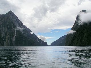
There are ten marine reserves in Fiordland region of New Zealand's South Island. They protect a wide variety of species and habitats. The original two reserves were established at the request of New Zealand Federation of Commercial Fishermen in 1993. An additional eight reserves were established on the recommendation of the Guardians of Fiordland in 2005.

Whangarei Harbour is a large harbour on the east coast of the North Island of New Zealand.

The Akaroa Marine Reserve, an area of 475 hectares at the entrance to the Akaroa Harbour in New Zealand, was approved in 2013 after a lengthy campaign. The reserve is yet to be gazetted.