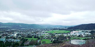
Upper Hutt is a city in the Wellington Region of New Zealand and one of the four cities that constitute the Wellington metropolitan area.

The Hutt River flows through the southern North Island of New Zealand. It flows south-west from the southern Tararua Range for 56 kilometres (35 mi), forming a number of fertile floodplains, including Kaitoke, central Upper Hutt and Lower Hutt.

Kaitoke, part of Upper Hutt City, is a locality in the southern North Island of New Zealand. It is located at the northern end of the Hutt Valley, 45 kilometres northeast of Wellington City and six kilometres from the northern end of the Upper Hutt urban area. It also lies at the southern end of the Tararua Ranges.

The Tararua Range, often referred to as the Tararua Ranges or Tararua, is one of several mountain ranges in the North Island of New Zealand.

Public transport in the Wellington Region, branded under the name Metlink, is the public transport system serving Wellington and its surrounding region. It is the most used public transport system in New Zealand, and consists of electric and diesel buses, suburban trains, ferries and a funicular. It also included trams until 1964, and trolleybuses until 2017.

Te Mārua is the easternmost urban suburb of Upper Hutt. For reasons of location and distance from the city, the area is often classified as rural. In December 2019, the approved official geographic name of the locality was gazetted as "Te Mārua".
Wellington Regional Council, branded as Greater Wellington Regional Council, is the regional council overseeing the Wellington Region of New Zealand's lower North Island. It is responsible for public transport under the brand Metlink, environmental and flood protection, and the region's water supply. As of 2023, it is the majority owner of CentrePort Wellington with a 77% shareholding.

Regional parks of New Zealand are protected areas administered by regional councils, the top tier of local government. Regional parks are found across five regions of New Zealand: the Auckland Region, Waikato Region, Bay of Plenty Region, Wellington Region and Canterbury Region. Regional parks in the Auckland and Waikato regions are administered by the Auckland Council, while parks in other areas are administered by regional councils: the Bay of Plenty Regional Council, Greater Wellington Regional Council, and Canterbury Regional Council.

The Wairarapa Connection is a New Zealand interurban commuter rail service along the Wairarapa Line between Masterton, the largest town in the Wairarapa, and Wellington. It is operated by Wellington suburban operator Transdev under contract from the Greater Wellington Regional Council. It is a diesel-hauled carriage service, introduced by the New Zealand Railways Department in 1964 after passenger demand between Masterton to Wellington exceeded the capacity of the diesel railcars then used.

The Hutt Valley Line is the electrified train service operated by Transdev Wellington on behalf of Metlink on the section of the Wairarapa Line railway between Wellington and Upper Hutt, New Zealand.

Maymorn railway station is a twin platform, rural request stop railway station serving the small settlement of Maymorn on the Maymorn Plateau, east of Upper Hutt, in New Zealand’s North Island. It is served by the Wairarapa Connection, and sees five services each way Monday to Thursday, six on Friday and two on Saturday and Sunday.

Wallaceville railway station is a suburban railway station serving Wallaceville in Upper Hutt, New Zealand. The station is located on the Hutt Valley section of the Wairarapa Line, 31.3 km (19.4 mi) north of Wellington, and is served by Metlink on behalf of the Greater Wellington Regional Council. Trains between Upper Hutt and Wellington stop at Wallaceville.

Belmont Regional Park is a regional park located between Lower Hutt and Porirua, in the Wellington Region at the southern end of New Zealand's North Island. It is administered by Wellington Regional Council. It was the first park in New Zealand to include land for recreation, conservation and farming.
East Harbour Regional Park is a regional park stretching from Baring Head along the east side of the Wellington Harbour along the east side of Eastbourne. It is located in Lower Hutt City, in the Wellington Region of New Zealand's North Island.

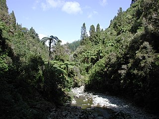
Kaitoke Regional Park is regional park located at Kaitoke, northeast of Upper Hutt, in the Wellington Region of New Zealand's southern North Island. It is administered by Wellington Regional Council, alongside the adjacent Hutt Water Collection Area.
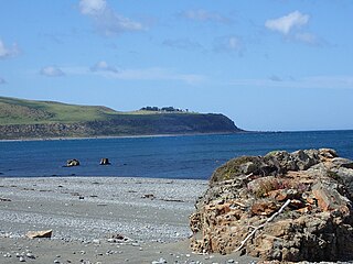
Baring Head is a headland, located between Wellington Harbour and Palliser Bay at the southern end of the North Island of New Zealand. It marks the southern end of Fitzroy Bay.
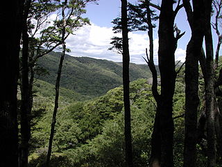
Akatarawa Forest is a regional park in the Upper Hutt within the Wellington Region at the southern tip of the North Island of New Zealand. It encompasses 15,000 hectares of native and plantation forest. It includes the headwaters of the Maungakotukutuku Steam, Akatarawa River West and the Whakatīkei River.
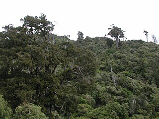
Pākuratahi Forest is a regional park located in Upper Hutt in the Wellington Region at the southern end of New Zealand's North Island. It is administered by Wellington Regional Council.

Wainuiomata Regional Park is a regional park located near Wainuiomata, Lower Hutt in the Wellington Region of New Zealand. It is administered by Wellington Regional Council. The name of the park was changed from Wainuiomata Recreation Area to Wainuiomata Regional Park in January 2022.
Wainuiomata Water Collection Area is a reserve located near Wainuiomata, Lower Hutt in the Wellington Region at the southern end of New Zealand's North Island. It is administered by Wellington Regional Council, for exclusive use by Wellington Water as a water catchment reserve. The park covers the catchments of the Wainuiomata River and the Ōrongorongo River. It adjoins Remutaka Forest Park and Wainuiomata Regional Park.

