Kaitoke

Last updated

The upper Stuart Macaskill reservoir. Upper Kaitoke reservoir.jpg
The upper Stuart Macaskill reservoir.

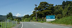
Kaitoke (sometimes called Pakuratahi), part of Upper Hutt City, is a locality in the southern North Island of New Zealand. It is located at the northern end of the Hutt Valley, 45 kilometres northeast of Wellington City and six kilometres from the northern end of the Upper Hutt urban area. It also lies at the southern end of the Tararua Ranges.

The New Zealand Ministry for Culture and Heritage gives a translation of "eat worms" for Kaitoke. [1]

The "Puffer" tramping track providing access into the Tararua Forest Park climbs from Kaitoke onto and along the Marchant Ridge. This ridge is the part of the Tararuas that is prominently visible from Wellington. The Marchant Track has a side track leading to the Tauherenikau Valley. The end of the Marchant Ridge (after four hours of 'up hill, all the way, both ways') leads to Mount Alpha, and onto The Southern Crossing. The entire track to Alpha skirts the Hutt Water Collection Area.

The first Youth Hostel in the North Island was established in the old Ministry of Works barracks at Kaitoke, which were behind the Post Office and alongside the Kaitoke Hall. The Post Office, the Hall, and the Youth Hostel were the only buildings of the settlement. Other facilities include a small airstrip operated by the Upper Valley Gliding Club for the purposes of gliding the area's thermals. [2]

The Pakuratahi River flows through the eastern Kaitoke Basin from its source in the Remutaka Ranges. The old route of the Wairarapa Line railway, which closed with the opening of the Rimutaka Tunnel in November 1955, ran from Upper Hutt via Maymorn to Kaitoke and around Goat Rock up the Pakuratahi to the Summit, and from there, because of excessive steepness, the Fell mountain railway system was used to aid trains on the Rimutaka Incline between Summit and Cross Creek. This railway is now the Remutaka Rail Trail. The Hutt River has its source to the north of Kaitoke, and much of the land in the vicinity is used as a water supply reserve. Filming, rafting, swimming and other human activity all take place downstream of the water intake.

The nearby Kaitoke Regional Park was the filming location for exterior shots of Rivendell for the movie The Lord of the Rings: The Fellowship of the Ring .

Related Research Articles

<span class="mw-page-title-main">Hutt Valley</span> Valley in Greater Wellington, New Zealand

The Hutt Valley is the large area of fairly flat land in the Hutt River valley in the Wellington region of New Zealand. Like the river that flows through it, it takes its name from Sir William Hutt, a director of the New Zealand Company in early colonial New Zealand.

<span class="mw-page-title-main">Upper Hutt</span> City in Wellington Region, New Zealand

Upper Hutt is a city in the Wellington Region of New Zealand and one of the four cities that constitute the Wellington metropolitan area.

<span class="mw-page-title-main">Hutt River (New Zealand)</span> River in New Zealand

The Hutt River flows through the southern North Island of New Zealand. It flows south-west from the southern Tararua Range for 56 kilometres (35 mi), forming a number of fertile floodplains, including Kaitoke, central Upper Hutt and Lower Hutt.

<span class="mw-page-title-main">Rimutaka Incline</span>

The Rimutaka Incline was a 3-mile-long (4.8 km), 3 ft 6 in gauge railway line on an average grade of 1-in-15 using the Fell system between Summit and Cross Creek stations on the Wairarapa side of the original Wairarapa Line in the Wairarapa district of New Zealand. The term "Rimutaka Incline" is sometimes used incorrectly to refer to other parts or all of the closed and deviated section of the Wairarapa Line between Upper Hutt and Speedy's Crossing, near Featherston. The incline formation is now part of the Remutaka Rail Trail.

<span class="mw-page-title-main">Remutaka Range</span> Mountain range

The Remutaka Range is the southernmost range of a mountain chain in the lower North Island of New Zealand. The chain continues north into the Tararua, then Ruahine Ranges, running parallel with the east coast between Wellington and East Cape.

<span class="mw-page-title-main">Tararua Range</span> Mountain range in the North Island of New Zealand

The Tararua Range, often referred to as the Tararua Ranges or Tararua, is one of several mountain ranges in the North Island of New Zealand.

<span class="mw-page-title-main">Remutaka Tunnel</span> Railway Tunnel In New Zealand

The Remutaka Tunnel is a railway tunnel through New Zealand's Remutaka Range, between Maymorn, near Upper Hutt, and Featherston, on the Wairarapa Line.

<span class="mw-page-title-main">Te Mārua</span> Suburb of Upper Hutt, New Zealand

Te Mārua is the easternmost urban suburb of Upper Hutt. For reasons of location and distance from the city, the area is often classified as rural. In December 2019, the approved official geographic name of the locality was gazetted as "Te Mārua".

<span class="mw-page-title-main">Wairarapa Line</span> Railway line in New Zealand

The Wairarapa Line is a secondary railway line in the south-east of the North Island of New Zealand. The line runs for 172 kilometres (107 mi), connects the capital city Wellington with the Palmerston North - Gisborne Line at Woodville, via Lower Hutt, Upper Hutt and Masterton.

<span class="mw-page-title-main">Southern Crossing</span> Hiking trail in New Zealand

The Southern Crossing is a tramping track in New Zealand's Tararua Range. The track is approximately 32 kilometres (20 mi) long and typically takes two to three days to complete. It begins in Ōtaki Forks in the west, and continues over Mount Hector finishing in Kaitoke north of Upper Hutt.

The Rimutaka Incline Railway Heritage Trust is a non-profit, charitable trust in New Zealand that was established in 2003 with the objective of reinstating an operating heritage railway over the Remutaka Ranges using the original route of the Wairarapa Line between Maymorn and Featherston, including the world-famous Rimutaka Incline.

<span class="mw-page-title-main">Kaitoke railway station</span> Defunct railway station in New Zealand

Kaitoke railway station was a single-platform rural railway station on the Wairarapa Line between Upper Hutt and Featherston in the Wellington region of New Zealand's North Island. Initially it was the railhead of the Wairarapa Line, at a point where the railway met the main road between Upper Hutt and the Wairarapa. Later it was a point at which locomotives were changed, steam engines were watered, trains could cross, and passengers could make use of the refreshment room.

<span class="mw-page-title-main">Cross Creek railway station</span> Defunct railway station in New Zealand

Cross Creek railway station was the base of operations for the Rimutaka Incline, a Fell railway over the Remutaka Ranges, and part of the original Wairarapa Line between Upper Hutt and Featherston in the Wellington region of New Zealand's North Island. The station was between Pigeon Bush and Summit stations on the Wairarapa Line. The station was bypassed when the Rimutaka Tunnel was opened.

<span class="mw-page-title-main">Remutaka Rail Trail</span>

The Remutaka Rail Trail is a walking and cycling track in the North Island of New Zealand. It runs between Maymorn and Cross Creek, and follows 22 kilometres (14 mi) of the original route of the Wairarapa Line over the Remutaka Range between the Mangaroa Valley and the Wairarapa, including the world-famous Rimutaka Incline. Parts of the trail are also used by vehicles both from the regional council and from forestry companies with tree plantations in the area; members of the public have limited vehicular access from the Kaitoke end to a car park, go-kart track and gun range. Access is also granted by permission to horse riders. Touring coaches have been used upon occasion to convey tourists and other visitors to various parts of the route.

<span class="mw-page-title-main">Remutaka Forest Park</span>

Remutaka Forest Park is a protected area near Wellington, New Zealand. Popular access points are south of Wainuiomata and in the upper Hutt Valley. The park covers 220 square kilometres (85 sq mi), encompassing the Catchpool Valley and the Ōrongorongo Valley at the southern end of the Remutaka Range. Established in 1972, the park contains several short walks and six huts that can be booked and accessed by longer bush tramps. The park is one part of several local conservation areas, as it borders the Pakuratahi Forest and the Tararua Range.

<span class="mw-page-title-main">Kaitoke Regional Park</span> Regional park in the Wellington Region

Kaitoke Regional Park is regional park located at Kaitoke, northeast of Upper Hutt, in the Wellington Region of New Zealand's southern North Island. It is administered by Wellington Regional Council, alongside the adjacent regional park of Hutt Water Collection Area.

<span class="mw-page-title-main">Pākuratahi River</span> River in New Zealand

The Pākuratahi River, previously the Pakuratahi River, is a river of the Wellington Region of New Zealand's North Island. It flows northwest from its source in the Remutaka Range 15 kilometres (9 mi) east of Lower Hutt to join the Te Awa Kairangi / Hutt River near Kaitoke.

<span class="mw-page-title-main">Price's Bush Tramway</span>

Price's Bush Tramway was a bush tramway built around 1903 near Akatarawa in the Tararua Range of New Zealand's North Island. It was built with a raised Fell third rail for braking the loaded trucks, as used by the Rimutaka Incline.

<span class="mw-page-title-main">Hutt Water Collection Area</span> Reserve in Upper Hutt, New Zealand

Hutt Water Collection Area is a reserve located in Upper Hutt in the Wellington Region at the southern end of New Zealand's North Island. It is administered by Wellington Regional Council and is located alongside the larger Kaitoke Regional Park.

<span class="mw-page-title-main">Pakuratahi Forest</span>

Pakuratahi Forest is a regional park located in Upper Hutt in the Wellington Region at the southern end of New Zealand's North Island. It is administered by Wellington Regional Council.

References

  1. "1000 Māori place names". New Zealand Ministry for Culture and Heritage. 6 August 2019.
  2. "Upper Valley Gliding Club". Archived from the original on 2016-03-04. Retrieved 2010-07-28.

41°5′0.5″S175°10′3″E / 41.083472°S 175.16750°E / -41.083472; 175.16750