Manor Park, New Zealand

Last updated

Manor Park
Suburb of Lower Hutt City
Manor Park, New Zealand
Country New Zealand
CityLower Hutt City
Electoral wardWestern
Established1925
Area
  Land159 ha (393 acres)
Population
 (2020 [1] )
  Total410
Train station(s) Manor Park Railway Station
Haywards
Pfeil oben.svg
Pfeil links.svgManor ParkPfeil rechts.svg
Pfeil unten.svg
Pinehaven
Pomare Stokes Valley

Manor Park, a northern suburb of Lower Hutt City, lies in the south of the North Island of New Zealand. The suburb separates the western bank of the Hutt River from State Highway 2.

Contents

History

At the end of 1925, W.H. George auctioned his Manor Park Estate, which at the time was part of Haywards. [2] Much of it was subdivided and sold as township sections. [3] Part of the land was purchased by Karori Golf Club, which renamed itself to Manor Park Golf Club after moving there and opening a course in 1926. [4]

A flood in April 1931 swept away Manor Park Bridge, a private bridge that connected the suburb with Stokes Valley. [5] The flood also caused damage to the Manor Park Golf Course. [6]

The suburb was previously home to Manor Park School, which has admission records dating back to 1962. [7] The school was declared closed on 15 February 1996. [8]

Landmarks

Manor Park is home to the Manor Park Golf Club. [9] The suburb is mostly residential, other than the aforementioned golf club and a small private hospital. Over recent years new houses have been built at the southern end of the suburb.

Demographics

Manor Park statistical area covers 1.59 km2 (0.61 sq mi). [10] It had an estimated population of 460 as of June 2021, [11] with a population density of 289 people per km2.

Historical population
YearPop.±% p.a.
2006381    
2013390+0.33%
2018417+1.35%
Source: [12]

Manor Park had a population of 417 at the 2018 New Zealand census, an increase of 27 people (6.9%) since the 2013 census, and an increase of 36 people (9.4%) since the 2006 census. There were 135 households. There were 219 males and 198 females, giving a sex ratio of 1.11 males per female. The median age was 45.8 years (compared with 37.4 years nationally), with 57 people (13.7%) aged under 15 years, 75 (18.0%) aged 15 to 29, 180 (43.2%) aged 30 to 64, and 102 (24.5%) aged 65 or older.

Ethnicities were 82.7% European/Pākehā, 12.2% Māori, 5.0% Pacific peoples, 12.9% Asian, and 1.4% other ethnicities (totals add to more than 100% since people could identify with multiple ethnicities).

The proportion of people born overseas was 23.0%, compared with 27.1% nationally.

Although some people objected to giving their religion, 50.4% had no religion, 32.4% were Christian, 2.9% were Hindu, 2.2% were Buddhist and 5.0% had other religions.

Of those at least 15 years old, 60 (16.7%) people had a bachelor or higher degree, and 66 (18.3%) people had no formal qualifications. The median income was $31,400, compared with $31,800 nationally. The employment status of those at least 15 was that 162 (45.0%) people were employed full-time, 36 (10.0%) were part-time, and 9 (2.5%) were unemployed. [12]

Related Research Articles

Eastbourne, New Zealand Place in New Zealand

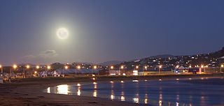
Eastbourne is a suburb of Lower Hutt, a part of Wellington, New Zealand. Lying beside the sea, it is a popular local tourist destination via car from Petone or from ferry crossings from central Wellington. An outer suburb, it lies on the eastern shore of Wellington Harbour, five kilometres south of the main Lower Hutt urban area and directly across the harbour from the Miramar Peninsula in Wellington city. A narrow exposed coastal road connects it with the rest of Lower Hutt via the Eastern Bays and the industrial suburb of Seaview. It is named for Eastbourne in England, another seaside town known as a destination for day-trips.

Upper Hutt City in Wellington, New Zealand

Upper Hutt (Māori: Te Awa Kairangi ki Uta is a city in the Wellington Region of the North Island of New Zealand, and one of the four cities that constitute the Wellington metropolitan area.

Petone Suburb of Hutt City in New Zealand

Petone, a large suburb of Lower Hutt in the Wellington Region of New Zealand's North Island, stands at the southern end of the Hutt Valley, on the northern shore of Wellington Harbour. The Māori name Pito-one means "end of the sand beach".

Naenae Suburb of Lower Hutt City in New Zealand

Naenae is a suburb of the city of Lower Hutt, New Zealand. It lies on the eastern edge of the floodplain of the Hutt River, four kilometres from the Lower Hutt Central business district. A small tributary of the Hutt, the Waiwhetu Stream, flows through the suburb.

Avalon, New Zealand Suburb of Lower Hutt City in New Zealand

Avalon is a suburb of Lower Hutt in New Zealand, formed as a private residential development in the 1970s on land formerly occupied by market-gardens on the left (eastern) bank of the Hutt River. It features mostly California-inspired designed houses, often split-level, with 3 or 4 bedrooms.

Te Mārua is the easternmost urban suburb of Upper Hutt. For reasons of location and distance from the city, the area is often classified as rural. Te Mārua is well known for its Plateau Reserve where remnants of the old Rimutaka Railway path can be found, which now form part of a historic walk. Mt Climie, the highest peak of the Remutaka Range, can also be reached from the reserve. The suburb is also the location of the Wellington Speedway, a nationally important venue for stock car racing, and of the Wellington Naturist Club's club grounds, venue of the historic 2016 World Congress of the International Naturist Federation.

Alicetown is a central suburb of Lower Hutt located at the bottom of the North Island of New Zealand.

Belmont, Wellington Suburb of Lower Hutt City in New Zealand

Belmont, a suburb of Lower Hutt, to the north of Wellington in the North Island of New Zealand, lies on the west bank of the Hutt River, on State Highway 2, the Wellington-Hutt main road, and across the river from the centre of Lower Hutt.

Lyall Bay Suburb of Wellington City in New Zealand

Lyall Bay is a bay and a suburb on the south side of the Rongotai isthmus in Wellington, New Zealand.

Heretaunga is a suburb of the city of Upper Hutt, located in the lower (southern) North Island of New Zealand. The settlement, one of the older suburbs in the Hutt Valley, dates from the 1840s when European settlers sought country sections. A prime example of a "leafy" suburb, Heretaunga includes quiet tree-lined streets. It is characterised by large houses, often Edwardian or from the mid-20th century.

Waterloo is an eastern suburb of Lower Hutt, Wellington. It is named after the Battle of Waterloo won by the Duke of Wellington in 1815.

Moera Suburb of Lower Hutt City in New Zealand

Moera, a suburb of the city of Lower Hutt in New Zealand, forms part of the urban area of greater Wellington.

Lower Hutt City in Wellington, New Zealand

Lower Hutt is a city in the Wellington Region of the North Island of New Zealand. Administered by the Hutt City Council, it is one of the four cities that constitute the Wellington metropolitan area.

Kelson, New Zealand Suburb of Hutt City in New Zealand

Kelson is a suburb of Lower Hutt in Wellington, New Zealand. It is situated on the western hills of the Hutt Valley. To the west of the suburb lies the Belmont Regional Park, while to the east runs the Hutt River and State Highway 2.

Boulcott is a central suburb of Lower Hutt City situated in the south of the North Island of New Zealand. The suburb lies about a kilometre north-east of the Lower Hutt CBD.

Epuni Suburb of Lower Hutt City in New Zealand

Epuni is a suburb of Lower Hutt, New Zealand situated in the south of the North Island of New Zealand. The suburb lies around one kilometre east of the Lower Hutt CBD.

Normandale, New Zealand Suburb of Lower Hutt City in New Zealand

Normandale is a semi-rural suburb of Lower Hutt City, New Zealand, on the western hills of the Hutt Valley. It consists of two main roads – Normandale Road and Miromiro Road – and the hills between, and is a five minute drive from the Lower Hutt city centre.

Maungaraki is a suburb of Lower Hutt City situated at the bottom of the North Island of New Zealand. The suburb is located on the western hills of the Hutt Valley with access to the area via State Highway 2 and offers extensive views of Wellington harbour and Matiu/Somes Island. It contains the largest suburban development on the Hutt Valley's western escarpment that runs along the Wellington Fault.

Korokoro, New Zealand Suburb of Lower Hutt City in New Zealand

Korokoro, a suburb of Lower Hutt City, lies in the south of the North Island of New Zealand. The suburb occupies part of the western hills of the Hutt Valley; its eastern slopes overlook Petone and the Wellington harbour.

Hutt Valley District Health Board

The Hutt Valley District Health Board is a district health board with the focus on providing healthcare to the cities of Lower Hutt and Upper Hutt in New Zealand.

References

  1. "Subnational population estimates". NZ.Stat. Statistics New Zealand . Retrieved 9 March 2021.
  2. "Sale By Auction: Hayward's Farm and Manor Park Estate, Haywards". Evening Post, Volume CX, Issue 114, 10 November 1925. 1925. Retrieved 17 April 2018.
  3. "Haywards Daily Bulletin". Evening Post, Volume CX, Issue 145, 16 December 1925. 1925. Retrieved 17 April 2018.
  4. "Haywards Daily Bulletin". Evening Post, Volume CX, Issue 124, 21 December 1925. 1925. Retrieved 17 April 2018.
  5. "Manor Park Bridge". Hutt News, Volume 3, Issue 47, 30 April 1931. 1931. Retrieved 17 April 2018.
  6. "April 1931 New Zealand Storm". NZ Historic Weather Events Catalog. 2016. Retrieved 17 April 2018.
  7. "Manor Park School: Records". National Library of New Zealand. 1996. Retrieved 17 April 2018.
  8. "Closure of Manor Park School (2901)". New Zealand Gazette. 1996. Retrieved 17 April 2018.
  9. Manor Park Golf Club Archived 2009-01-21 at the Wayback Machine Retrieved: 10 January 2009
  10. "ArcGIS Web Application". statsnz.maps.arcgis.com. Retrieved 10 June 2021.
  11. "Population estimate tables - NZ.Stat". Statistics New Zealand . Retrieved 22 October 2021.
  12. 1 2 "Statistical area 1 dataset for 2018 Census". Statistics New Zealand. March 2020. Manor Park (243900). 2018 Census place summary: Manor Park

Coordinates: 41°09′30″S174°58′45″E / 41.158320°S 174.979176°E / -41.158320; 174.979176