Onepoto, Wellington

Last updated

Onepoto
Onepoto, Wellington
CountryNew Zealand
City Porirua City
Local authority Porirua City Council
Electoral ward
  • Onepoto General Ward
  • Porirua Māori Ward
Area
  Land224 ha (554 acres)
Population
 (June 2022) [1]
  Total2,010
Whitireia Park
Tītahi Bay
Pfeil oben.svg
Pfeil links.svgOnepotoPfeil rechts.svg
Pfeil unten.svg
(Porirua Harbour)
Takapūwāhia

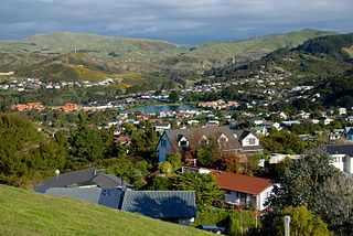
Onepoto is a locality of Porirua City in New Zealand. It is bounded to the north by Whitireia Park, a large park which is slowly being returned to native bush, and to the east by the Porirua Harbour.

Contents

Onepoto covers a land area of 2.24 km², [2] including an area of coast. [3]

The New Zealand Ministry for Culture and Heritage translates Onepoto as "short beach". [4]

Demography

Onepoto statistical area covers 2.24 km2 (0.86 sq mi). [5] It had an estimated population of 2,010 as of June 2022, with a population density of 897.32 people per km2.

Historical population
YearPop.±% p.a.
20061,845    
20131,800−0.35%
20181,917+1.27%
Source: [6]

Onepoto had a population of 1,917 at the 2018 New Zealand census, an increase of 117 people (6.5%) since the 2013 census, and an increase of 72 people (3.9%) since the 2006 census. There were 624 households, comprising 936 males and 978 females, giving a sex ratio of 0.96 males per female. The median age was 35.3 years (compared with 37.4 years nationally), with 468 people (24.4%) aged under 15 years, 345 (18.0%) aged 15 to 29, 882 (46.0%) aged 30 to 64, and 222 (11.6%) aged 65 or older.

Ethnicities were 70.1% European/Pākehā, 32.2% Māori, 18.0% Pasifika, 4.5% Asian, and 3.0% other ethnicities. People may identify with more than one ethnicity.

The percentage of people born overseas was 17.2, compared with 27.1% nationally.

Although some people chose not to answer the census's question about religious affiliation, 52.7% had no religion, 35.1% were Christian, 1.7% had Māori religious beliefs, 0.2% were Hindu, 0.6% were Muslim, 0.8% were Buddhist and 1.4% had other religions.

Of those at least 15 years old, 333 (23.0%) people had a bachelor's or higher degree, and 249 (17.2%) people had no formal qualifications. The median income was $36,800, compared with $31,800 nationally. 270 people (18.6%) earned over $70,000 compared to 17.2% nationally. The employment status of those at least 15 was that 840 (58.0%) people were employed full-time, 171 (11.8%) were part-time, and 63 (4.3%) were unemployed. [6]

Economy

In 2018, 11.9% of the workforce worked in healthcare, 11.3% worked in construction, 10.7% worked in education, 4.5% worked in manufacturing, 4.5% worked in transport and 3.9% worked in hospitality. [6]

Transportation

As of 2018, among those who commute to work, 70.9% drove a car, 4.7% rode in a car, 0.9% used a bike, and 0.9% walked or ran. No one used public transport. [6]

Related Research Articles

<span class="mw-page-title-main">Whitby, New Zealand</span> Suburb of Porirua

Whitby, a large suburb of Porirua City, New Zealand, located along much of the southern shore of the Pauatahanui Inlet of Porirua Harbour was comprehensively planned in the 1960s and it has been continuously developed since, with current landscaping and expansion in the hills behind the eastern part of Whitby to facilitate the future growth of the suburb.
<span class="mw-page-title-main">Tokomaru Bay</span> Town in the North Island of New Zealand

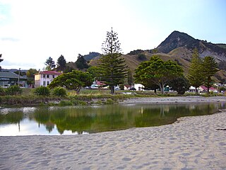
Tokomaru Bay is a small beachside community located on the isolated East Coast of New Zealand's North Island. It is 91 km north of Gisborne, on State Highway 35, and close to Mount Hikurangi. The district was originally known as Toka-a-Namu, which refers to the abundance of sandflies. Over the years the name was altered to Tokomaru Bay.

<span class="mw-page-title-main">Paremata</span> Suburb of Porirua

Paremata is a suburb of Porirua, on the Tasman Sea coast to the north of Wellington, New Zealand.

<span class="mw-page-title-main">Camborne, New Zealand</span> Suburb of Porirua

Camborne, New Zealand is a hilltop and seaside suburb of Porirua.
<span class="mw-page-title-main">Tītahi Bay</span> Suburb of Porirua

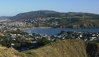
Tītahi Bay, a suburb of Porirua in the North Island of New Zealand, lies at the foot of a short peninsula on the west coast of the Porirua Harbour, to the north of Porirua city centre.

<span class="mw-page-title-main">Wairakei</span> Settlement in Waikato, New Zealand

Wairakei is a small settlement, and geothermal area a few kilometres north of Taupō, in the centre of the North Island of New Zealand, on the Waikato River. It is part of the Taupō Volcanic Zone and features several natural geysers, hot pools. boiling mud pools, and the Wairakei Power Station, a major geothermal electric power generating station.
<span class="mw-page-title-main">Northcote Central</span> Suburb in Auckland, New Zealand

Northcote Central is a suburb of Auckland's North Shore, in northern New Zealand. It is located on the northern shore of the Waitematā Harbour.
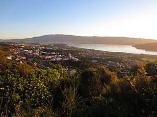
<span class="mw-page-title-main">Papakōwhai</span> Suburb of Porirua

Papakōwhai is a suburb of Porirua City. It lies approximately 22 kilometres (14 mi) north of Wellington in New Zealand.
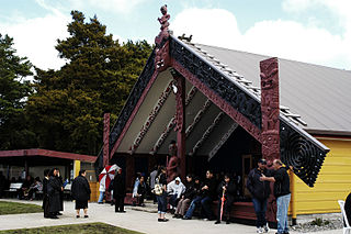
<span class="mw-page-title-main">Pukawa</span> Settlement in Waikato, New Zealand

Pukawa or Pukawa Bay is a bay and a small township on the southern shores of Lake Taupo on New Zealand's North Island. It is off State Highway 41 between Turangi and Taumarunui, in the Taupo District and Waikato region.

Ascot Park is a suburb of Porirua City approximately 22 kilometres (14 mi) north of Wellington in New Zealand.

Waitangirua is a suburb of Porirua City approximately 22km north of Wellington in New Zealand.
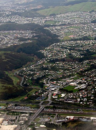
<span class="mw-page-title-main">Cannons Creek, New Zealand</span> Suburb of Porirua City near Wellington, New Zealand

Cannons Creek is a suburb of Porirua City approximately 22km north of Wellington in New Zealand.

<span class="mw-page-title-main">Ruawai</span> Place in Northland Region, New Zealand

Ruawai is a small town located 30 km south of Dargaville in Northland, New Zealand.

Fernridge is a small rural settlement located 4 km northwest of Masterton, New Zealand. The area has a mixture of farms, horticultural smallholdings and lifestyle blocks.

<span class="mw-page-title-main">Aotea, New Zealand</span> Suburb of Porirua

Aotea is a suburb of Porirua.

<span class="mw-page-title-main">Linden, New Zealand</span> Suburb of Wellington City, New Zealand

Linden is a part of Tawa, the northernmost suburb of Wellington, New Zealand. Linden lies at the northern end of Tawa, just south of the city of Porirua.
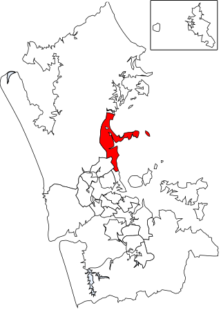
<span class="mw-page-title-main">Hibiscus and Bays Local Board</span> Local board of Auckland Council in New Zealand

The Hibiscus and Bays Local Board is one of the 21 local boards of the Auckland Council. It is one of two boards overseen by the council's Albany Ward councillors. The board consists of eight members elected at large.
<span class="mw-page-title-main">Porirua Central</span> Central business district of Porirua

Porirua Central is the central business district and central suburb of Porirua, in the Wellington region of New Zealand's North Island.

<span class="mw-page-title-main">Elsdon, New Zealand</span> Suburb of Porirua

Elsdon is a suburb of the New Zealand city of Porirua located immediately to the west to of the city's CBD. The area was named after Elsdon Best, a historian who studied archaeological sites in the area. Its industrial area, the largest in the city, is known for housing the factory used by New Zealand chocolate company Whittaker's; constructed in 1969, it remains the company's sole production site to this day.

<span class="mw-page-title-main">Rānui, Porirua</span> Suburb of Porirua

Rānui is a suburb of Porirua City approximately 21 kilometres (13 mi) north of Wellington in New Zealand. Rānui means midday in the Māori language.

References

  1. "Population estimate tables - NZ.Stat". Statistics New Zealand . Retrieved 25 October 2022.
  2. "Statistical Area 2 2018 (generalised) GIS" (Data table). stats.govt.nz. Statistics New Zealand.
  3. "Porirua City - Drivers of population change". idnz.co.nz. ID Community.
  4. "1000 Māori place names". New Zealand Ministry for Culture and Heritage. 6 August 2019.
  5. "ArcGIS Web Application". statsnz.maps.arcgis.com. Retrieved 29 May 2021.
  6. 1 2 3 4 "Statistical area 1 dataset for 2018 Census". Statistics New Zealand. March 2020. Onepoto (239500). 2018 Census place summary: Onepoto

41°06′50″S174°50′53″E / 41.1139°S 174.8481°E / -41.1139; 174.8481