The South Wairarapa District is a district at the south-east tip of the North Island of New Zealand, governed by the South Wairarapa District Council. The district comprises the southernmost part of the Wairarapa, and is part of the Wellington Region.

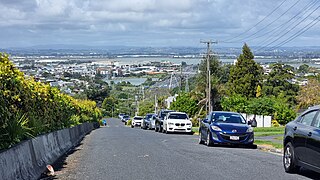
Mount Wellington is a suburb in East Auckland, New Zealand, located 10 km (6.2 mi) southeast of the city centre. It is surrounded by the suburbs of Stonefields, Tamaki, Panmure, Penrose, and Ellerslie, and by the Tāmaki River. The suburb is named after the volcanic peak of Maungarei / Mount Wellington. Sylvia Park is a large business park and shopping centre located in the suburb.

Horowhenua District is a territorial authority district on the west coast of the North Island of New Zealand, administered by Horowhenua District Council. Located north of Wellington and Kāpiti, it stretches from slightly north of the town of Ōtaki in the south to just south of Himatangi in the north, and from the coast to the top of the Tararua Range. It is in the Manawatū-Whanganui local government region. The name Horowhenua is Māori for landslide.

The Thames-Coromandel District is a territorial authority district in the North Island of New Zealand, covering all the Coromandel Peninsula and extending south to Hikutaia.

Hauraki District is a territorial authority governed by the Hauraki District Council within the Waikato region of New Zealand. The seat of the council is at Paeroa.

Central Otago District is local government district in New Zealand. It is administered by the Central Otago District Council, and it is in the Otago region, the top tier of local government in New Zealand. The major towns in the district are Alexandra, Cromwell, Roxburgh, Clyde and Ranfurly. The district covers 9,968 km2 (3,849 sq mi), making it the fourth-largest district in New Zealand by area, and is home to 26,500 people as of June 2024.

Westland District is a territorial authority district on the West Coast of New Zealand's South Island. It is administered by the Westland District Council. The district's population is 9,430.

Buller District is one of 53 districts of New Zealand, and is within the West Coast Region. It covers Westport, Karamea, Reefton and Inangahua Junction.
Grey District is a district in the West Coast Region of New Zealand that covers Greymouth, Runanga, Blackball, Cobden, and settlements along the Grey River. It has a land area of 3,474.31 square kilometres (1,341.44 sq mi). The seat of the Grey District Council, the local government authority that administers the district, is at Greymouth, where 58.4% of the district's population live.

Clutha District is a local government district of southern New Zealand, with its headquarters in the Otago town of Balclutha. Clutha District has a land area of 6,334.47 km2 (2,445.75 sq mi) and an estimated population of 19,300 as of June 2024. Clutha District occupies the majority of the geographical area known as South Otago.
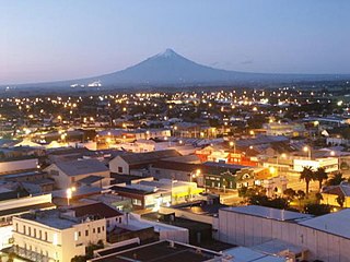
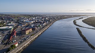
South Taranaki is a territorial authority on the west coast of New Zealand's North Island that contains the towns of Hāwera, Manaia, Ōpunake, Patea, Eltham, and Waverley. The District has a land area of 3,575.46 km2 and a population of 30,400. It is part of the greater Taranaki Region.
Royal Oak is a small suburb in New Zealand's largest city of Auckland. It is situated between the suburbs of Epsom (north) and Onehunga (south).
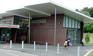
Hillsborough is a suburb of Auckland, New Zealand. It is under the local governance of the Auckland Council. Hillsborough is a leafy suburb of 20th-century houses. The area is serviced by two shopping areas; Onehunga and Three Kings. The area is served by secondary schools Mount Roskill Grammar School and Marcellin College.
West Harbour is a suburb of Auckland, located to the west of the Auckland isthmus and CBD. It is named for its location on the western side of the Waitematā Harbour. West Harbour is under the governance of Auckland Council after the amalgamation of district councils in 2010.

Lincoln is a suburb in West Auckland, New Zealand. It is also the filming location of Shortland Street. The suburb is sometimes called Lincoln North or treated as part of Henderson North to avoid confusion with Lincoln in Canterbury.

Whangarei District is a territorial authority district in the Northland Region of New Zealand that is governed by the Whangarei District Council. The district is made up in area largely by rural land, and includes a fifth of the Northland Region. It extends southwards to the southern end of Bream Bay, northwards to Whangaruru and almost to the Bay of Islands, and westwards up the Mangakahia River valley past Pakotai and almost to Waipoua Forest. It includes the Hen and Chicken Islands and the Poor Knights Islands.

Ashburton District is a territorial authority district in the Canterbury Region of the South Island of New Zealand. It encompasses the town of Ashburton, a number of small towns and settlements and the surrounding rural area, roughly coterminous with Mid Canterbury. The district had a population of 38,400 as of June 2024.

Waimate District is a territorial authority district located in the Canterbury Region of the South Island of New Zealand. The main town is Waimate, while there are many smaller rural communities dispersed throughout the area. Its boundary to the south is the Waitaki River, to the west Lake Benmore and to the north-east the Pareora River.
One Tree Hill is a suburb of Auckland, New Zealand. The residential part of the suburb is located to the east and south-east of Maungakiekie / One Tree Hill, from which it takes its name, with the volcanic peak located within the suburb's boundaries.
Rānui is a suburb of West Auckland, New Zealand, which is under the local governance of Auckland Council. The area is densely populated but close to the western fringe of the Auckland urban area.