These are lists of long-distance trails in the Republic of Ireland, and include recognised and maintained walking trails, pilgrim trails, cycling greenways, boardwalk-mountain trails, and interconnected national and international trail systems.
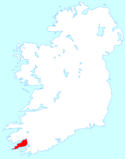
Beara or the Beara Peninsula is a peninsula on the south-west coast of Ireland, bounded between the Kenmare "river" to the north side and Bantry Bay to the south. It contains two mountain ranges running down its centre: the Caha Mountains and the Slieve Miskish Mountains. The northern part of the peninsula from Kenmare to near Ardgroom is in County Kerry, while the rest forms the barony of Bear in County Cork.

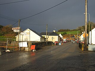
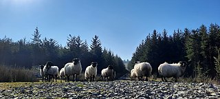
Eyeries is a village and its hinterland, on the Beara Peninsula in County Cork, Ireland, near the border with County Kerry. It lies at the foot of a hilly area, with a beach nearby, and is home to several retail and tourist businesses.

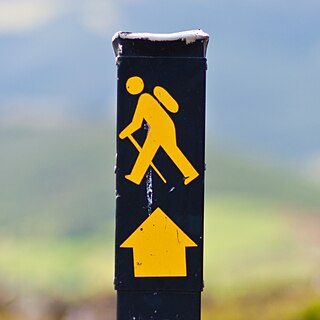
The Beara Way is a long-distance trail in the southwest of Ireland. It is a 206-kilometre (128-mile) long circular trail around the Beara Peninsula that begins and ends in Glengarriff, County Cork, also passing through parts of County Kerry. It is typically completed in nine days. It is designated as a National Waymarked Trail by the National Trails Office of the Irish Sports Council and is managed by the Beara Tourism and Development Association.
Hollyford is a small village in County Tipperary, Ireland. It is in the Roman Catholic parish of Kilcommon and Hollyford and Rearcross, in the Archdiocese of Cashel and Emly, and is in the barony of Kilnamanagh Lower.
Meelick, also Milic, is a townland on the River Shannon in Ireland. It lies approximately 4 km southeast of Eyrecourt in County Galway.It is best known for its walkway that connects to Lusmagh (Offaly). It also holds the oldest church still in use in Ireland at 608 years old given papal permission and built in 1414 AD it is also within the Parish of Clonfert which is home to the madonna statue Our Lady of Clonfert. Clonfert is the head of its diocese with its headquarters home to Most Rev. Bishop Michael Duignan, St. Brendans Presbytery Loughrea. It is home to the oldest hurling club in Ireland which was founded in 1884. It has a little pub 10 yards from The Church known locally as “George’s/The Shop” It holds a kayaking festival each year after the boating season halts to its winter end with a great quay half way between Portumna and Banagher home to SilverLine Cruisers, CarrickCraft and Emerald Star-line. It holds a car rally in association with Galway Rally ever few years. Its current Parish Priest (2021) is REV.Fr.Declan McInerney PP.

Toomevara, officially Toomyvara, is a village in County Tipperary, Ireland. The village is at the junction on the R445 where it meets the R499 regional road. The village was bypassed in December 2010 by the M7 Dublin - Limerick motorway. It is also a parish in the Roman Catholic Diocese of Killaloe, and is in the historical barony of Ormond Upper.
Lorrha is a small village at the northern tip of County Tipperary, Ireland. It is located on a minor road between the R489 Birr to Portumna road and the N65 Nenagh to Portumna road about five kilometres east of the point where the River Shannon enters Lough Derg.

Ballingarry is a civil parish and a townland in the barony of Ormond Lower, County Tipperary in Ireland. It is located on the N52 between Borrisokane and Birr. Ballingarry townland has an area of 5.3 square kilometres (2 sq mi), and had a population of 170 people as of the 2011 census.
The Ballyhoura Way is a long-distance trail in Ireland. It is 89 kilometres long and begins at St John’s Bridge, near Kanturk, County Cork and ends at Limerick Junction, County Tipperary. It is typically completed in four days. It is designated as a National Waymarked Trail by the National Trails Office of the Irish Sports Council and is managed by Ballyhoura Fáilte. The trail was opened in April 1994 by President Mary Robinson.
The Cavan Way is a long-distance trail in County Cavan, Ireland. It is 22 kilometres long and begins in Blacklion and ends in Dowra. It is typically completed in one day. It is designated as a National Waymarked Trail by the National Trails Office of the Irish Sports Council and is managed by Cavan County Council. The trail was devised by a local man, Harold Johnston, and set up by the Blacklion Community Council and the Cavan County Development Team between 1984 and 1985.
The Hymany Way is a long-distance trail in County Galway, Ireland. It is 50 kilometres long and begins in Portumna and ends in Aughrim. It is typically completed in two days. It is designated as a National Waymarked Trail by the National Trails Office of the Irish Sports Council and is managed by the Aughrim Development Company Limited. The trail was developed with funding assistance from the NTR Foundation, a philanthropic organisation of NTR plc. It was officially opened on 24 September 2010 by Councillor Jimmy McClearn, Mayor of County Galway. It is planned to extend the trail from Aughrim to Ballygar where it will join with the Suck Valley Way.

The Miners' Way and Historical Trail is a long-distance trail in Ireland. It is a 118-kilometre (73-mile) long circular route that begins and ends in Arigna, County Roscommon. It is typically completed in five days. It is designated as a National Waymarked Trail by the National Trails Office of the Irish Sports Council and is managed by Roscommon Integrated Development Company, Roscommon County Council, Leitrim County Council and Sligo County Council. The trail was developed to encourage tourism in the area in the wake of the closure of the Arigna mines in 1990. The route was originally conceived by a local priest, Father Sean Tynan, and built with funding from the European Regional Development Fund. The trail was opened by broadcaster Donncha Ó Dúlaing in July 2000.
The Multeen Way is a long-distance trail in County Tipperary, Ireland. It is 23 kilometres long and begins in Tipperary Town and ends in Upperchurch. It is typically completed in one day. It is designated as a National Waymarked Trail by the National Trails Office of the Irish Sports Council.

The Suck Valley Way is a long-distance trail in Ireland. It is a 105-kilometre (65-mile) long circular route that begins and ends in Castlerea, County Roscommon. It is typically completed in five days. It is designated as a National Waymarked Trail by the National Trails Office of the Irish Sports Council and is managed by Roscommon County Council, Roscommon Integrated Development Company and the Suck Valley Committee.
The Wild Atlantic Way is a tourism trail on the west coast, and on parts of the north and south coasts, of Ireland. The 2,500 km driving route passes through nine counties and three provinces, stretching from County Donegal's Inishowen Peninsula in Ulster to Kinsale, County Cork, in Munster, on the Celtic Sea coast.
The Beara-Breifne Way is a long-distance walking and cycling trail being developed from the Beara Peninsula in County Cork, Ireland, to Blacklion in the area of Breifne in County Cavan. The trail follows closely the line of the historical march of O’Sullivan Beare.
The Leitrim Way is a 56km long-distance trail between Leitrim village, and Manorhamilton County Leitrim, Ireland. This route is generally completed over 2–3 days, and brings walkers through a variety of landscape forms common to this beautiful part of the northwest of Ireland. The Leitrim Way forms part of Ireland's National Waymarked Ways.

The R575 road is a regional road in Ireland. It is a road on the Beara Peninsula in County Cork. The road forms part of the Wild Atlantic Way. Parts of the road form part of the Beara Way walking trail.
The Ireland Way is Ireland's longest coast-to-coast walking and cycling trail that joins the newly developed Beara-Breifne Way to the Ulster Way on the island of Ireland. The trail goes from the Beara Peninsula in County Cork, Republic of Ireland to Ballycastle, County Antrim in Northern Ireland. The Beara-Breifne Way trail follows closely the line of the historical march of O’Sullivan Beare. One of the first people to walk the Ireland Way in one go was a Canadian woman named Maysen Forbes in 2017.