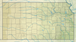
The Santa Fe Dam Recreation Area is a county park located in Irwindale, California, US, in the San Gabriel Valley, inside the Santa Fe Dam. The park and dam are nestled among gravel quarries in the area, many of which are currently inactive. The dam is a flood-control dam on the San Gabriel River. The dam functions as a dry dam most of the time. The San Gabriels produce more gravel than most other mountains. The park is maintained and operated by the Los Angeles County Department of Parks and Recreation. The park, located off the San Gabriel River Freeway, contains a 70-acre lake for year-round fishing and non motorized watercraft.

Cimarron National Grassland is a National Grassland located in Morton County, Kansas, United States, with a very small part extending eastward into Stevens County. Cimarron National Grassland is located near Comanche National Grassland which is across the border in Colorado. The grassland is administered by the Forest Service together with the Pike and San Isabel National Forests and the Comanche National Grassland, from common headquarters located in Pueblo, Colorado. There are local ranger district offices in Elkhart, Kansas. The grassland is the largest area of public land in the state of Kansas.
Cheney State Park is a state park of Kansas in the United States. Completed in 1964, the park is located in Kingman and Reno counties in Kansas, 5 miles north of Cheney and 20 miles west of Wichita.
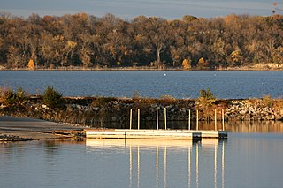
Clinton State Park is a public recreation area located on the north shore of Clinton Lake at the western edge of Lawrence, Kansas, United States.
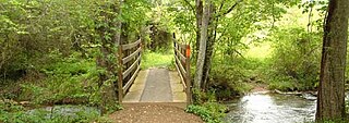
Elk City State Park is a state park in Montgomery County, Kansas, United States, located west of Independence.
Millwood State Park is a public recreation area known for its fishing and wildlife habitats located along the southern side of 29,500-acre (11,900 ha) Millwood Lake, nine miles (14 km) east of Ashdown in Little River County, Arkansas.

Wilson Lake is a reservoir in the U.S. state of Kansas, on the border of Russell County and Lincoln County. Built and managed by the U.S. Army Corps of Engineers for flood control, it is also used for wildlife management and recreation. Several parks are located along its shoreline, including Wilson State Park.
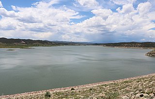
Trinidad Lake State Park is a state park 4 miles (6.4 km) west of Trinidad, Colorado, United States. The park protects Trinidad Lake, a dammed reservoir. There are hiking trails, and camping and boating opportunities. The park features historical attractions such as the coal mining ruins at Cokedale. An exposure of the Cretaceous–Paleogene boundary is visible in the southern part of the park.
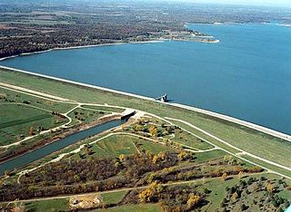
Perry Lake is a US Army Corps of Engineers operated reservoir in northeast Kansas. Its primary purposes are flood control, water reserve for nearby areas and regional recreation. The lake is approximately 11,150 acres (45 km²) in size, with over 160 miles (260 km) of shoreline. Perry Lake's full multi-purpose pool elevation is 891.5 feet (271.7 m) above sea level. Perry Lake is located about 40 miles (64 km) west of Kansas City, just northwest of Lawrence, Kansas. Its close proximity to Kansas City, Lawrence, and the state capitol, Topeka, make it a very popular destination, with the nickname "Paradise on the Plains".

Big Hill Lake is a body of water in Labette County, Kansas, United States. It is located 3.5 miles (5.6 km) east of Cherryvale and 9.5 miles (15.3 km) southwest of Parsons. The reservoir holds 1,240 acres (5.0 km2) of water, with 367 acres (1.49 km2) available for public use. Fishing, picnicking, boating, and a sandy beach swimming area are popular activities. The lake is operated by the U.S. Army Corps of Engineers.

Wilson State Park is a public recreation area found on the south shore of 9,000-acre (3,600 ha) Wilson Lake reservoir approximately 10 miles (16 km) north of the city of Wilson in Russell County, Kansas, United States. Located at the reservoir's eastern end, the state park covers 945 acres (382 ha) divided into two areas by the reservoir's southeastern arm: the Hell Creek area on the west side and the Otoe area on the east side. The Hell Creek area hosts a marina. Both areas include hiking trails, swimming beaches, boat ramps, and camping facilities.

Yellowstone Lake State Park is a state park of Wisconsin, United States, featuring a 455-acre (184 ha) reservoir on a tributary of the Pecatonica River. The state park is included in the 4,047-acre (1,638 ha) Yellowstone Lake State Wildlife Area. The park has 128 campsites and 5 group sites. There is a swimming area with sand beach, picnic areas, and playgrounds. Boat launch, boat rentals, fishing for bluegill, largemouth bass, walleye and channel catfish, with some northern pike and muskellunge. Hiking trails, and groomed cross country ski trails. The adjacent 4,000 acre wildlife area offers extensive horse trails and a shooting range.

El Dorado Lake is a reservoir on the Walnut River 0.5 miles (0.80 km) northeast of El Dorado in the Flint Hills region of Kansas. Built and managed by the U.S. Army Corps of Engineers, it is used for flood control, recreation, and water supply. El Dorado State Park is located on its shore.

John Redmond Reservoir is a reservoir on the Neosho River in eastern Kansas. Built and managed by the U.S. Army Corps of Engineers, it is used for flood control, recreation, water supply, and wildlife management. It borders the Flint Hills National Wildlife Refuge to the northwest.

Lake Scott State Park is a 1,280-acre (520 ha) Kansas state park in Scott County, Kansas in the United States. The park was established in 1928 following a donation of the land by the Herbert Steele family. The park, also known as Scott State Park, surrounds Lake Scott, a spring-fed freshwater lake. Lake Scott State Park is between Oakley and Scott City, about one mile west of U.S. Route 83 on Route K-95. The park is open for year-round recreation including camping, hunting, fishing, hiking, boating and picnicking. Lake Scott State Park is home to the only known Indian pueblo in Kansas, El Cuartelejo.
Shawnee State Fishing Lake is approximately 8 miles (13 km) northwest of Topeka, Kansas, and is in northern Shawnee County, Kansas. This lake is sometimes confused with Lake Shawnee, on the east side of Topeka. It is a 135-acre (550,000 m2) surface area lake with a maximum depth of 25 feet (7.6 m). This is a manmade freshwater lake, which was constructed in the late 1960s. The lake is widest at the dam, which is at the south end of the lake. It can be reached by a number of roads. The only asphalted road reaching it is on the southeast corner. To the north is 94th Street and on the west side is Humphrey Road.

Kanopolis Lake is a reservoir in Ellsworth County in the Smoky Hills of central Kansas, about 31 miles southwest of Salina and a few miles southeast of the town of Kanopolis. The lake is formed by Kanopolis Dam. Completed in 1948 as a flood control and water conservation project of the United States Army Corps of Engineers, the dam impounds the Smoky Hill River.

Council Grove Lake is a reservoir on the Neosho River in east-central Kansas. Built and managed by the U.S. Army Corps of Engineers, it is used for flood control, recreation, and water supply.
Meade State Park is a state park southwest of the city of Meade in Meade County, Kansas, United States. The park features an 80-acre (32 ha) lake that contains Bluegill, Channel Cat & Flathead Catfish, Trout, Saugeye, Crappie, and Largemouth Bass. Fishing is allowed in the lake year-round with motorized boating restricted to fishing only and no wake speed. In addition the park encompasses a 440-acre (180 ha) campsite and wildlife area. This can be enjoyed via hiking trails located within the park.
