
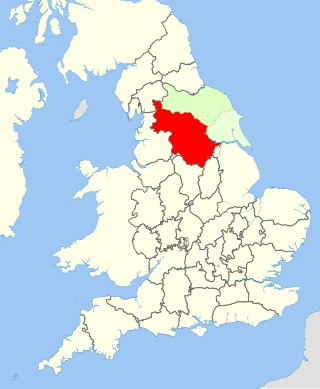
Castleford is a town within the City of Wakefield district, West Yorkshire, England. It had a population of 45,106 at a 2021 population estimate. Historically in the West Riding of Yorkshire, to the north of the town centre the River Calder joins the River Aire and the Aire and Calder Navigation. It is located north east of Wakefield, north of Pontefract and south east of Leeds. Castleford is the largest town in the Wakefield district after Wakefield itself.
The West Riding of Yorkshire was one of three historic subdivisions of Yorkshire, England. From 1889 to 1974 the riding was an administrative county named County of York, West Riding. The lieutenancy at that time included the city of York and as such was named "West Riding of the County of York and the County of the City of York". The riding ceased to be used for administrative purposes in 1974, when England's local government was reformed.

Selby District was a local government district of North Yorkshire, England, from 1974 to 2023. Its council was based in the town of Selby. The district had a population of 83,449 at the 2011 Census. The southernmost district of North Yorkshire, it bordered the City of York unitary authority, the Borough of Harrogate in North Yorkshire, the City of Leeds and City of Wakefield districts in West Yorkshire, the City of Doncaster in South Yorkshire, and the ceremonial county of the East Riding of Yorkshire.
Darton is a large village in the Metropolitan Borough of Barnsley, on the border with West Yorkshire, England. At the time of the 2001 UK census, it had a population of 14,927, increasing to 21,345 for both Darton Wards at the 2011 Census.

Wakefield, commonly known as the City of Wakefield, is a local government district with the status of a city and metropolitan borough in West Yorkshire, England. Wakefield, the largest settlement, is the administrative centre of the district. The population of the City of Wakefield at the 2011 Census was 325,837.
Osgoldcross Rural District was a rural district in the West Riding of Yorkshire, England. It was created in 1938, from 19 remaining parishes of the disbanded Pontefract Rural District after three-quarters of its population had been transferred to surrounding authorities - specifically to Castleford, Knottingley, and Pontefract.

Pontefract and Castleford was a constituency represented in the House of Commons of the Parliament of the United Kingdom until the 2010 general election. It elected one Member of Parliament (MP) by the first past the post system of election.
The Ainsty or the Ainsty of York was a historic district of Yorkshire, England, west of the city of York. Originally a wapentake or subdivision of the West Riding of Yorkshire it later had a unique status as a rural area controlled by the corporation of the city.
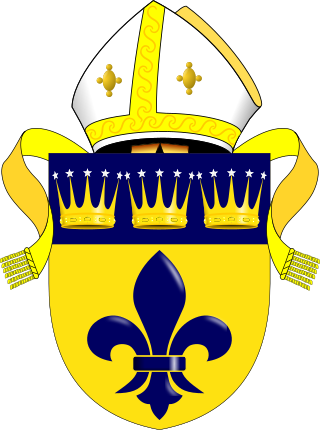
The Diocese of Wakefield is a former Church of England diocese based in Wakefield in West Yorkshire, covering Wakefield, Barnsley, Kirklees and Calderdale. The cathedral was Wakefield Cathedral and the bishop was the diocesan Bishop of Wakefield.
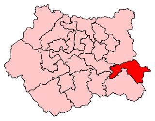
Normanton, Pontefract and Castleford is a constituency in West Yorkshire represented in the House of Commons of the UK Parliament by Yvette Cooper of the Labour Party since its 2010 creation. Cooper has served under the governments of Tony Blair and Gordon Brown alongside her husband Ed Balls, and served as Shadow Home Secretary under the leadership of Ed Miliband. Having served as chair of the Home Affairs Select Committee, she is once again the Shadow Home Secretary.

Staincross was a Wapentake (Hundred), which is an administrative division, in the historic county of the West Riding of Yorkshire. It consisted of seven parishes, and included the towns of Barnsley and Penistone
Agbrigg and Morley was a wapentake of the West Riding of Yorkshire, England. The main purpose of the wapentake was the administration of justice by a local court. At the time of the Domesday survey in 1086, Agbrigg and Morley were separate wapentakes. For example, Methley was in Agbrigg while Rothwell was in Morley. The wapentakes were probably combined by the 13th century when similar administrative reforms occurred elsewhere in England. It was kept in two divisions, which in the mid-nineteenth century again became wapentakes in their own right.
Barkston Ash was a wapentake of the West Riding of Yorkshire, named after the meeting-place at the village of Barkston. It included the parishes of Birkin, Bramham cum Oglethorpe, Brayton, Drax, Kirk Fenton, Ledsham, Monk Fryston, Saxton with Scarthingwell and Sherburn-in-Elmet and parts of Brotherton, Kirkby Wharfe, Ryther, Snaith and Tadcaster.
Staincliffe, also known as Staincliff, was a wapentake of the West Riding of Yorkshire, England.

Ferry Fryston is a suburb of the town of Castleford in West Yorkshire, England. It is situated in the metropolitan borough of the City of Wakefield. The appropriate ward is called Airedale and Ferry Fryston.

Airedale is a suburb in the town of Castleford, West Yorkshire, England. It consists mainly of Local Authority Housing. It borders with Ferry Fryston. The ward of the City of Wakefield called Airedale and Ferry Fryston had a population of 14,811 at the 2011 Census. The River Aire runs in close proximity to Airedale and is thought to get its name from there.
East Hardwick is a village and civil parish in the City of Wakefield in West Yorkshire, England. It has a population of 191, reducing to 173 at the 2011 Census. Until 1974 it was part of Osgoldcross Rural District.

The Municipal Borough of Castleford was a local government district in the West Riding of Yorkshire from 1955 to 1974 around the town of Castleford, covering Airedale, New Fryston, Whitwood, Cutsyke, Glasshoughton and Whitwood. The Castleford Urban District administered the town from 1894 to 1955.

Sitlington, historically Shitlington, was a township in the ancient ecclesiastical parish of Thornhill in the wapentake of Agbrigg and Morley in the West Riding of Yorkshire comprising the villages and hamlets of Middlestown, Netherton, Overton and Midgley. The h was dropped from Shitlington and Sitlington was adopted in 1929 with the approval of the county council. The population of the civil parish at the 2011 census was 5,963.

Fryston Hall was a country house at Water Fryston, West Yorkshire which stood in an estate between the town of Castleford and the River Aire near where the river is crossed by the A1(M). The main building was demolished in 1934 and only some outbuildings survive as farm buildings.
