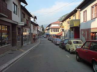
Zmajevo is a village in Serbia. It is situated in the Vrbas municipality, in the South Bačka District, Vojvodina province. The village has a Serb ethnic majority and its population numbering 4,361 people. It has lakes that are full of carp, a very big hunting ground with a lot of wild animals. Anglers from all over Serbia come to Zmajevo to fish the carp in Vojvodina.

Bingula is a village in Serbia. It is situated in the Šid municipality, in the Srem District, Vojvodina province. The village has a Serb ethnic majority and its population numbering 906 people.

Bistreț is a commune in Dolj County, Romania with a population of 4,616 people in 2002. It is composed of four villages: Bistreț, Bistrețu Nou, Brândușa and Plosca.

Wygoda Smoszewska is a village in the administrative district of Gmina Zakroczym, within Nowy Dwór Mazowiecki County, Masovian Voivodeship, in east-central Poland. It lies approximately 9 kilometres (6 mi) west of Zakroczym, 13 km (8 mi) west of Nowy Dwór Mazowiecki, and 43 km (27 mi) north-west of Warsaw.

Dudy Puszczańskie is a village in the administrative district of Gmina Łyse, within Ostrołęka County, Masovian Voivodeship, in east-central Poland. It lies approximately 43 kilometres (27 mi) north of Ostrołęka and 141 km (88 mi) north of Warsaw.
Nyíri is a village in Borsod-Abaúj-Zemplén County in northeastern Hungary.
Márokföld is a village in Zala County, Hungary.

Donji Drenovac is a village in the municipality of Žitorađa, Serbia. According to the 2002 census, the village has a population of 450 people.

Božetići is a village in the municipality of Nova Varoš, western Serbia. According to the 2002 census, the village has a population of 392 people.

Debelja is a village in the municipality of Nova Varoš, western Serbia. According to the 2002 census, the village has a population of 148 people.

Vilovi is a village in the municipality of Nova Varoš, western Serbia. According to the 2002 census, the village has a population of 396 people.

Boroviće is a village in the municipality of Raška, Serbia. According to the 2002 census, the village has a population of 177 people.
Vrh is a village situated in Kraljevo municipality in Serbia.

Bučje is a village in the municipality of Priboj, Serbia. According to the 2002 census, the village has a population of 186 people.
Kasidoli, Priboj is a village in the municipality of Priboj, Serbia. According to the 2002 census, the village has a population of 455 people.

Ritošići is a village in the municipality of Priboj, Serbia. According to the 2002 census, the village has a population of 228 people.

Brodarevo is a village in the municipality of Prijepolje, Serbia. According to the 2002 census, the village has a population of 6,500.

Crkveni Toci is a village in the municipality of Prijepolje, Serbia. According to the 2002 census, the village has a population of 78 people.

Džurovo is a village in the municipality of Prijepolje, Serbia. According to the 2002 census, the village has a population of 179 people.

Irvington Bus Terminal is a regional bus terminus in Irvington, New Jersey. It is owned and operated by New Jersey Transit (NJT) and is served by buses traveling to Newark and other points in Essex County, to Union and Passaic counties, and to the Port Authority Bus Terminal in Midtown Manhattan. The terminal was originally built in 1947 and underwent significant renovation and expansion in the early 2000s. It is one of the NJT's busiest facilities, daily serving over 12,500 passengers with more than 450 bus trips. and is origination/termination point for one of Greater Newark's bus rapid transit (BRT) lines. In July 2015, the central business district around the terminal was designated a transit village, qualifying it for incentives for revitalization.


