
Ortel Królewski Drugi is a village in the administrative district of Gmina Piszczac, within Biała Podlaska County, Lublin Voivodeship, in eastern Poland. It lies approximately 10 kilometres (6 mi) west of Piszczac, 13 km (8 mi) south-east of Biała Podlaska, and 91 km (57 mi) north-east of the regional capital Lublin.
Stary Cydzyn is a village in the administrative district of Gmina Piątnica, within Łomża County, Podlaskie Voivodeship, in north-eastern Poland. It lies approximately 6 kilometres (4 mi) north of Piątnica, 9 km (6 mi) north of Łomża, and 72 km (45 mi) west of the regional capital Białystok.
Zawady is a village in the administrative district of Gmina Rzeczyca, within Tomaszów Mazowiecki County, Łódź Voivodeship, in central Poland. It lies approximately 4 kilometres (2 mi) west of Rzeczyca, 19 km (12 mi) north-east of Tomaszów Mazowiecki, and 58 km (36 mi) east of the regional capital Łódź.
Małoszów is a village in the administrative district of Gmina Książ Wielki, within Miechów County, Lesser Poland Voivodeship, in southern Poland. It lies approximately 4 kilometres (2 mi) south of Książ Wielki, 11 km (7 mi) north-east of Miechów, and 42 km (26 mi) north of the regional capital Kraków.
Michałów is a village in the administrative district of Gmina Urszulin, within Włodawa County, Lublin Voivodeship, in eastern Poland.
Chocimów is a village in the administrative district of Gmina Kunów, within Ostrowiec County, Świętokrzyskie Voivodeship, in south-central Poland. It lies approximately 4 kilometres (2 mi) south-west of Kunów, 11 km (7 mi) west of Ostrowiec Świętokrzyski, and 45 km (28 mi) east of the regional capital Kielce.
Szymankowszczyzna is a village in the administrative district of Gmina Stanisławów, within Mińsk County, Masovian Voivodeship, in east-central Poland.
Doliwo is a village in the administrative district of Gmina Mordy, within Siedlce County, Masovian Voivodeship, in east-central Poland.
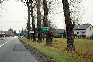
Brzozów is a village in the administrative district of Gmina Sokołów Podlaski, within Sokołów County, Masovian Voivodeship, in east-central Poland. It lies approximately 6 kilometres (4 mi) west of Sokołów Podlaski and 83 km (52 mi) east of Warsaw.

Chlewiska is a village in Szydłowiec County, Masovian Voivodeship, in east-central Poland. It is the seat of the gmina called Gmina Chlewiska. It lies approximately 7 kilometres (4 mi) west of Szydłowiec and 110 km (68 mi) south of Warsaw.

Stara Huta is a village in Stara Vyzhivka Raion, Volyn Oblast, Ukraine. The population of the village is 1024 people.
Bylew is a village in the administrative district of Gmina Ślesin, within Konin County, Greater Poland Voivodeship, in west-central Poland.
Łysek-Sosnówka is a village in the administrative district of Gmina Wierzbinek, within Konin County, Greater Poland Voivodeship, in west-central Poland.
Marcelino is a settlement in the administrative district of Gmina Środa Wielkopolska, within Środa Wielkopolska County, Greater Poland Voivodeship, in west-central Poland.
Beznazwa is a village in the administrative district of Gmina Władysławów, within Turek County, Greater Poland Voivodeship, in west-central Poland. It lies approximately 7 kilometres (4 mi) north-west of Władysławów, 17 km (11 mi) north of Turek, and 106 km (66 mi) east of the regional capital Poznań.
Lniska is a village in the administrative district of Gmina Żukowo, within Kartuzy County, Pomeranian Voivodeship, in northern Poland. It lies approximately 4 kilometres (2 mi) east of Żukowo, 14 km (9 mi) east of Kartuzy, and 15 km (9 mi) west of the regional capital Gdańsk.
Rodowo Małe is a village in the administrative district of Gmina Prabuty, within Kwidzyn County, Pomeranian Voivodeship, in northern Poland. It is approximately 8 kilometres (5 mi) northeast of Prabuty, 23 km (14 mi) northeast of Kwidzyn, and 73 km (45 mi) southeast of the regional capital Gdańsk.
Sopieszyno-Wybudowanie is a village in the administrative district of Gmina Wejherowo, within Wejherowo County, Pomeranian Voivodeship, in northern Poland. It lies approximately 7 kilometres (4 mi) south of Wejherowo and 33 km (21 mi) north-west of the regional capital Gdańsk.
Mintowo is a village in the administrative district of Gmina Srokowo, within Kętrzyn County, Warmian-Masurian Voivodeship, in northern Poland, close to the border with the Kaliningrad Oblast of Russia.
Wąwelnica is a village in the administrative district of Gmina Dobra, within Police County, West Pomeranian Voivodeship, in north-western Poland, close to the German border. It lies approximately 5 kilometres (3 mi) south-east of Dobra, 14 km (9 mi) south-west of Police, and 13 km (8 mi) west of the regional capital Szczecin.


