
Avra Valley is a census-designated place (CDP) in Pima County, Arizona, United States. The population was 5,038 at the 2000 census.

The City of Federal Heights is a Home Rule Municipality located in Adams County, Colorado, United States. As of the 2010 census, the city had a population of 11,467. The current Mayor is Daniel Dick, who was elected to a four-year term in 2015.

Symerton is a village in Will County, Illinois, United States. The population was 106 at the 2000 census. In 2003, the estimated population was 111. By population, it is the smallest village in Will County.
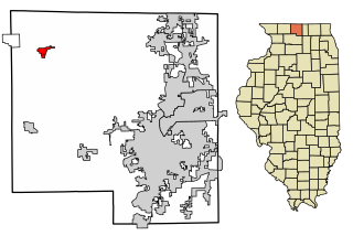
Durand is a village in Winnebago County, Illinois, United States. It is part of the Rockford, Illinois Metropolitan Statistical Area The population was 1,443 at the 2010 census, up from 1,081 in 2000.

Aurora is a town in Hancock County, Maine, United States. The town was named for the goddess of dawn. The population was 114 at the 2010 census.

North Seekonk is a census-designated place (CDP) in the town of Seekonk in Bristol County, Massachusetts, United States. The population was 2,643 at the 2010 census.

Bel-Ridge is a northern suburban city in St. Louis County, Missouri, United States. The population was 2,737 at the 2010 census. Bel-Ridge is part of the Normandy School System and borders the affluent villages of Bel-Nor and Bellerive. Bel-Ridge became a city in 2015 by a vote of the voters.

Newport is a village in Rock County, Nebraska, United States. The population was 97 at the 2010 census.

Fayette is a village in Fulton County, Ohio, United States. The population was 1,340 at the 2000 census, decreasing to 1,283 in 2010.
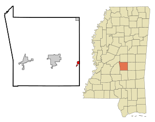
Lake is a town in Newton and Scott counties, Mississippi. The population was 408 at the 2000 census. Lake is the birthplace of country music singer Randy Houser.

Ramotswa is a village in South-East District of Botswana, southwest of the capital of Gaborone. The population was 27,760 in 2011 census. It is the tribal capital of the BaLete, an ethnic majority springing from the Nguni tribe.

Banjole is a village in the municipality of Medulin, in southern Istria in Croatia. In 2011 it had a population of 983.

Gleichen is a hamlet in southeast Alberta, Canada within Wheatland County. It is located adjacent to the Siksika Nation at the intersection of Highway 1 and Highway 547, approximately 40 kilometres (25 mi) southeast of Strathmore. It has an elevation of 903 m (2,963 ft).
Ikoga is a village in North-West District of Botswana. It is located close to Okavango Delta and has a primary school. The population was 699 in 2001 census.
Otse is a village in South-East District of Botswana. It is located 60 km south of Gaborone, along the Gaborone–Lobatse road and close to the border with South Africa. This village is home to the Balete people who are related to those in Ramotswa, Gabane and Mogobane. The population was 7,636 in 2011 census.
Mogobane is a village in South-East District of Botswana. It is located 55 km south of Gaborone and 40 km east of Kanye. The village is designed along Mogobane dam. Mogobane is home to the Balete people who are related to those in Ramotswa, Gabane and Otse and the population was 2,053 in 2001 census. Like any other village that has a bit of a traditional Setswana essence, there are many dikgotla in Mogobane, the main one being where the customary court offices are located. The village chief has some elders from almost all village dikgotla as his advisors. There are two primary schools and one junior secondary school. The majority of the residents of Mogobane are Christians and so there are many churches in the village. Some interesting natural features in the village, which can be attractive to tourists include the dam, the hills which make borders around the village, and the rock type found in most parts of the village.
Niwiska Gruszczyńskie is a village in the administrative district of Gmina Krasocin, within Włoszczowa County, Świętokrzyskie Voivodeship, in south-central Poland.

Rafuna is a village in the municipality of Lebane, Serbia. According to the 2002 census, the village has a population of 131 people.

Kruščica is a village in the municipality of Kalinovik, Republika Srpska, Bosnia and Herzegovina.
Loma Linda East is a census-designated place (CDP) in Starr County, Texas, United States. It is a new CDP formed from part of the former La Casita-Garciasville CDP prior to the 2010 census with a population of 44.


