Related Research Articles

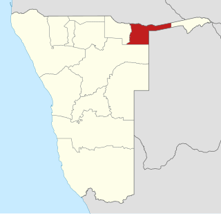
Kavango was one of the thirteen regions of Namibia until it was split into the Kavango East and Kavango West Regions in 2013. Its capital was Rundu.

Erongo is one of the 14 regions of Namibia. The capital is Swakopmund. It is named after Mount Erongo,a well-known landmark in Namibia and in this area. Erongo contains the municipalities of Walvis Bay,Swakopmund,Henties Bay and Omaruru,as well as the towns Arandis,Karibib and Usakos. All the main centres within this region are connected by paved roads.

Khomas is one of the fourteen regions of Namibia. Its name refers to the Khomas Highland,a high plateau landscape that dominates this administrative subdivision. Khomas is centered on the capital city Windhoek and provides for this reason superior transportation infrastructure. It is located in the central highlands of the country and is bordered by the Erongo region to the west and the northwest and by the Otjozondjupa region to the north. To the east is the Omaheke region,while in the south is the Hardap region. The region is characterized by its hilly countrysize and many valleys. It has well-developed economical,financial,and trade sectors. Khomas Region occupies 4.5% of the land area of Namibia but has the highest population of any of its regions (16.2%). Khomas is one of only three Namibian regions to have neither shoreline nor a foreign border.

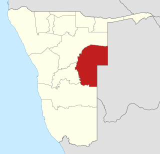
Otjozondjupa is one of the fourteen regions of Namibia. Its capital is Otjiwarongo. The region further contains the municipalities of Okahandja and Grootfontein and the towns Okakarara and Otavi. As of 2020,Otjozondjupa had 97,945 registered voters.

Oshikoto is one of the fourteen regions of Namibia,named after Lake Otjikoto. Its capital is Omuthiya. Further major settlements in the region are Tsumeb,Otjikoto's capital until 2008,and Oniipa. As of 2020,Oshikoto had 112,170 registered voters.

Oshana is one of the fourteen regions of Namibia,its capital is Oshakati. The towns of Oshakati,Ongwediva and Ondangwa,all situated with this region,form an urban cluster with the second largest population concentration in Namibia after the capital Windhoek. As of 2020,Oshana had 113,112 registered voters.

Omaheke is one of the fourteen regions of Namibia,the least populous region. Its capital is Gobabis. It lies in eastern Namibia on the border with Botswana and is the western extension of the Kalahari desert. The self-governed villages of Otjinene,Leonardville and Witvlei are situated in the region. As of 2020,Omaheke had 48,594 registered voters.

Kunene is one of the fourteen regions of Namibia. Its capital is Opuwo,its governor is Marius Sheya. The region's name comes from the Kunene River which forms the northern border with Angola. Besides the capital Opuwo,the region contains the municipality of Outjo,the town Khorixas and the self-governed village Kamanjab. Kunene is home to the Himba people,a subtribe of the Herero,as well as to Damara people and Nama people. As of 2020,Kunene had 58,548 registered voters.

Otjiwarongo is a city of 49,000 inhabitants in the Otjozondjupa Region of Namibia. It is the district capital of the Otjiwarongo electoral constituency and also the capital of Otjozondjupa.
Okakarara is a town in Otjozondjupa Region,Namibia,located 50 kilometres (31 mi) southeast of Waterberg National Park. It has an estimated population of 7,000 and is currently growing by 1,500 inhabitants annually.

Onyaanya Constituency is an electoral constituency in the Oshikoto Region of Namibia. It had 13,474 inhabitants in 2004 and 11,434 registered voters in 2020. Its district capital is the settlement of Onyaanya.

Grootfontein Constituency is an electoral constituency in the Otjozondjupa Region of Namibia. It had 21,595 inhabitants in 2004 and 16,629 registered voters in 2020. The constituency consists of the town of Grootfontein and the surrounding rural area. Until 1998 it also contained the area that today is Tsumkwe Constituency. It was split off following a recommendation of the Second Delimitation Commission of Namibia,and in preparation of the 1998 general election.

Okahandja Constituency is an electoral constituency in the Otjozondjupa Region of Namibia. It had 18,155 inhabitants in 2004 and 18,109 registered voters in 2020. The constituency consists of the town of Okahandja and the surrounding rural area.

Okakarara Constituency is an electoral constituency in the Otjozondjupa Region of Namibia. It had 21,336 inhabitants in 2004 and 16,221 registered voters in 2020. The constituency consists of the town of Okakarara and the surrounding rural area.

Omatako Constituency is an electoral constituency in the Otjozondjupa Region of Namibia. It had 11,998 inhabitants in 2004 and 7,372 registered voters in 2020. The constituency is entirely rural with commercial farms accounting for 95% of its 24,879 square kilometres (9,606 sq mi) area. The constituency office is situated at Okandjira,the constituency's only proclaimed settlement. Other populated places are Kalkfeld,Hochfeld and Ovitoto,as well as the Osire refugee camp and the Osona military base. Omatako Constituency is named after the Omatako Mountains,a prominent geological feature of the constituency.

Otavi Constituency is an electoral constituency in the Otjozondjupa Region of Namibia. It had 11,620 inhabitants in 2004 and 9,608 registered voters in 2020. The constituency consists of the town of Otavi and the surrounding rural area.

Otjiwarongo Constituency is an electoral constituency in the Otjozondjupa Region of Namibia. It had 22,614 inhabitants in 2004 and 22,931 registered voters in 2020. The constituency consists of the town of Otjiwarongo and the surrounding rural area.

Walvis Bay Urban is a constituency in the Erongo Region of Namibia,comprising most of the city of Walvis Bay. It had a population of 35,828 in 2011,up from 27,941 in 2001. As of 2020 the constituency had 25,311 registered voters.

Kavango East is one of the fourteen regions of Namibia. Its capital is Rundu,its governor is Bonifatius Wakudumo. The region was created in 2013 when the Kavango Region was split into Kavango East and Kavango West. The only self-governing settlements in Kavango East are the capital Rundu and the village of Divundu.

Kavango West is one of the fourteen regions of Namibia. Its capital and only self-governed settlement is Nkurenkuru,its governor is Sirkka Ausiku. The Region was created in 2013 when the Kavango Region was split into Kavango East and Kavango West. In the north,Kavango West borders the Cuando Cubango Province of Angola. Domestically,it borders the regions of Kavango East to the east,Otjozondjupa to the south,Oshikoto to the west and Ohangwena to the northwest.
References
- ↑ Ipinge re-elected at Otjiwarongo The Namibian , 18 May 2006
- ↑ Swapo squabbles continue The Namibian , 9 July 2010
- ↑ Otjiwarongo Constituency Results Archived 2011-07-22 at the Wayback Machine Electoral Commission of Namibia
- ↑ "President announces governors". The Namibian . 10 April 2015. Archived from the original on 14 April 2015.
- ↑ "Goodbye". Namibian Sun . 10 April 2020. p. 1.